Recommend YouTube

| View : |  | ||
| Difficulty : |  | ||
| Path : | |||
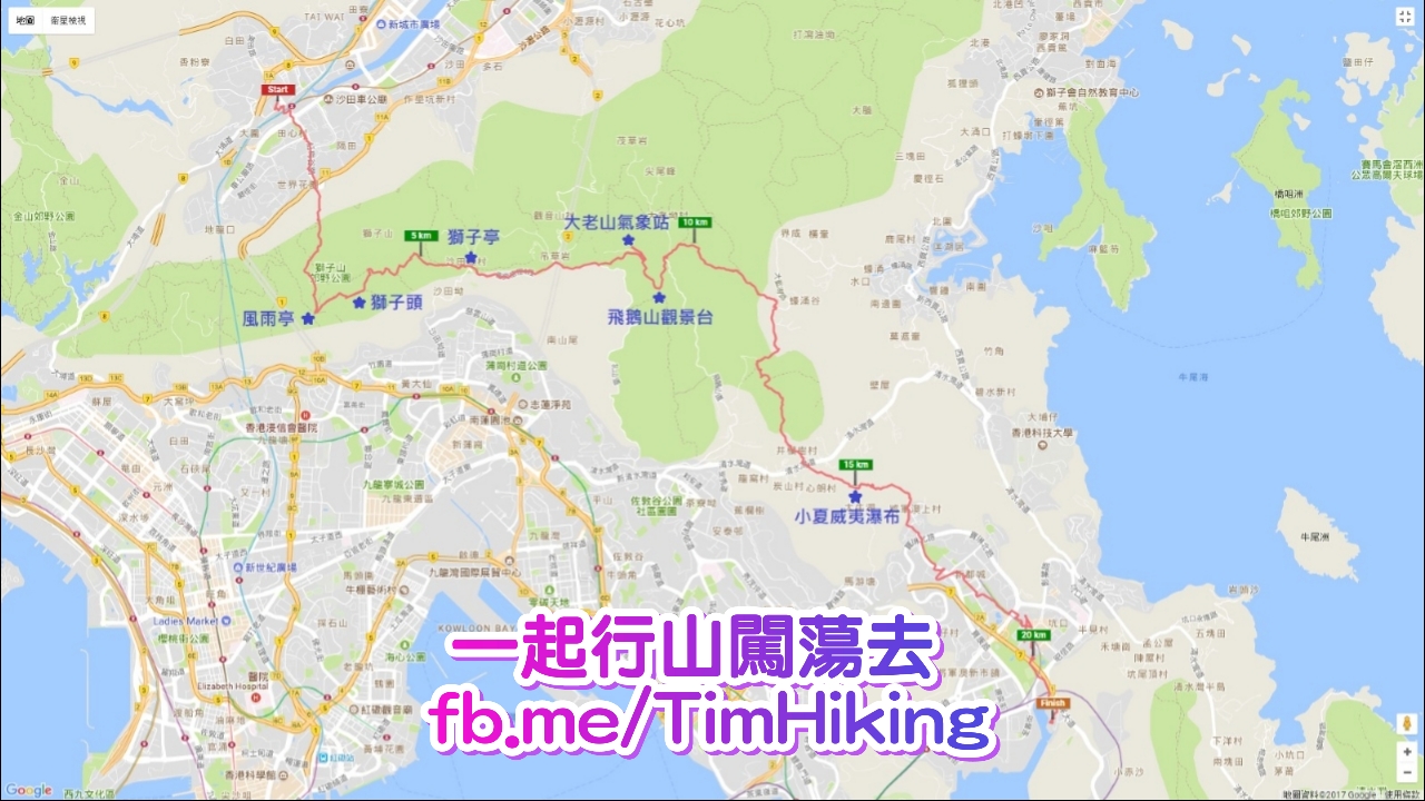
| Length : | 21km | ||
| Estimate : | 5hours | ||
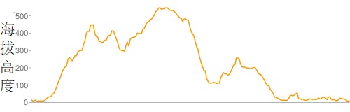 | |
| Ascent : 1,135m | Descent : 1,142m |
| Max : 549m | Min : 5m |
| (The accuracy of elevation is +/-30m) | |


 獅子亭士多 井欄樹士多


| View : | | ||
| Difficulty : | | ||
| Path : | |||
| Length : | 21km | ||
| Estimate : | 5hours | ||
| |
| Ascent : 1,135m | Descent : 1,142m |
| Max : 549m | Min : 5m |
| (The accuracy of elevation is +/-30m) | |
一起行山闖蕩去 | timhiking | timhiking | Message Board | Disclaimer