


 Recommend YouTube


| View : |  | ||
| Difficulty : |  | ||
 (Tai Tam Mound) | |||
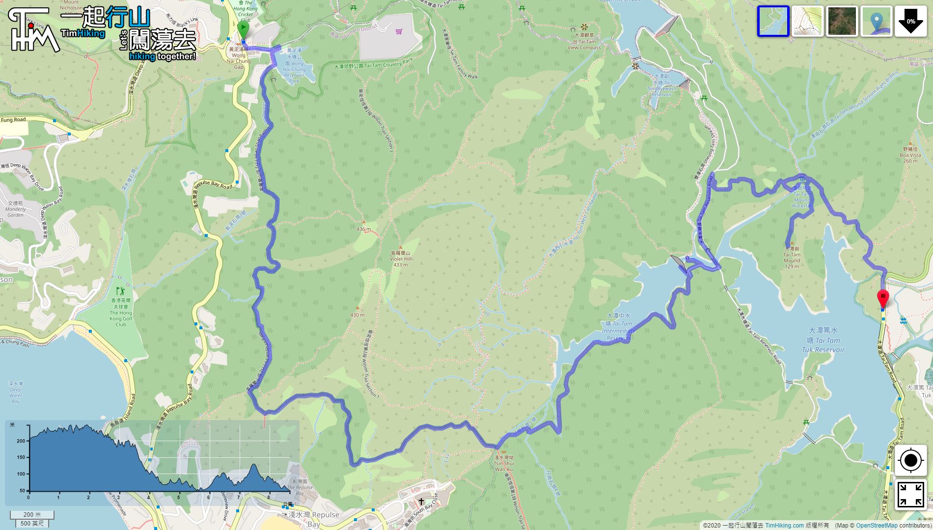
| Path : | |||
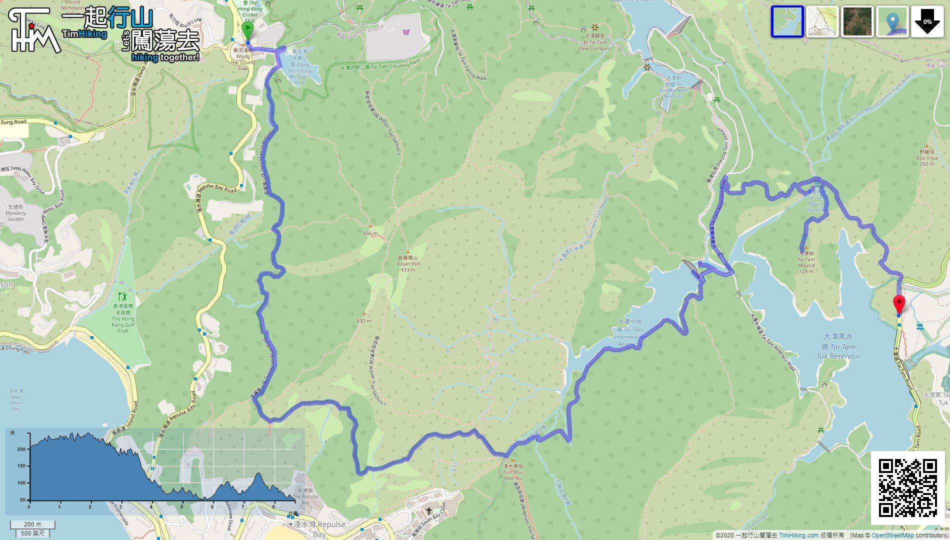
| Length : | 8.8km | ||
| Estimate : | 3hours | ||
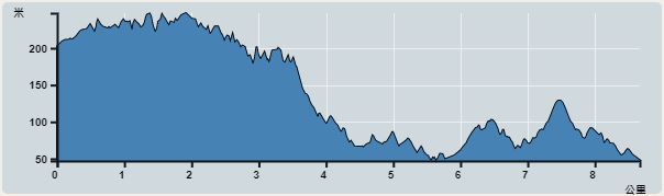 | |
| Ascent : 202m | Descent : 344m |
| Max : 248m | Min : 46m |
| (The accuracy of elevation is +/-30m) | |


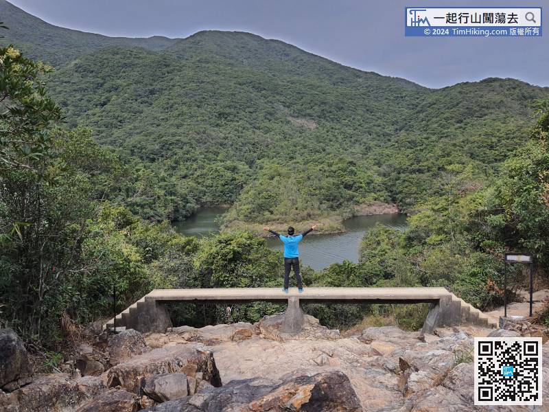
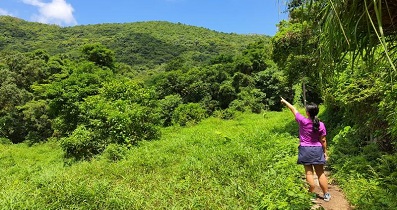
 6︰and the behind is Wong Nai Chung Reservoir.
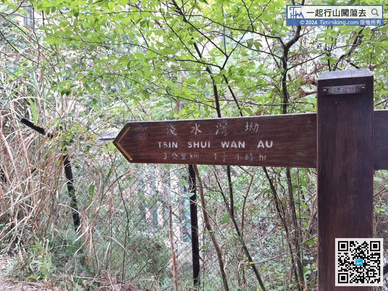
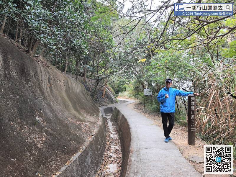
This route will go on Tsz Lo Lan Shan Path, so head towards Tsin Shui Wan Au.
22︰In an instance, leave the catchwater
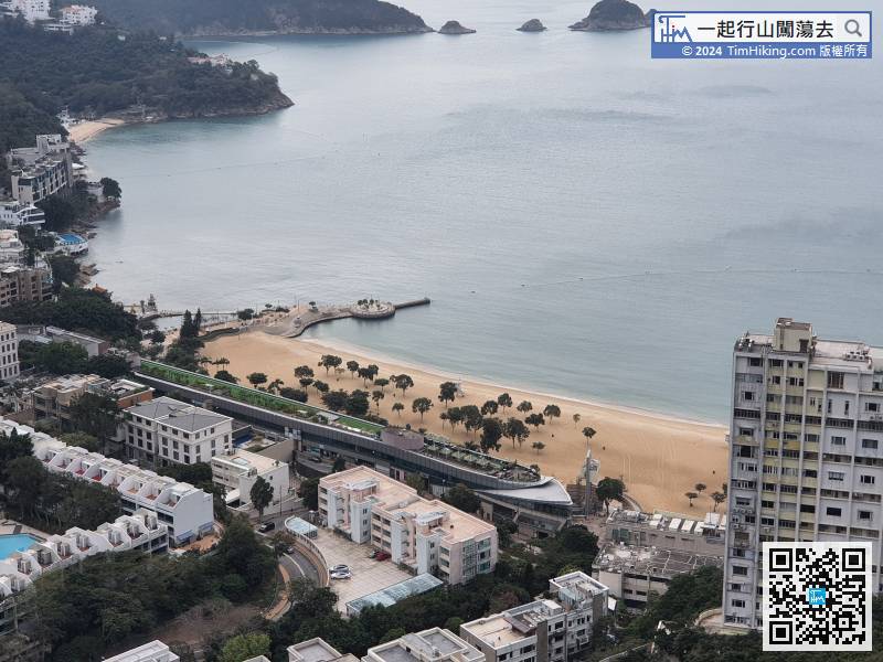
When seeing Repulse Bay The Lily, already on the edge of Repulse Bay.
35︰and then cross the Tsz Kong Bridge.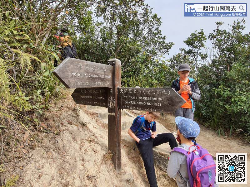 39︰passing by The Twins Stream No.4,
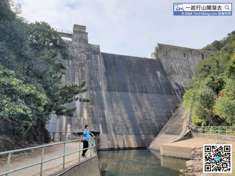
 50︰The other end of the dam is not able to pass.
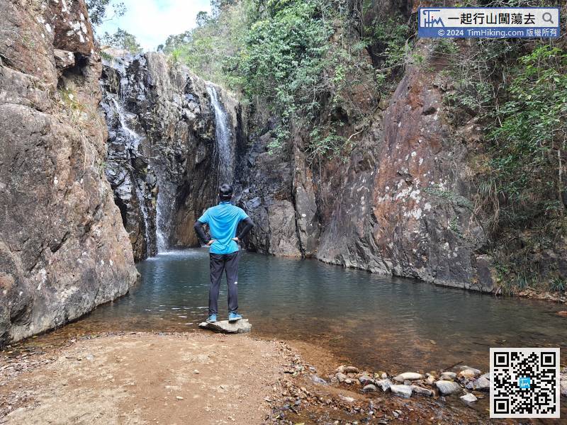
 67︰Walking all the way to the end, will see Tam Mound Falls. The water pool is within the range of the reservoir, swimming and splashing are prohibited.
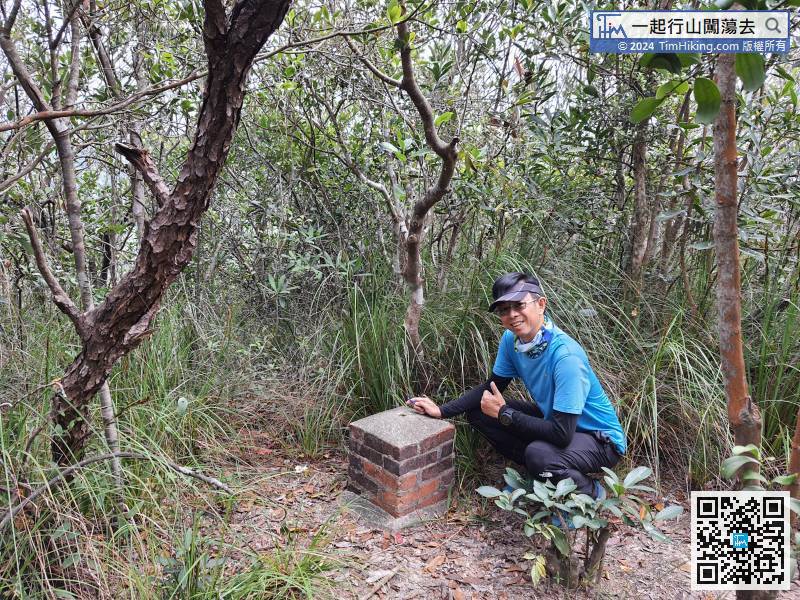
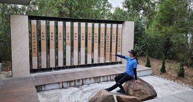
 80︰The open place at the end is the top of Tai Tam Mound, where the scenery is completely obscured by big trees. The most eye-catching is the red brick ancient pillar on the ground.
After visiting Tam Mound Falls, turn back to the wooden bridge at the entrance


