


 Recommend YouTube

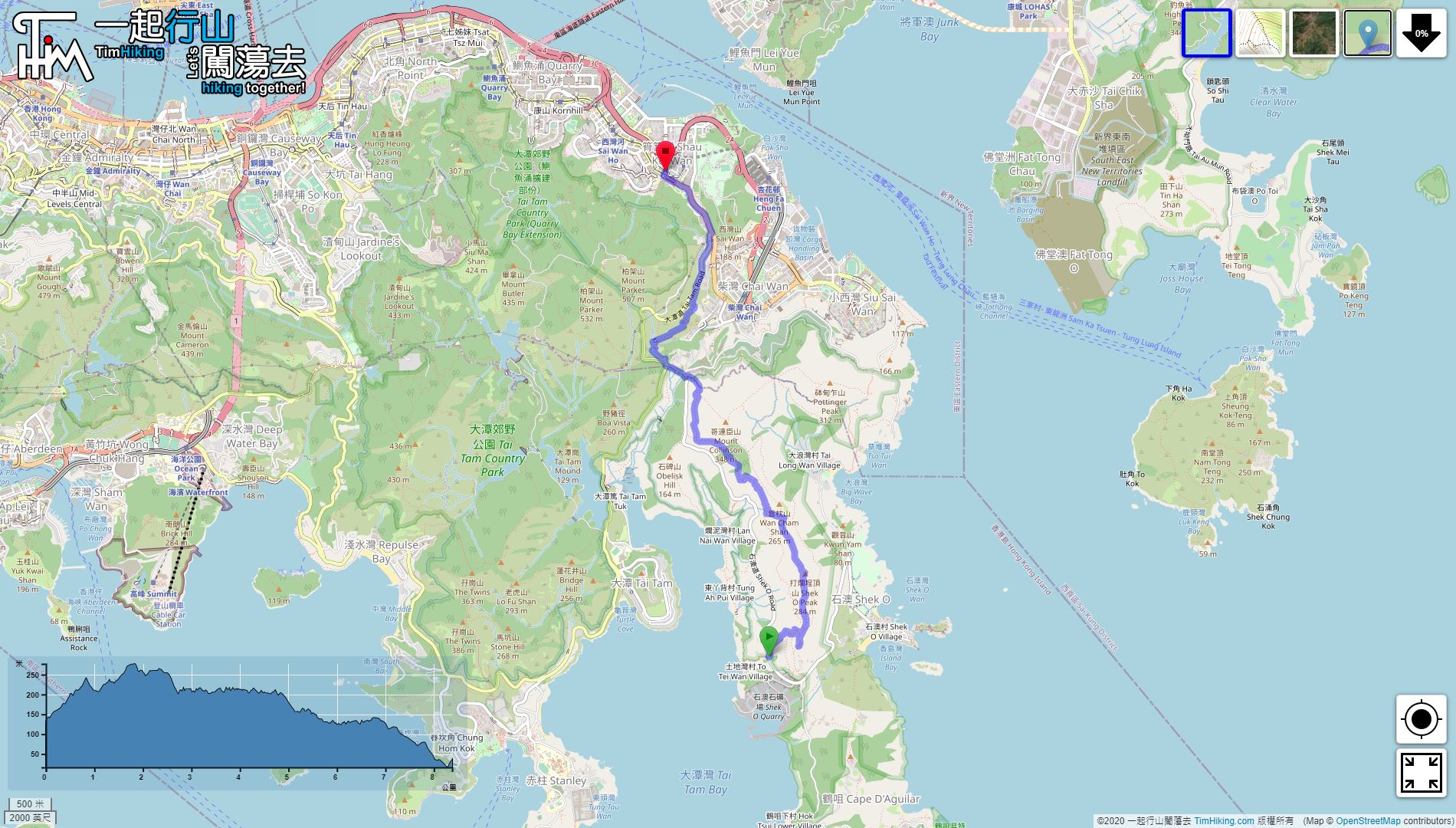

| View : |  | ||
| Difficulty : |  | ||
| Path : | |||
| Length : | 8.4km | ||
| Time : | 3½hours | ||
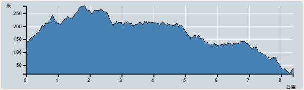 | |
| Ascent : 491m | Descent : 607m |
| Max : 277m | Min : 16m |
| (The accuracy of elevation is +/-30m) | |


 28︰The waterway bridge is made of reinforced concrete and is very magnificent. The two Masonry Bridge columns at the base are designed as arches, which resemble the ancient Masonry Bridge in Europe.


