


 YouTube 隨 機 推 介


| 景觀︰ |  | ||
| 難度︰ |  | ||
| 路線︰ | |||
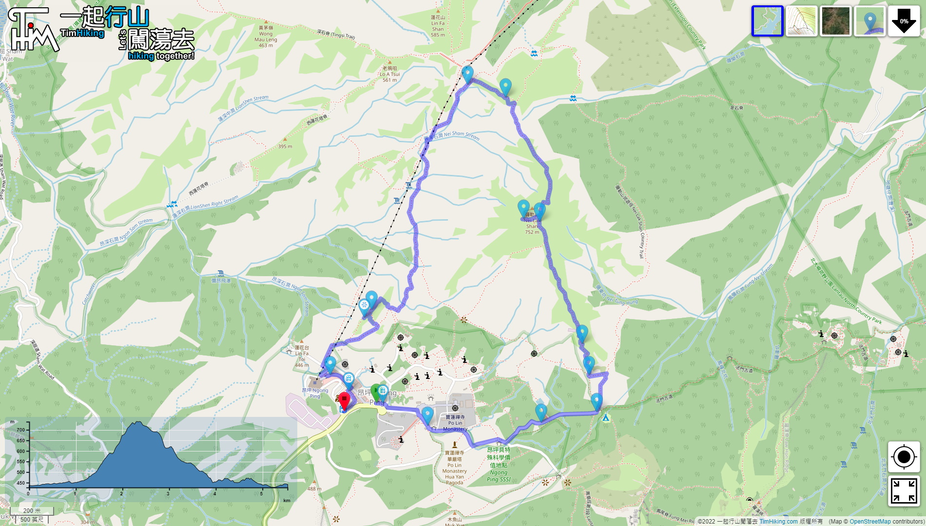
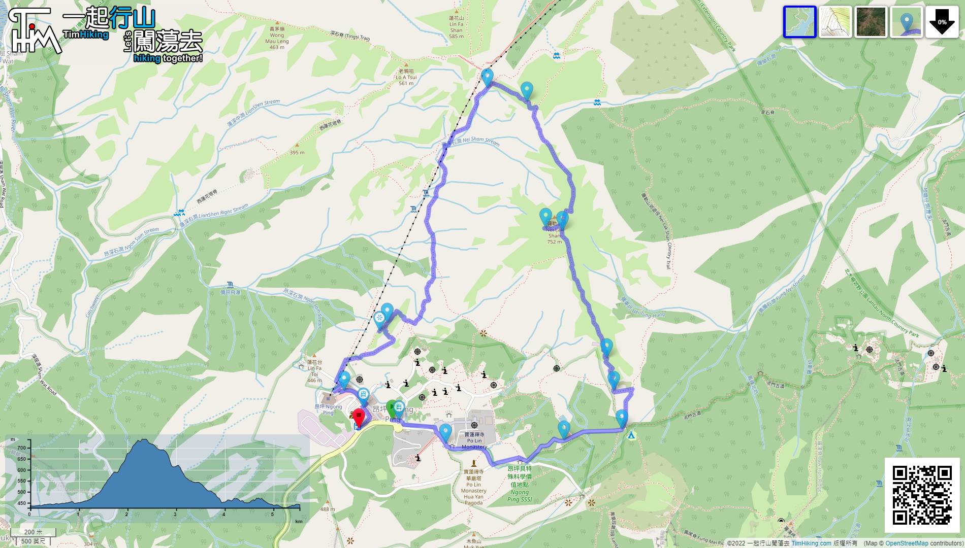
| 全長︰ | 5.6公里 | 需時︰ | 2½小時 |
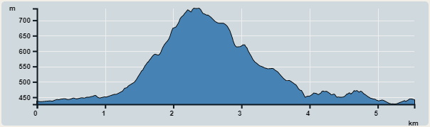 | |
| 攀升︰419米 | 下降︰402米 |
| 最高︰738米 | 最低︰427米 |
| (海拔高度值只供參考 誤差約是30米內) | |


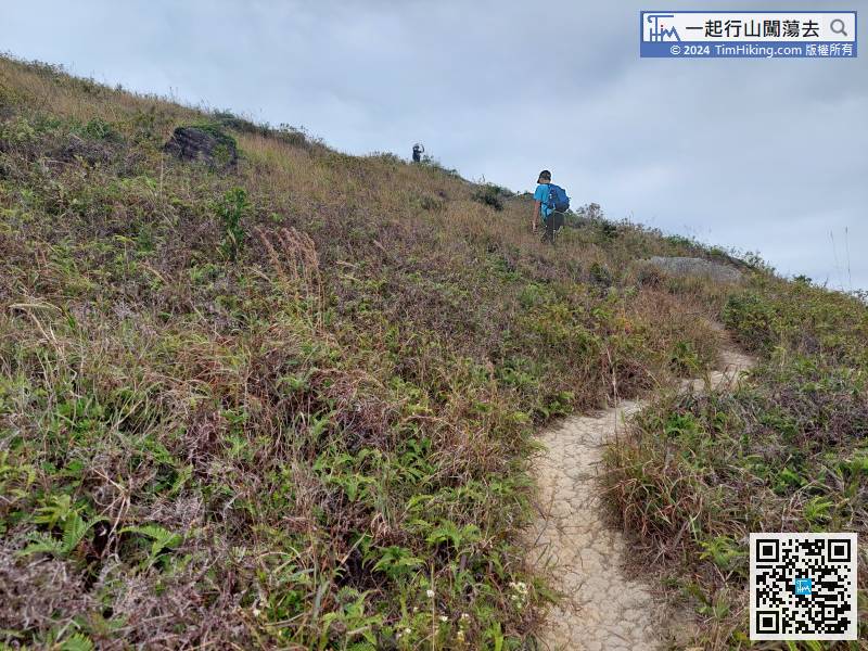
 23︰大約行2分鐘左右,
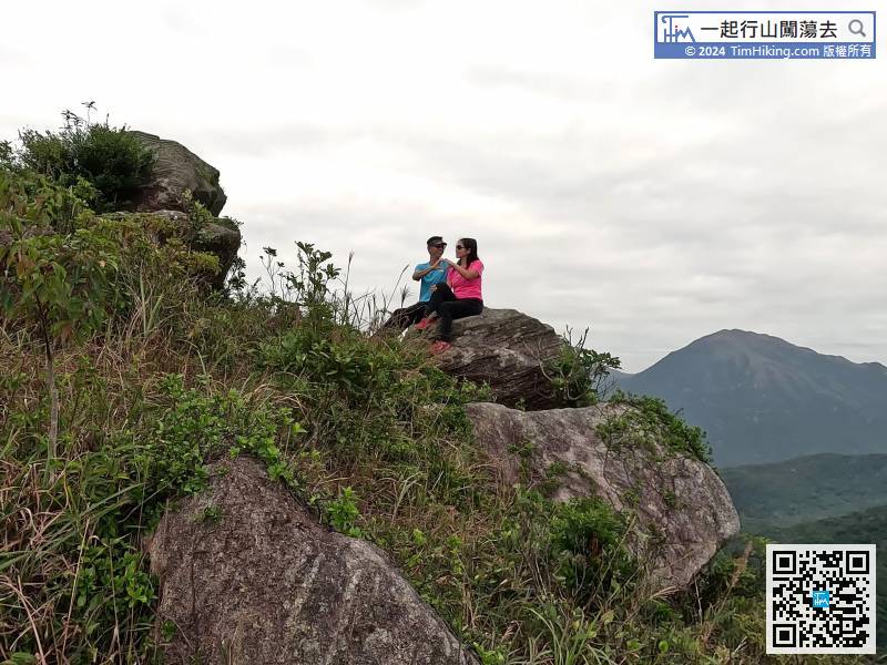
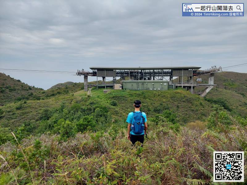
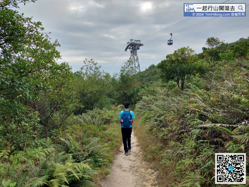
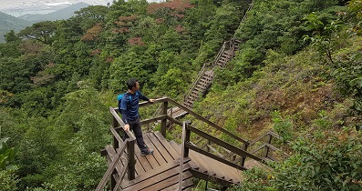
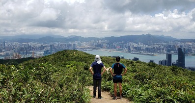
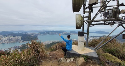
 55︰在山頂處,有一排古怪的石牆,沒有建築物,是直昇機坪來的。
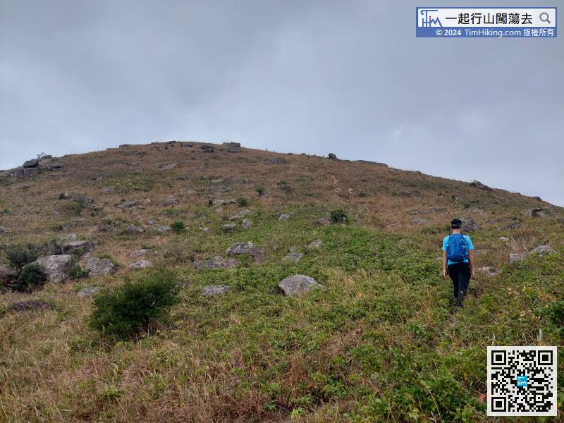
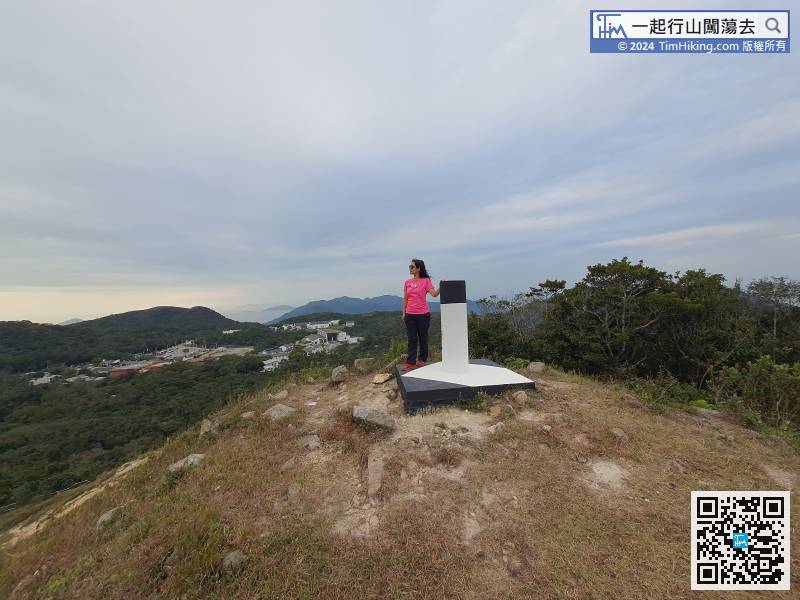
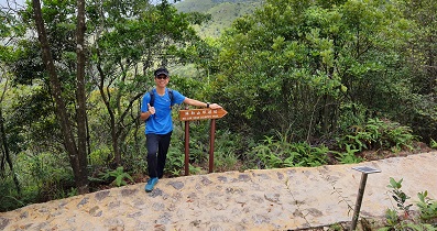
 79︰就在小山丘之前是有一個分叉路口的,
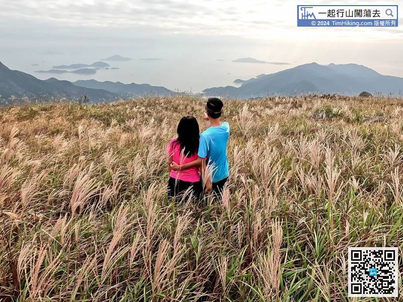
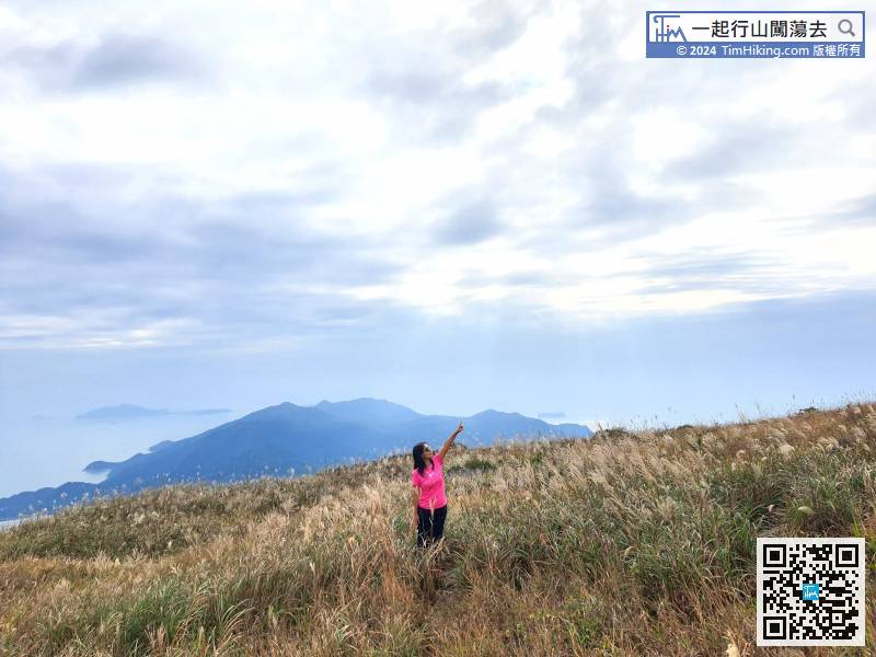
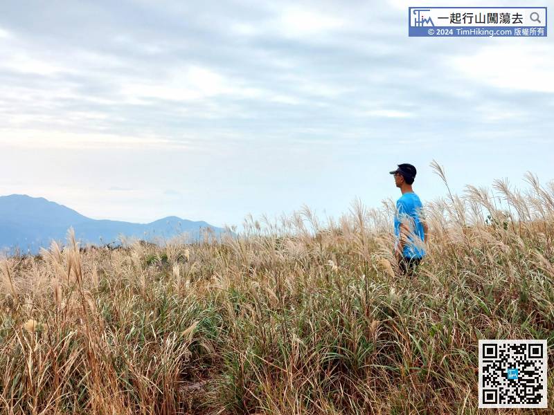
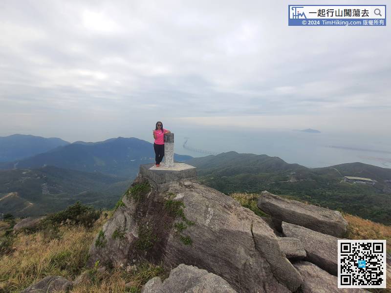
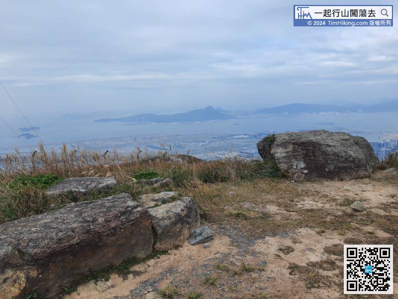
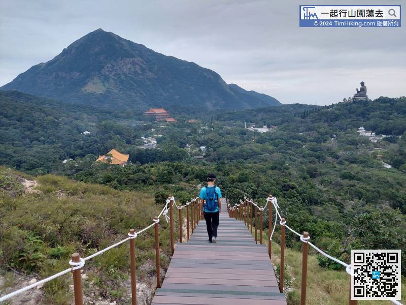
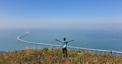
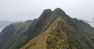
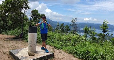
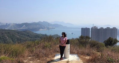
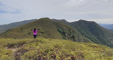
 111︰小山丘沒有名稱,標高柱的位置高493.3米,按慣例就稱它做493山頭,景觀近乎是360度,非常之開揚的。

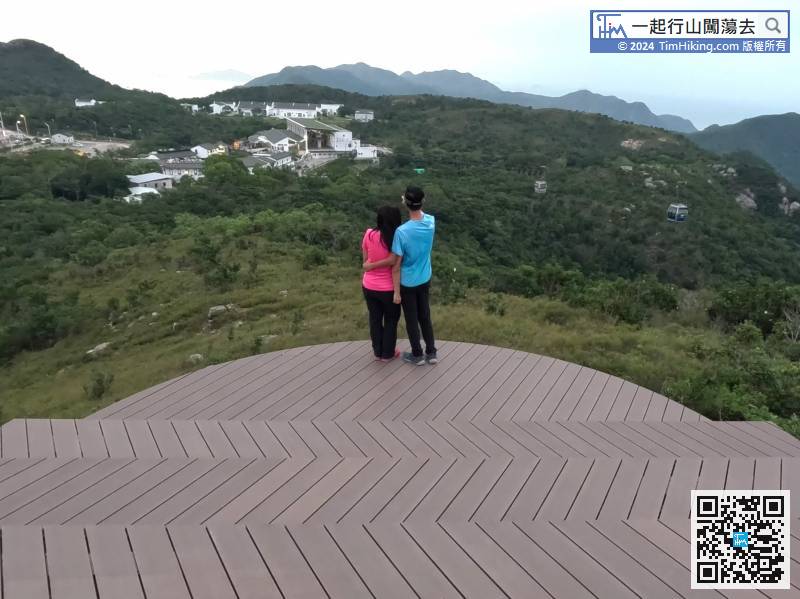
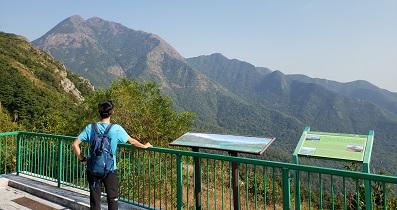
 彌勒山 新昂坪觀景台
| 景觀︰ | | ||
| 難度︰ | | ||
| 路線︰ | |||
| 全長︰ | 5.6公里 | 需時︰ | 2½小時 |
| |
| 攀升︰419米 | 下降︰402米 |
| 最高︰738米 | 最低︰427米 |
| (海拔高度值只供參考 誤差約是30米內) | |
23︰大約行2分鐘左右, 55︰在山頂處,有一排古怪的石牆,沒有建築物,是直昇機坪來的。 79︰就在小山丘之前是有一個分叉路口的, 111︰小山丘沒有名稱,標高柱的位置高493.3米,按慣例就稱它做493山頭,景觀近乎是360度,非常之開揚的。
| Markk : |  Tim sir,昨天由昂坪出發上彌勒山,落山時到郊遊徑後揀咗條冷門路線,落咗一個小山「大峒」,山頂其實係直升機坪,在此落返救援徑回東涌。原本計劃沿三角石脊落,不過草頭太密,放棄。Tim sir會否試一次三角石脊,看看那塊三角石? (2026-01-19) |
這些路可以密到好緊要,如果先試就由下面試行上來,落山不好找路。由下面上來,唔對路就即撤,強行上的話,一定越上越難搞。 (Tim Sir 2026-01-20) |
| Peacefuldoro : | 多謝Tim sir詳細介紹! 我上個星期去左,芒草好靚 我去到493山頭,研究左好耐,發現行山地圖冇起名,剩係顯示493,謝謝你解答左我疑惑🤣 (2022-10-28) |
客氣了!😊 一起開心行山闖蕩去啦! (Tim Sir 2022-10-28) |
| Surewinking : |  今日上去已經芒草遍遍 (2022-10-17) |
好正呀!已經上了去拍片。 (Tim Sir 2022-10-24) |
| Markk : |  Tim sir, 今日獨霸山頂。😁 芒草遍地。 (2021-11-17) |
Yeah! 😉 (Tim Sir 2021-11-18) |
| Joseph Lam : | 看到還有一條路從昂坪觀景台後面上彌勒山山頂。請問那條路路況如何?謝謝。 (2020-11-24) |
我猜你是說這個位 https://timhiking.com/blog.php?d=191213&=27 ,未行過,未試過刻意兜過去再上。但看等高線,這個位約520米,文章的上山位就500米,兩條線在722米交接,單憑數據,這邊比較斜。看實景圖,路胚因少人行也細一點。 (Tim Sir 2020-11-24) |


