


 Recommend YouTube


| View : |  | ||
| Difficulty : |  (edge climbing) | ||
 (return to the starting point) | |||
| Path : | |||
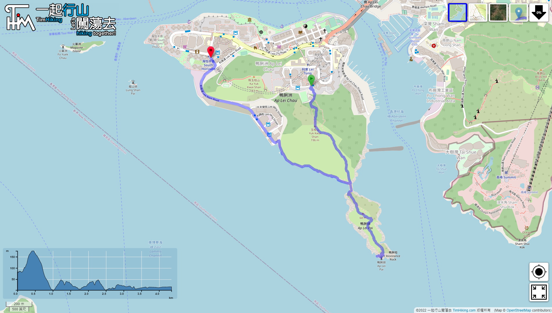
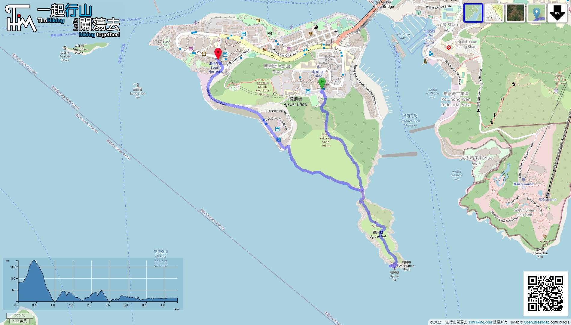
| Length : | 4.4km | ||
| Time : | 3½hours | ||
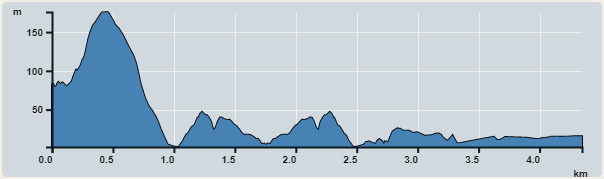 | |
| Ascent : 404m | Descent : 419m |
| Max : 176m | Min : 2m |
| (The accuracy of elevation is +/-30m) | |


 12︰and the other side has a warm reminder sign has two roads,
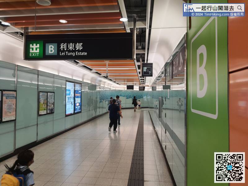
The starting point is at Ap Lei Chau, the transport is very convenient now, just take the MTR to Lei Tung Station, then leave from Exit B,
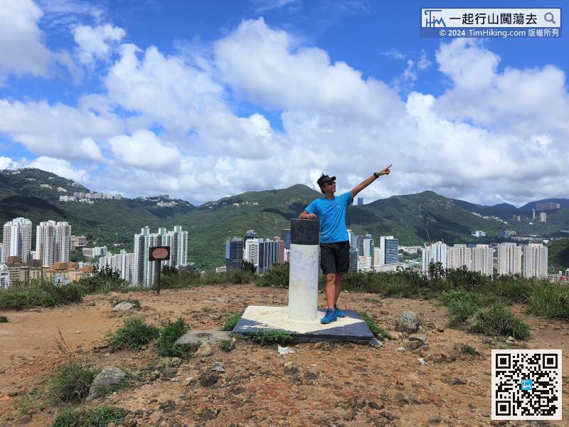
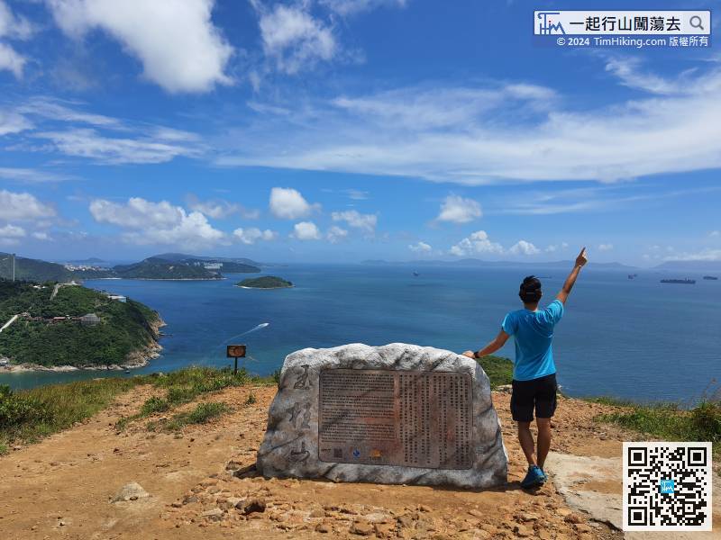
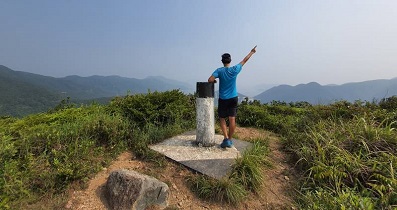
22︰Yuk Kwai Shan is 196 meters high, and there is a Trigonometrical Station on the top of the mountain, with a 360-degree view.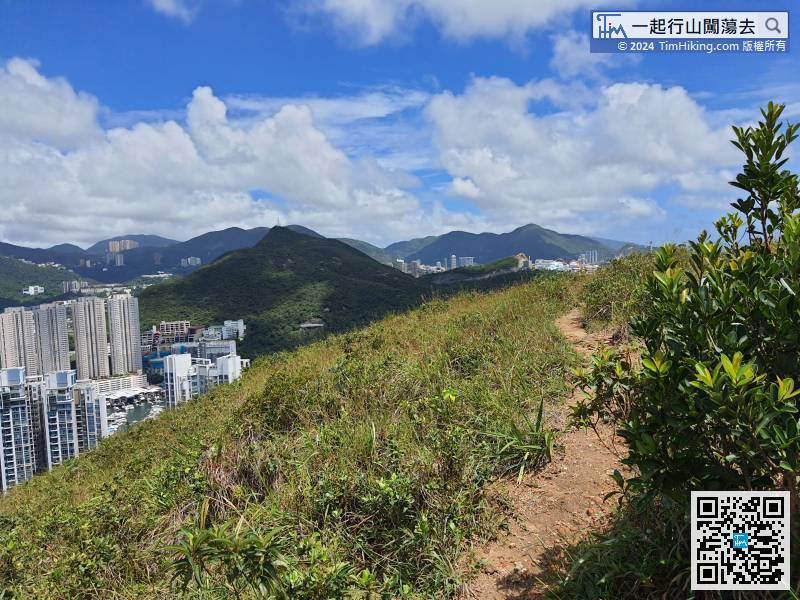
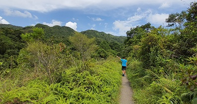
After reaching the top, pay attention to the trail on the left. Hikers who do not edge climbing are better to downhill there. The slope of this trail is smaller, and it is not recommended to go down from the middle.
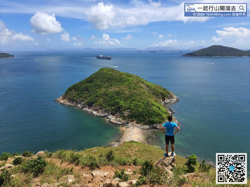
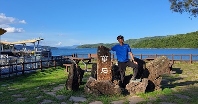
33︰To the bottom is Tombolo, and the front is Ap Lei Pai.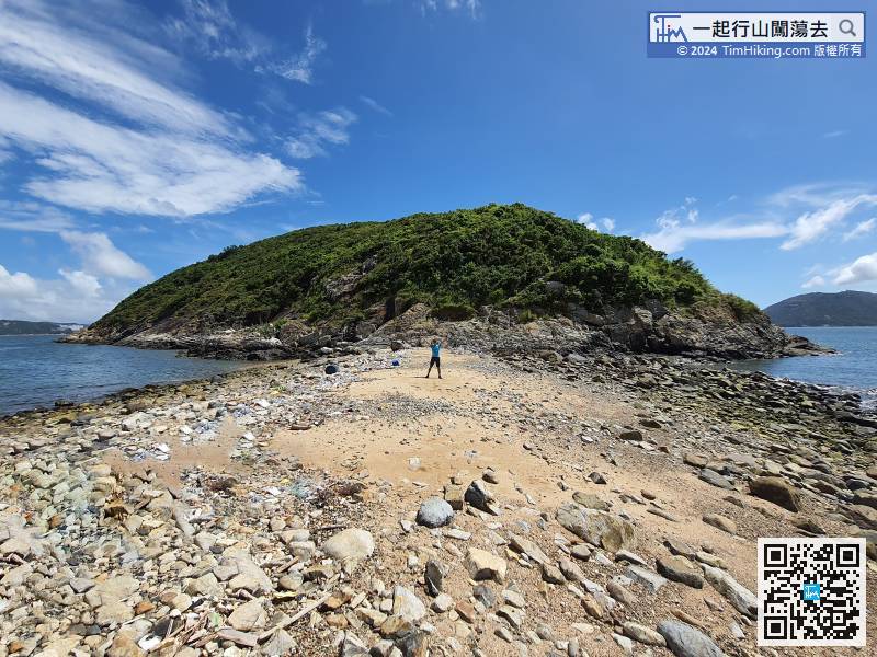
To the bottom is Tombolo, and the front is Ap Lei Pai.
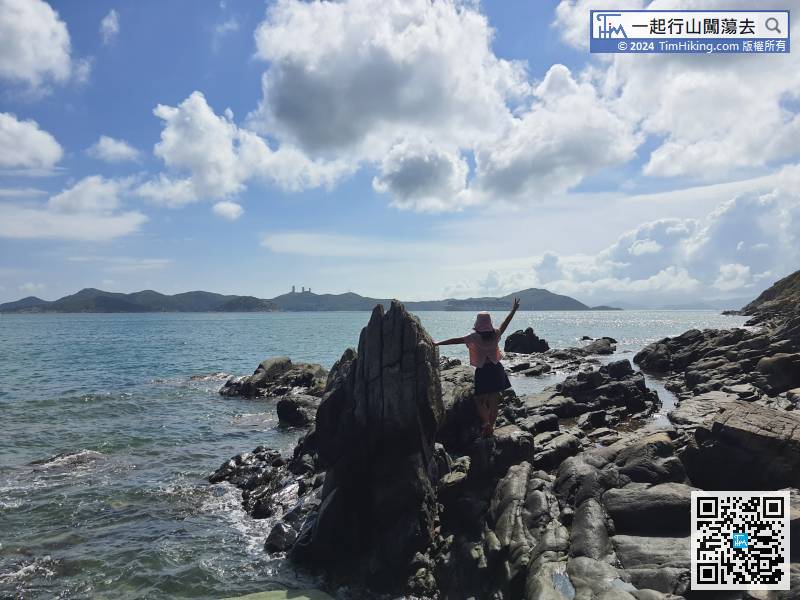
51︰Take pictures, enjoy the view, and take a break.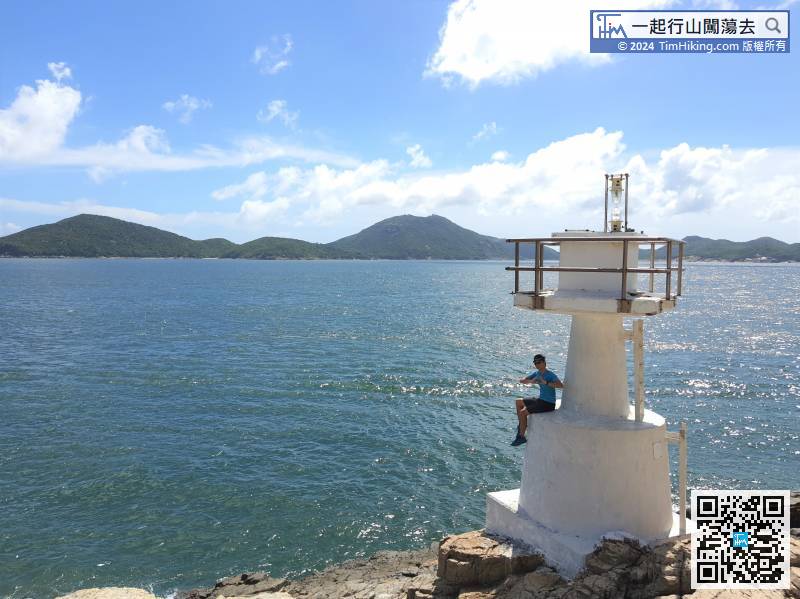
Find the best way from the left, and climb carefully down the lighthouse.
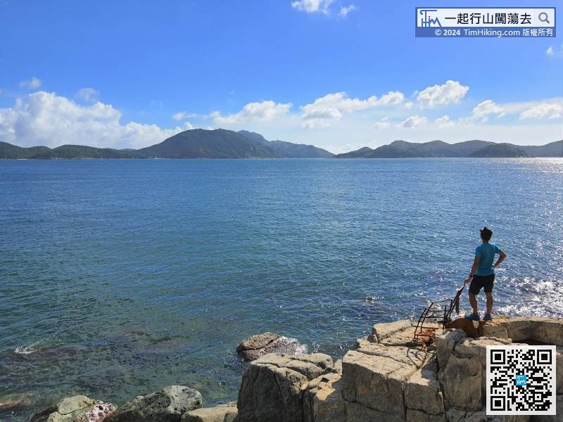
64︰On the day of the shooting was a big low tide, the Chart Datum was only 0.7 meters, and the water level was relatively low.
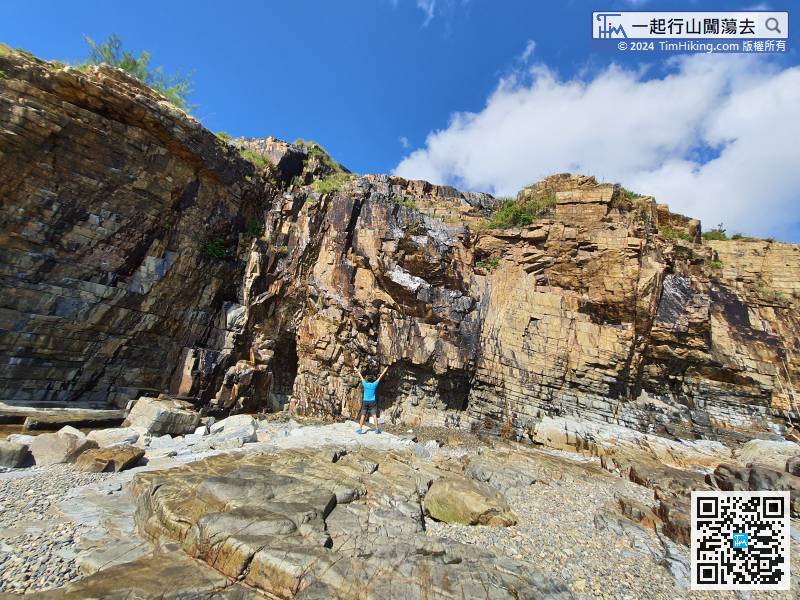
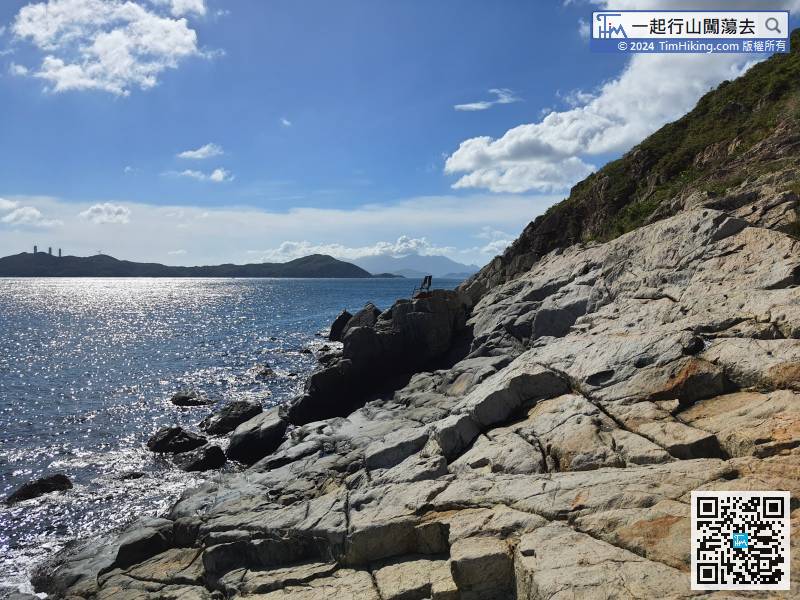
面前的筆直的崖壁The straight cliff in front is majestic, a bit like Lei Yue Mun Quarry.


