


 Recommend YouTube


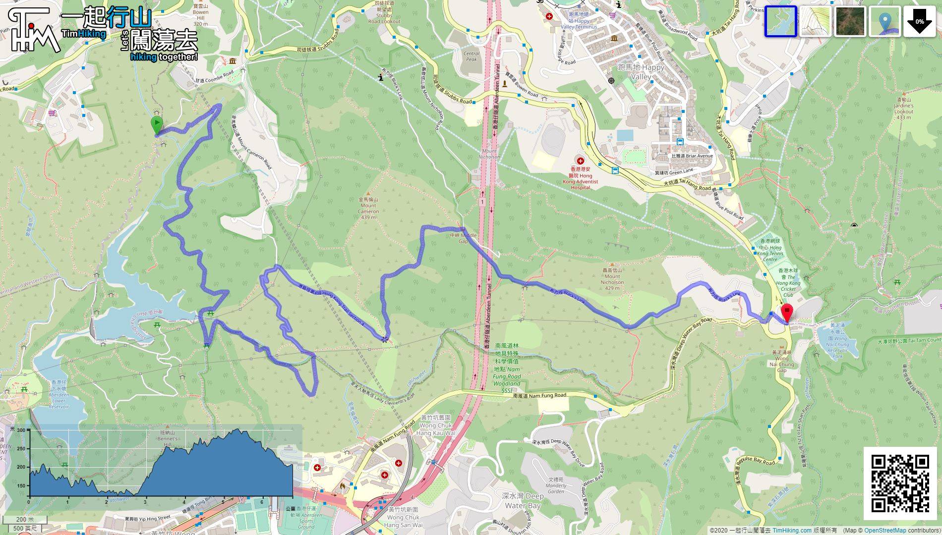
| View : |  | ||
| Difficulty : |  | ||
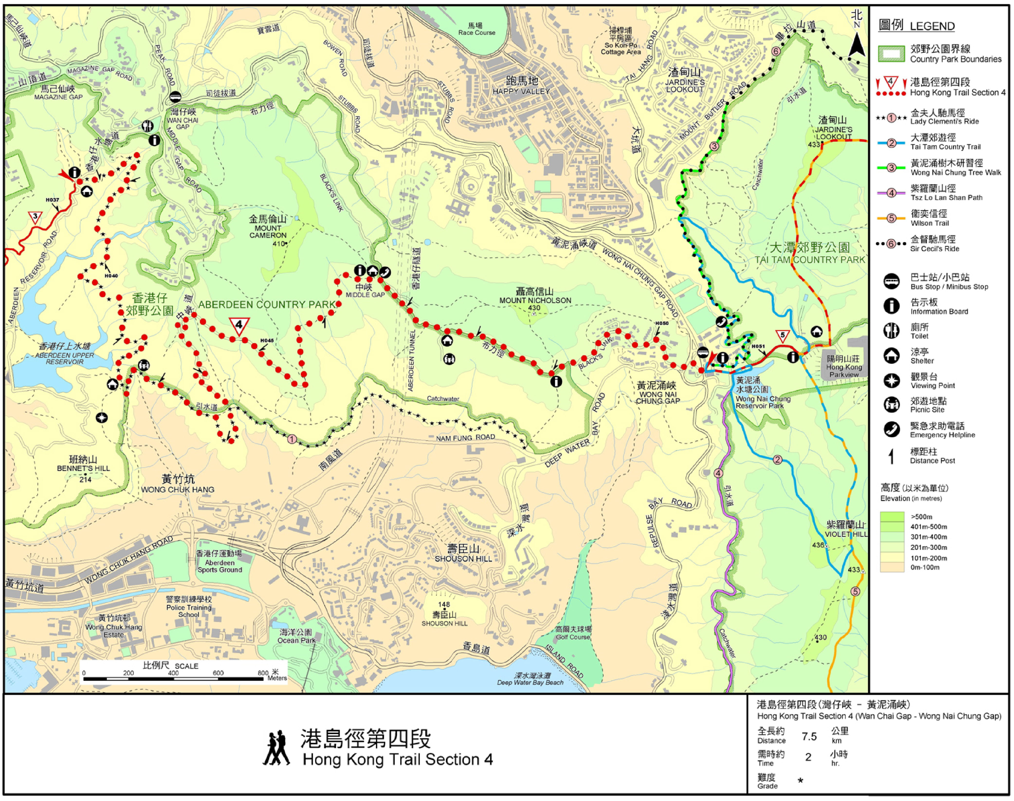
| Path : | |||
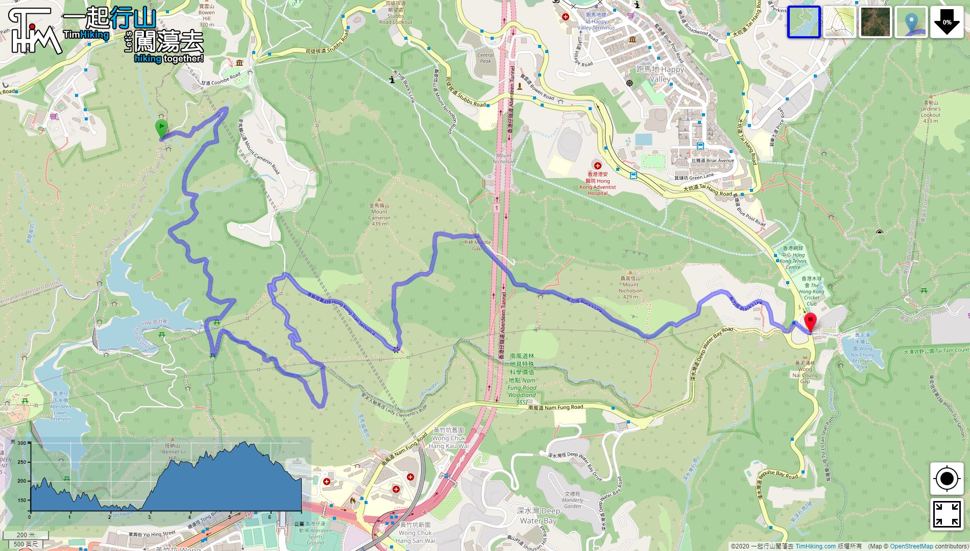
| Length : | 7km | ||
| Time : | 2hours | ||
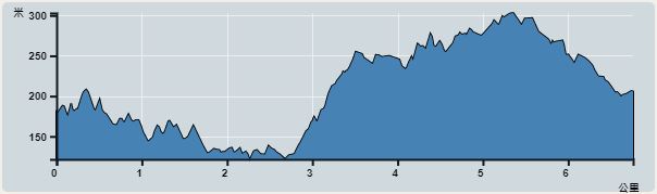 | |
| Ascent : 566m | Descent : 537m |
| Max : 306m | Min : 120m |
| (The accuracy of elevation is +/-30m) | |


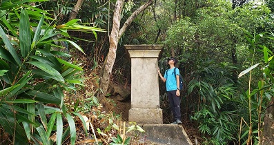
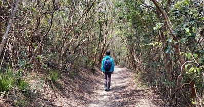
The starting point is at Wan Chai Gap. You can take a bus to Wan Chai Gap Road, and then head towards Aberdeen Reservoir. The starting point is about 500 meters.


Official Map


