


 Recommend YouTube

| View : |  | ||
| Difficulty : |  | ||
| Path : | |||
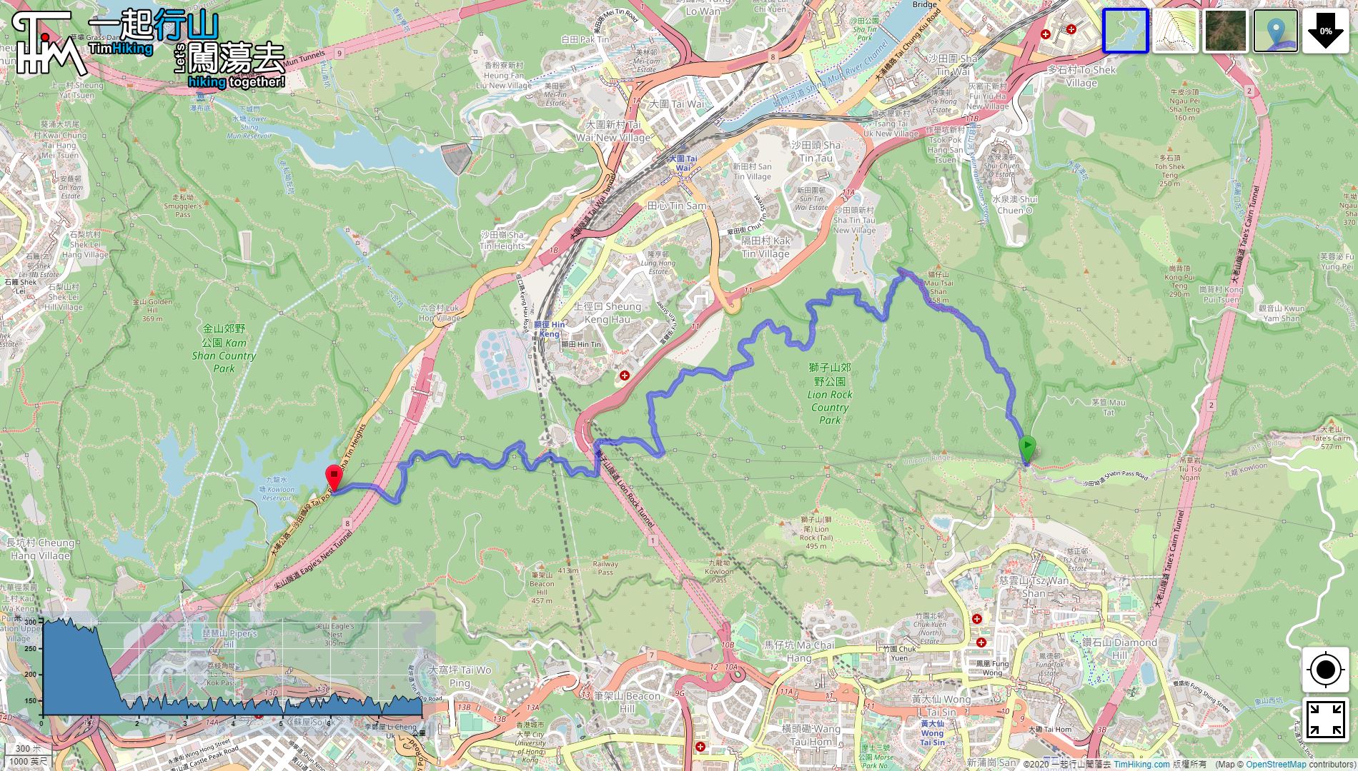
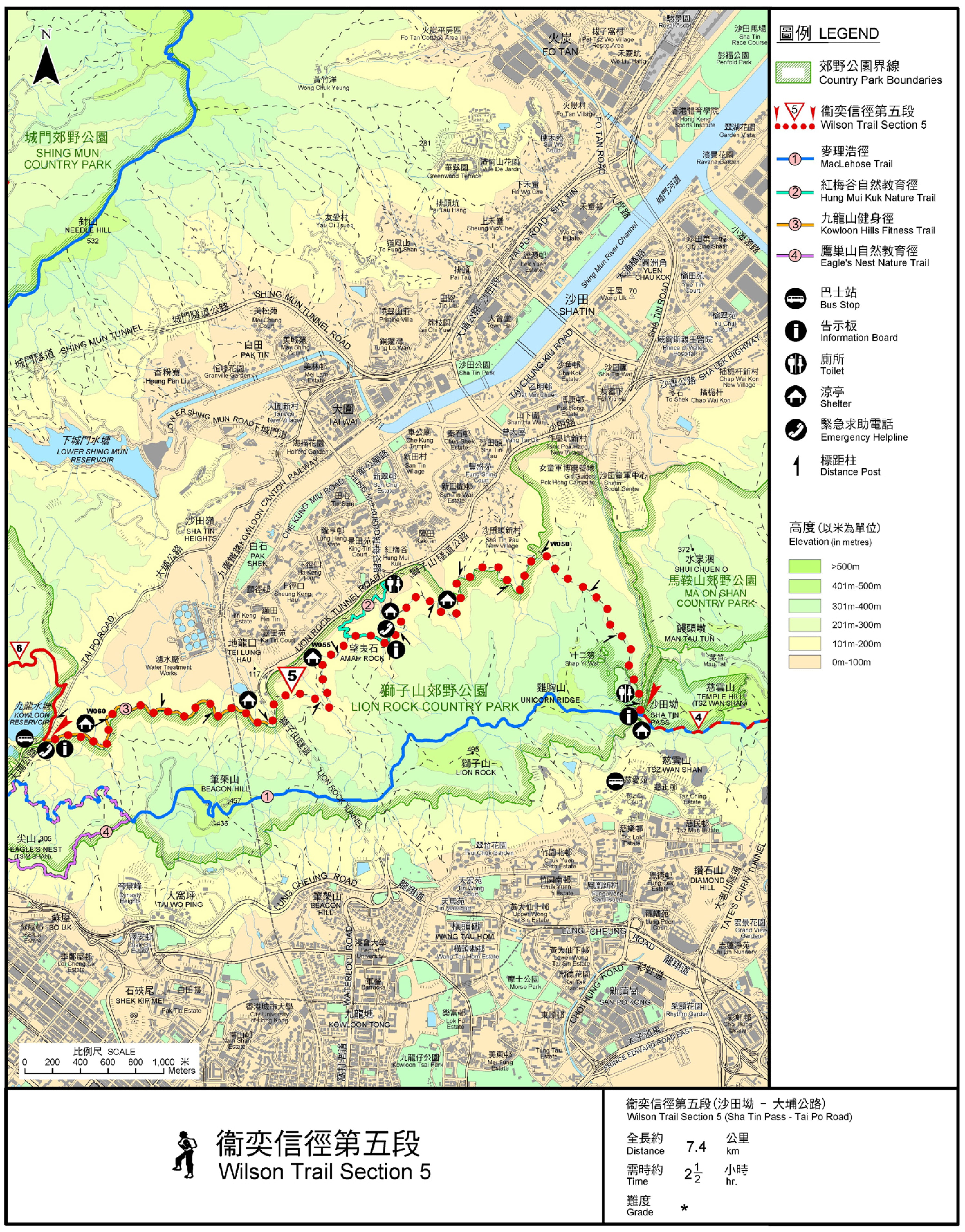
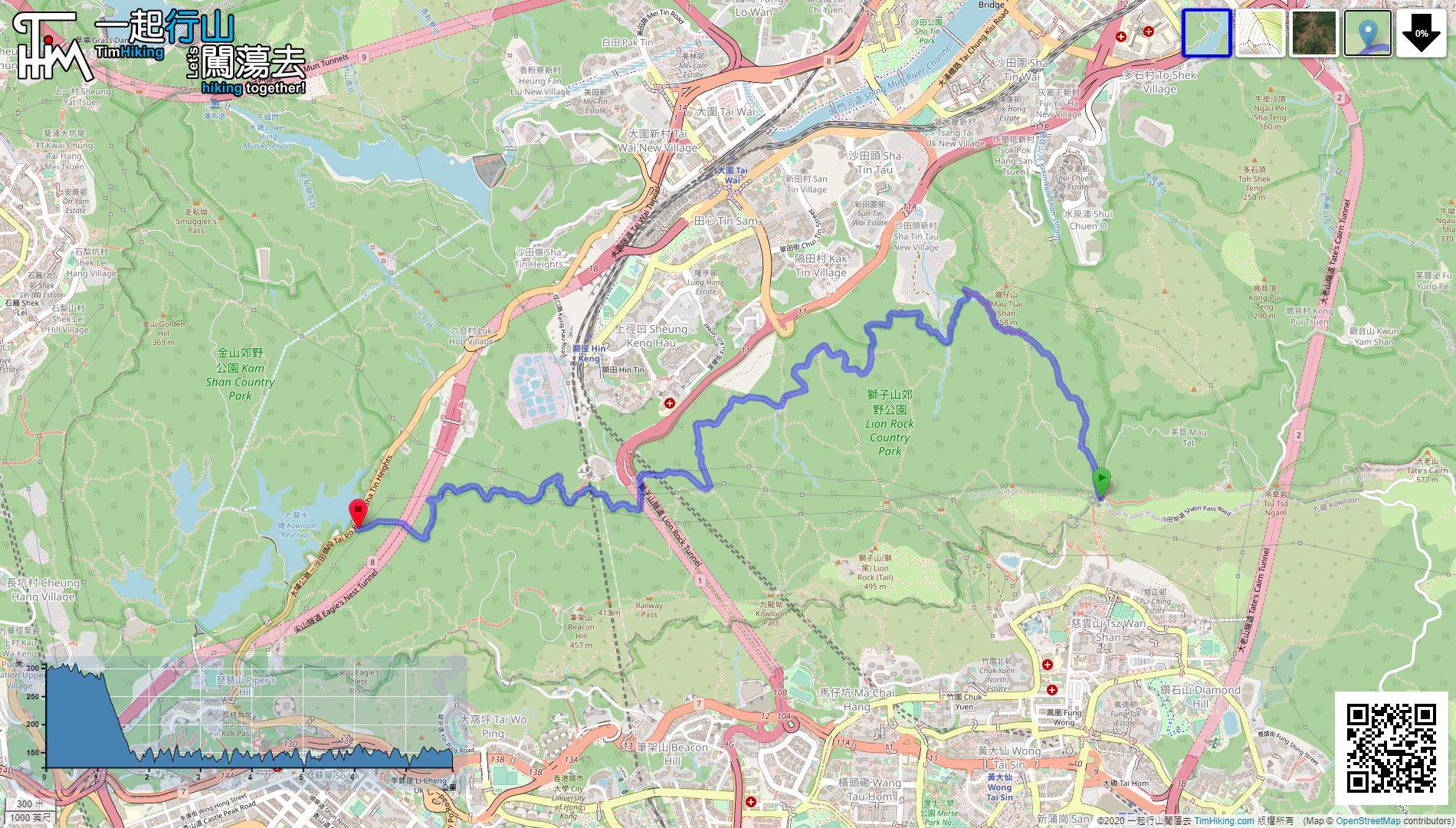
| Length : | 8.1km | ||
| Time : | 2½hours | ||
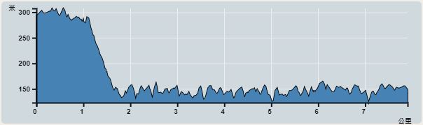 | |
| Ascent : 585m | Descent : 737m |
| Max : 309m | Min : 124m |
| (The accuracy of elevation is +/-30m) | |


Official Map


| View : | | ||
| Difficulty : | | ||
| Path : | |||
| Length : | 8.1km | ||
| Time : | 2½hours | ||
| |
| Ascent : 585m | Descent : 737m |
| Max : 309m | Min : 124m |
| (The accuracy of elevation is +/-30m) | |
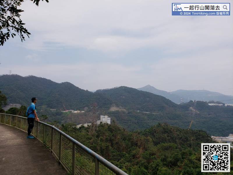
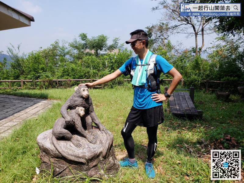
| rsschan : | 今天行了。特別在高溫下, 確是休閑輕鬆之選。上半段,有開揚景; 下半段,樹木臨立,香草味噴噴,又有馬騮看。 希望Tim Sir 將來有機會介紹如何由[16/42]去貓仔山。謝謝。 (2022-06-25) |
貓仔山曾經介紹過,可試試搜尋。 (Tim Sir 2022-06-26) |
Thanks a lot! Hope our hiking information is helpful to you. Everyone is happy to go hiking and safely!
Welcome to use Payme AlipayHK to sponsor Tim Sir's efforts! Continue to give selflessly for the mountain world.
Lord, you have given ear to the prayer of the poor: you will make strong their hearts, you will give them a hearing:
Psalms 10:17
一起爬山闖蕩去 | timhiking | timhiking | timhiking | Message Board | Disclaimer


