| View : |  | ||
| Difficulty : |  | ||
| Path : | |||
| Length : | 6.2km | ||
| Time : | 2¾hours | ||
 | |
| Ascent : 762m | Descent : 562m |
| Max : 797m | Min : 125m |
| (The accuracy of elevation is +/-30m) | |


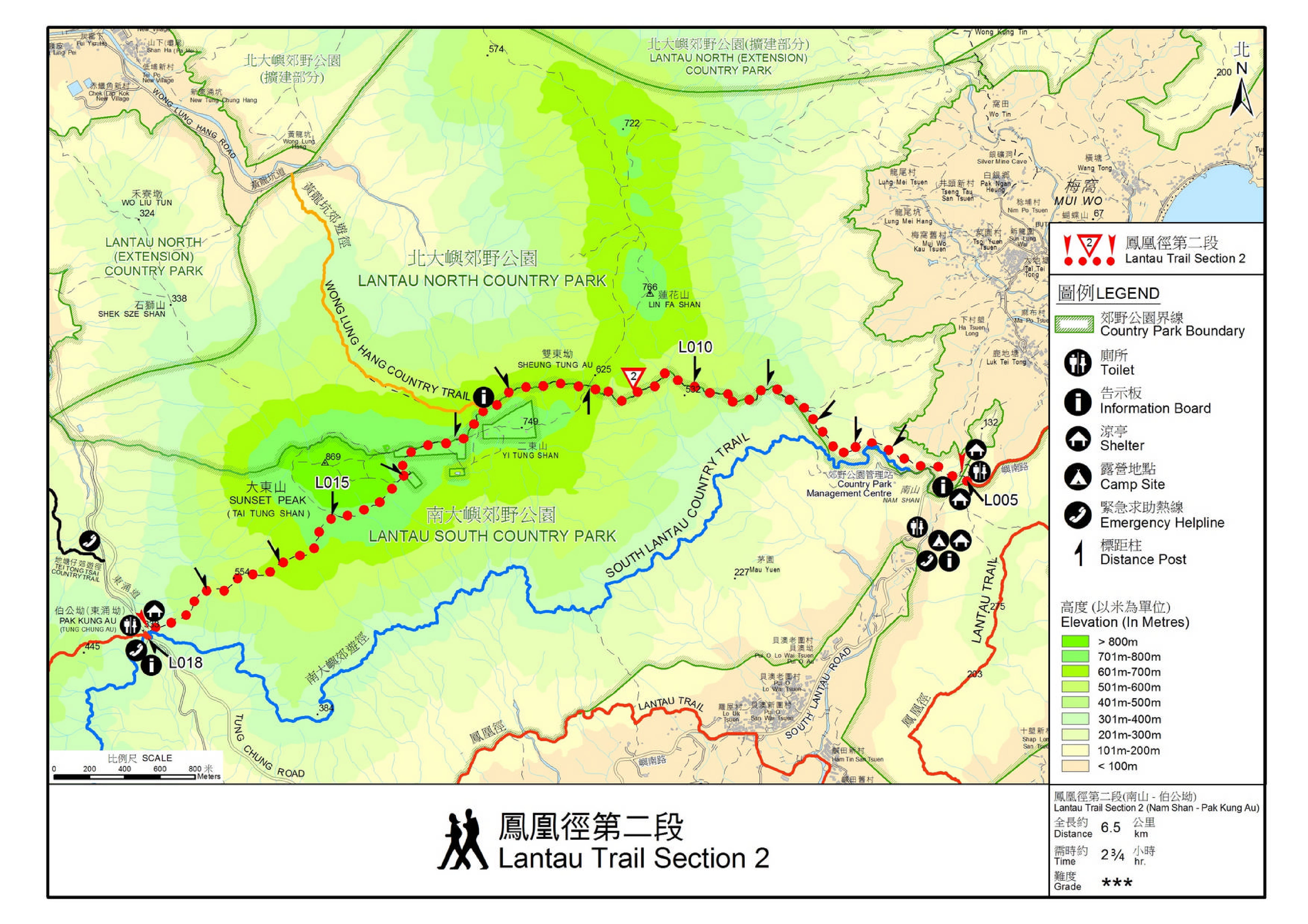
Official Map


| View : |  | ||
| Difficulty : |  | ||
| Path : | |||
| Length : | 6.2km | ||
| Time : | 2¾hours | ||
 | |
| Ascent : 762m | Descent : 562m |
| Max : 797m | Min : 125m |
| (The accuracy of elevation is +/-30m) | |


| cardry0320 : | 多謝 Tim Sir,每次行山我都會睇你個 page,cap 曬圖做足曬功課先岀發。早兩日順行鳳凰徑第二段,去到雙東坳轉上二東山東脊上山,斜度雖不及之前跟你另一個 blog 喺 L015 上跳板石斜,不過喺濃霧之下都要小心慢慢上,幸好沿途嘅荒徑都算清𥇦。最後行咗差不多二十分鐘,終於去到上二東山前嘅一片平地,心入面嘅滿足感無法形容。 (2023-05-06) |
滿足就是美!謝謝你的回覆。 (Tim Sir 2023-05-06) |
| Iris Cheung : |  Tim Sir, 星期六跟你這路線行, 又成功喇,謝謝你!有藍天白雲、有芒草,很美麗!(20221119) (2022-11-20) |
正!星期一開始就陰天了。 (Tim Sir 2022-11-21) |
| Vivian.wong : | 請問最後落山嘅2公里直插5百幾米會太難嗎? (2021-11-16) |
全是梯級,慢慢落,小心傷膝就得。落不慣,就用行山杖幫幫手。 (Tim Sir 2021-11-16) |
| May : | 請問這路線是否比伯公坳上大東山再返伯公坳看到更多芒星? 另外,如行這路線,中途可否去看看跳板石再返迴路線? 謝謝Tim sir (2021-11-15) |
差不多,但逆行一定易搭車。 可以。 (Tim Sir 2021-11-15) |
| bigbear : | 上星期去過,驗證最靚金黃芒海timing仍未到,但爛頭營風景真係超靚靚靚靚 (2021-11-05) |
起碼要等多3-4星期才到爆植期 (Tim Sir 2021-11-05) |
| Patrick : | 今日剛跟你的路線行了, 幾容易行, 謝謝推介. 但有一點是 : 我在東涌坐巴士, 應是南山營地落車, 比南山三屋村近一點 (2020-11-29) |
文中是指在梅窩乘任何一架巴士,不是東涌。若在東涌,的確是南山營地下地,不過這樣乘車時間會很長。所以,路線設計上,是乘船到梅窩起步,而非東涌,消耗在交通的時間會少很多。 (Tim Sir 2020-11-29) |
| Jill : |  今日跟Tim Sir路線睇期間限定,去到爛頭營直係堅多人,;不過景色絕佳,辛苦啲都值得👍👍 (2020-11-02) |
閒日應該不會太多人,人潮比假日已好很多了。 (Tim Sir 2020-11-02) |
| Jacky : | 請問逆行鳳凰徑第2段是否較難? (2020-10-23) |
如逆行,一開始的斜度會高一點。不過,攀升幅度就少點,落山路段也較長。總括而言,逆行有長有短,難度算是差不多。 (Tim Sir 2020-10-23) |
| Ryan NG : | 請問這段路的最高點是在哪裏? (2020-04-13) |
爛頭營附近 (Tim Sir 2020-04-13) |
| Ms Wong : | 請問你幾點開始起步? 看日落大約是幾點? (2019-11-26) |
時間因人而異,你要按自己步速去計算。至於爛頭營11月尾的日落時間,大約是16:30,會比正常早一點的,因為大東山會遮住。你預16:00上到爛頭營,慢慢影到日落,之後跟住太陽落山。 (Tim Sir 2019-11-26) |
Thanks a lot! Hope our hiking information is helpful to you. Everyone is happy to go hiking and safely!
Welcome to use Payme AlipayHK to sponsor Tim Sir's efforts! Continue to give selflessly for the mountain world.
There is a blessing on the man who undergoes testing; because, if he has God's approval, he will be given the crown of life, which the Lord has said he will give to those who have love for him.
James 1:12 BBE
一起爬山闖蕩去 | timhiking | timhiking | timhiking | Message Board | Disclaimer