


 Recommend YouTube


| View : |  | ||
| Difficulty : |  | ||
| Path : | |||
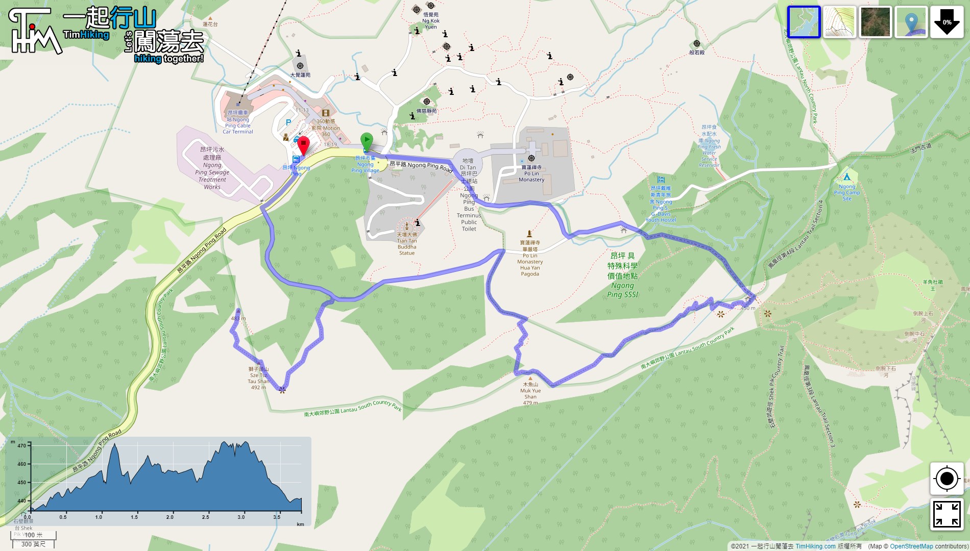
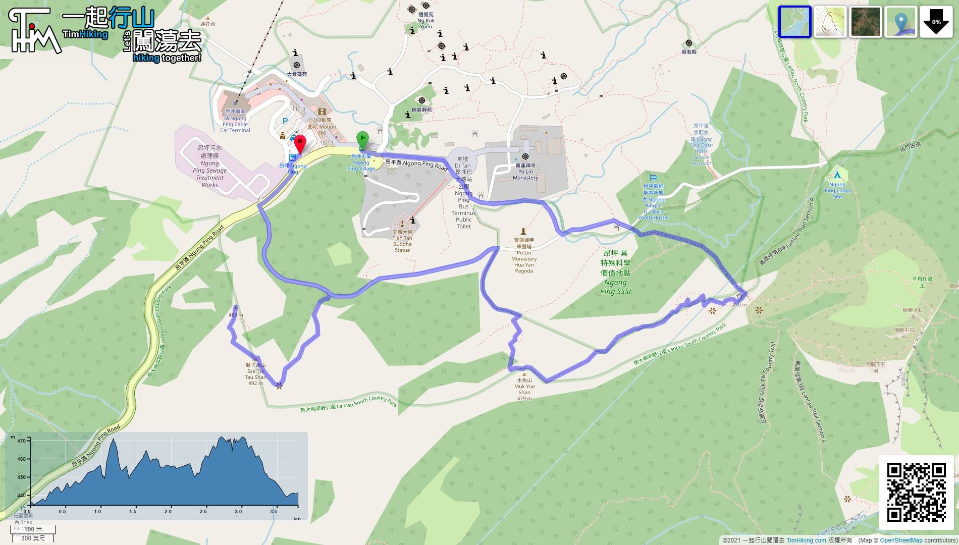
| Length : | 3.8km | ||
| Time : | 2hours | ||
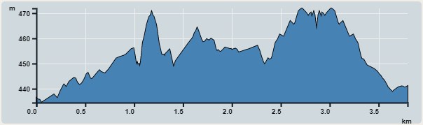 | |
| Ascent : 111m | Descent : 113m |
| Max : 472m | Min : 434m |
| (The accuracy of elevation is +/-30m) | |


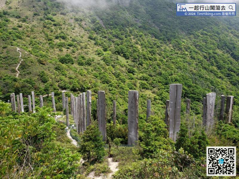
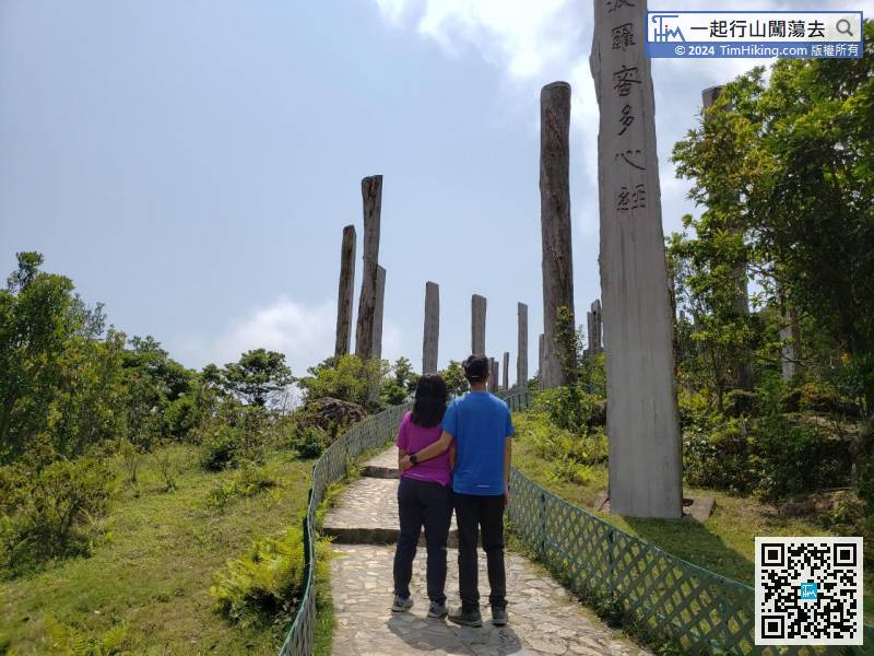
 7︰About 15 minutes, will come to the Phoenix Sculpture and the big archway of Phoenix View.
 11︰a small mountain peak that few hikers to go.
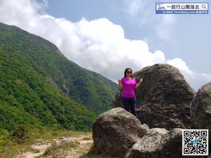
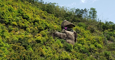
 15︰It takes less than 10 minutes to go up to the top of Muk Yue Shan. The top is not marked, only a few boulders.
It takes less than 10 minutes to go up to the top of Muk Yue Shan. The top is not marked, only a few boulders.
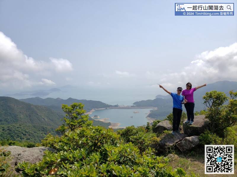
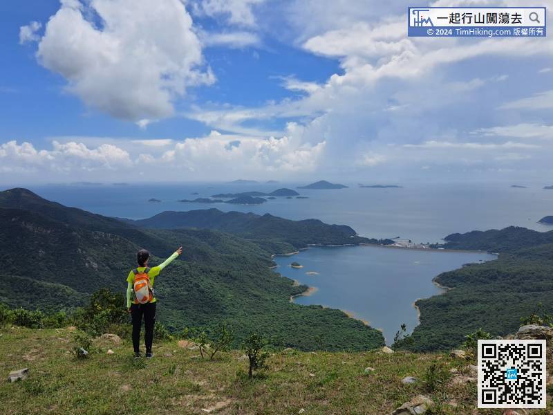
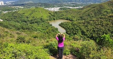
29︰and turn left on the concrete road again. 39︰After getting to Sze Tse Tau Shan, will first see the very intoxicating Shek Pik Reservoir, and can also overlook the Soko Islands.
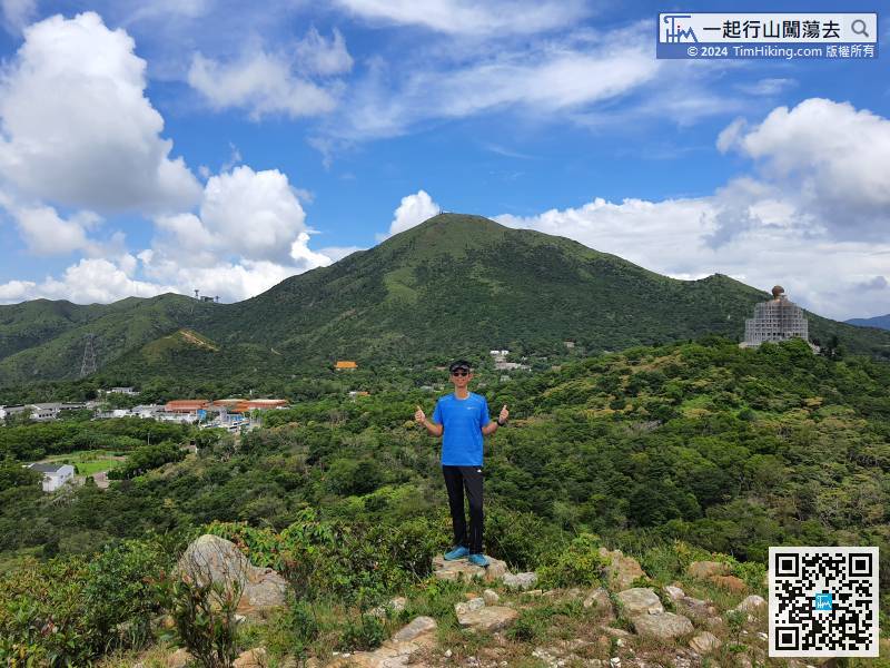
 44︰Hikers may as well take a few minutes to take a look. The scenery is wider than the main peak, and can enjoy the panoramic view of Ngong Ping.
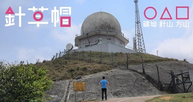
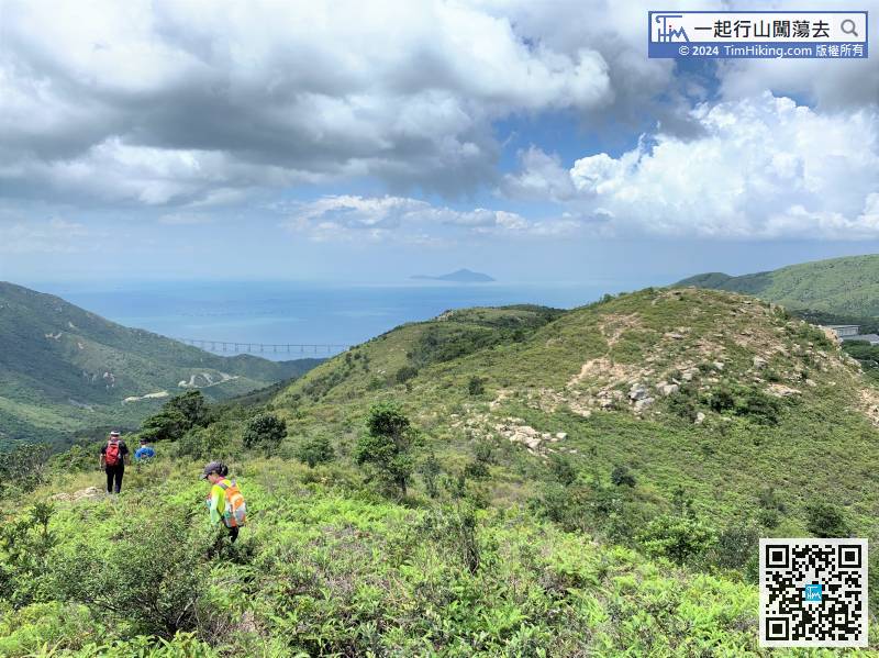


