


 Recommend YouTube

| View : |  | ||
| Difficulty : |  | ||
| Path : | |||
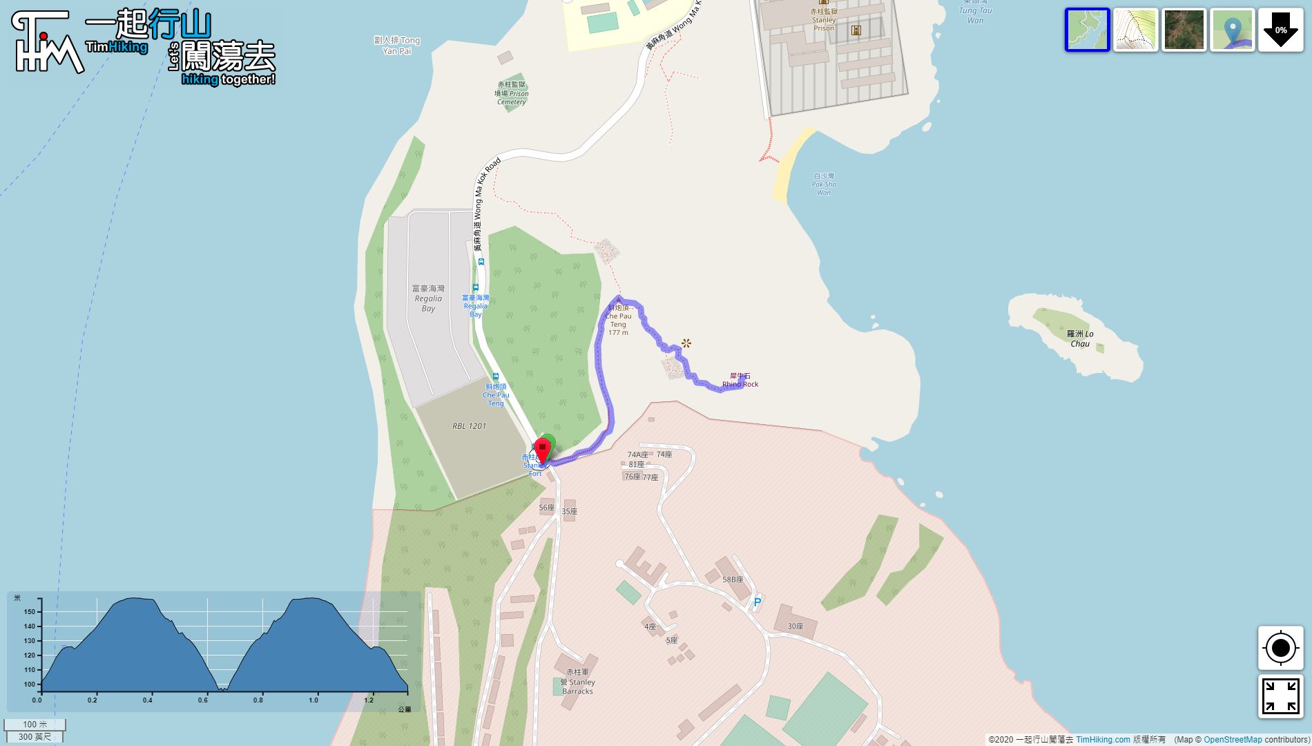
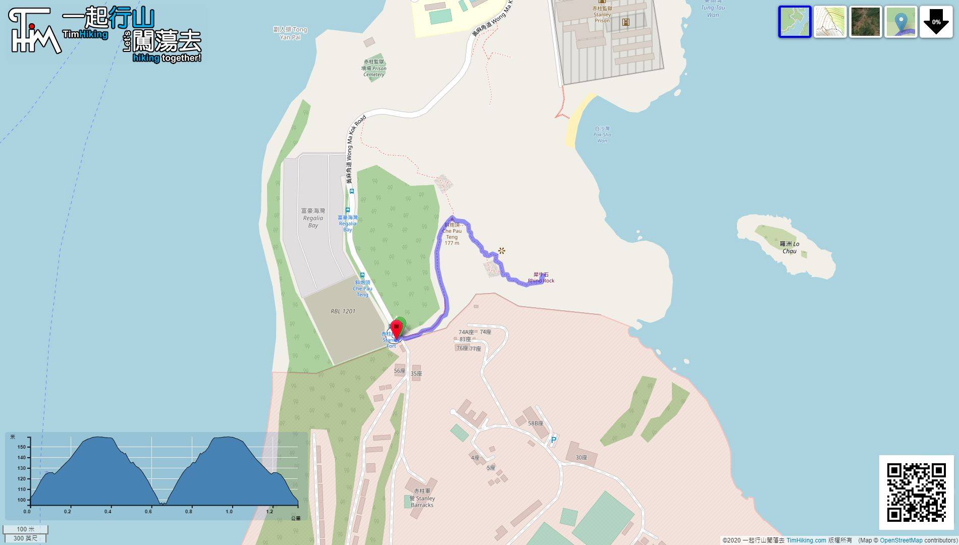
| Length : | 1.4km | ||
| Time : | 2hours | ||
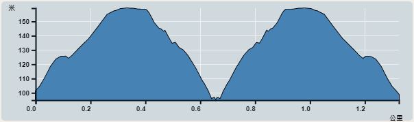 | |
| Ascent : 135m | Descent : 148m |
| Max : 159m | Min : 95m |
| (The accuracy of elevation is +/-30m) | |


| View : | | ||
| Difficulty : | | ||
| Path : | |||
| Length : | 1.4km | ||
| Time : | 2hours | ||
| |
| Ascent : 135m | Descent : 148m |
| Max : 159m | Min : 95m |
| (The accuracy of elevation is +/-30m) | |
Thanks a lot! Hope our hiking information is helpful to you. Everyone is happy to go hiking and safely!
Welcome to use Payme AlipayHK to sponsor Tim Sir's efforts! Continue to give selflessly for the mountain world.
The sun shall not smite thee by day, nor the moon by night. The LORD shall preserve thee from all evil: he shall preserve thy soul.
Psalms 121:6-7
一起爬山闖蕩去 | timhiking | timhiking | timhiking | Message Board | Disclaimer


