


 Recommend YouTube

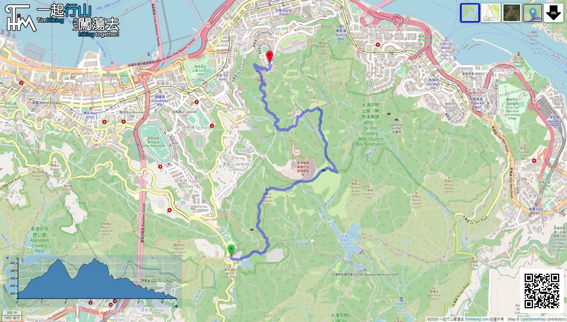
| View : |  | ||
| Difficulty : |  | ||
| Path : | |||
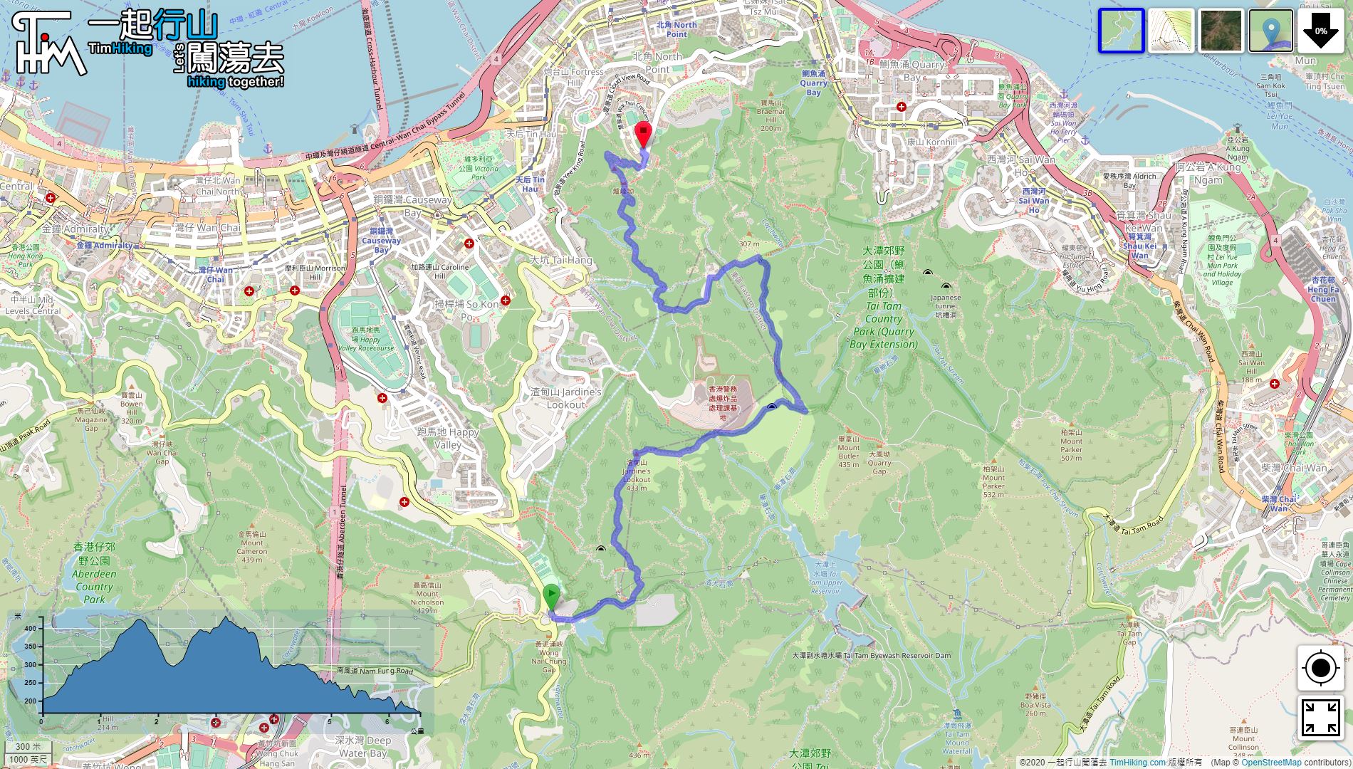
| Length : | 6.6km | ||
| Time : | 4hours | ||
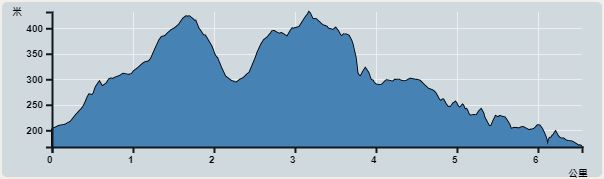 | |
| Ascent : 497m | Descent : 528m |
| Max : 432m | Min : 167m |
| (The accuracy of elevation is +/-30m) | |


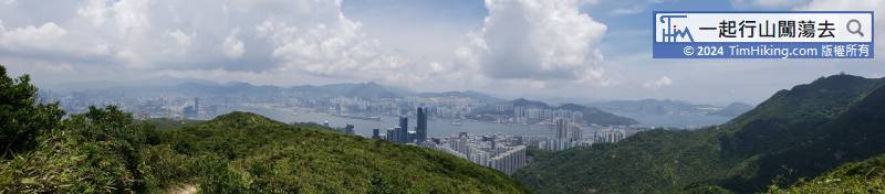

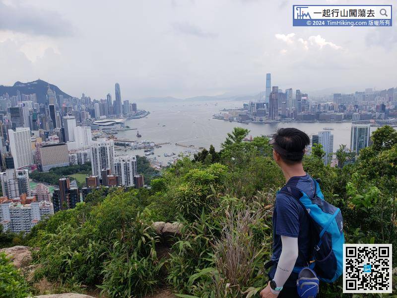
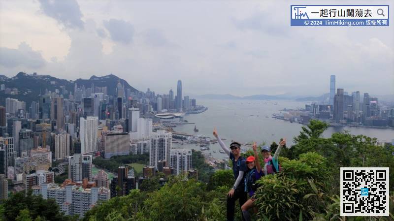
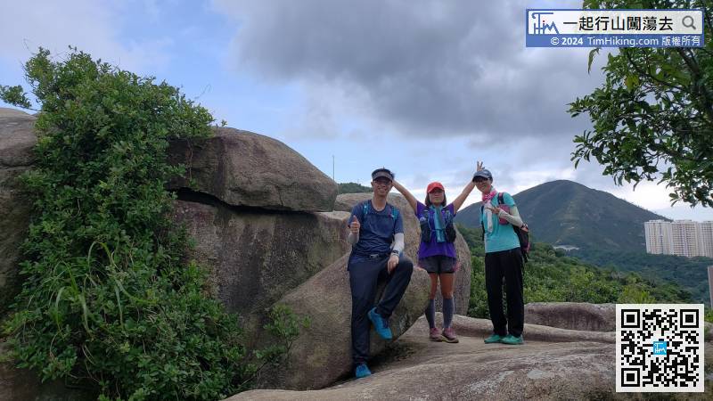
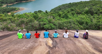
Behind is the landscape of Hung Heung Lo Fung, which is a well-known spot, it is so beautiful.


| View : | | ||
| Difficulty : | | ||
| Path : | |||
| Length : | 6.6km | ||
| Time : | 4hours | ||
| |
| Ascent : 497m | Descent : 528m |
| Max : 432m | Min : 167m |
| (The accuracy of elevation is +/-30m) | |
| cat : | 謝謝! (2021-01-19) |
You're welcome! (Tim Sir 2021-01-19) |
| cat : | 請問那條路線可經此電台呢? (2021-01-18) |
要在圖42的位置向北爆上去 (Tim Sir 2021-01-18) |
| Cat : |  請問這條線, 可否經相片中電台嗎? (2021-01-18) |
此路線沒有經過此位置 (Tim Sir 2021-01-18) |
一起爬山闖蕩去 | timhiking | timhiking | timhiking | Message Board | Disclaimer


