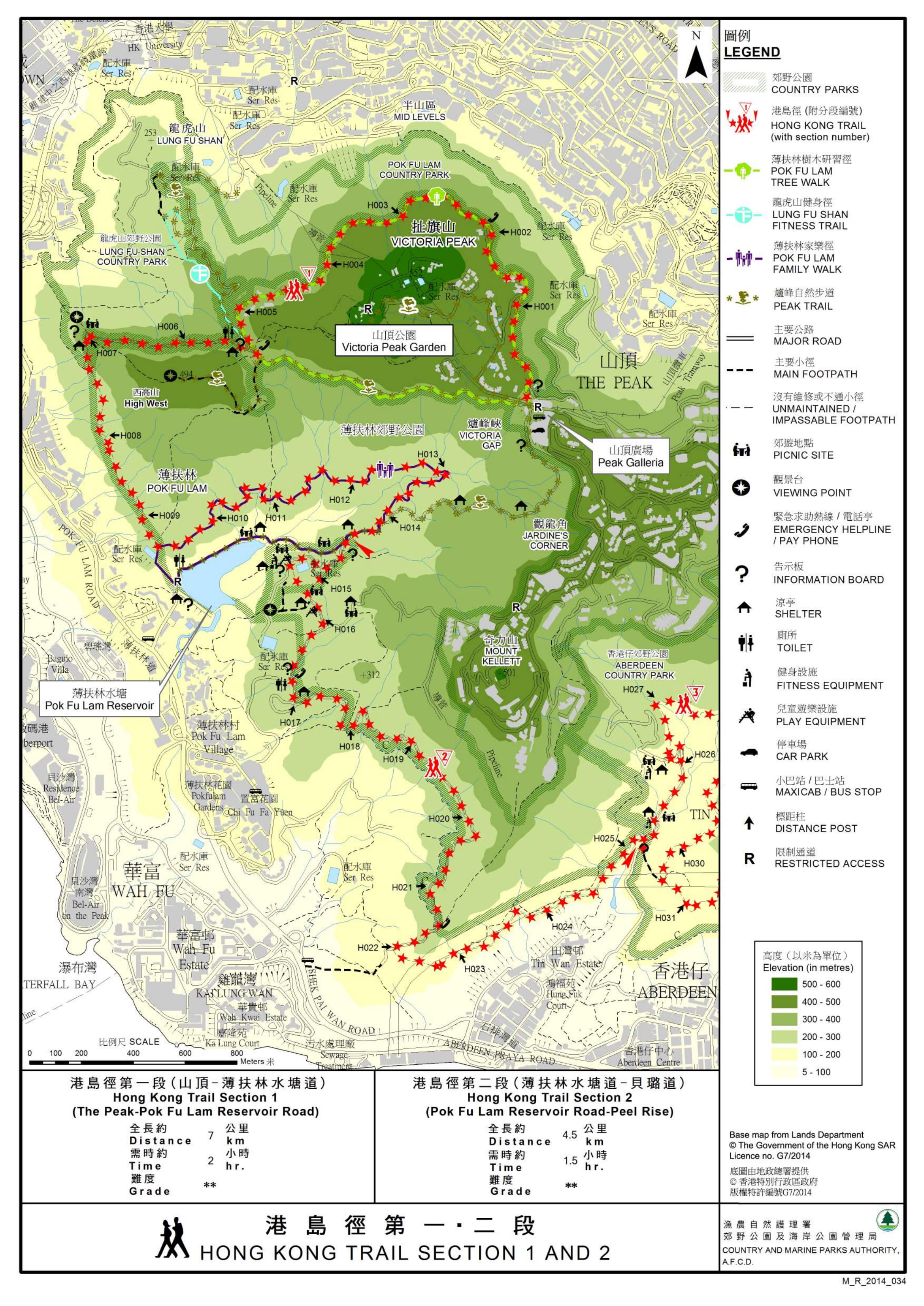
| View : |  | ||
| Difficulty : |  | ||
| Path : | |||
| Length : | 4.3km | ||
| Time : | 1½hours | ||
 | |
| Ascent : 309m | Descent : 416m |
| Max : 268m | Min : 109m |
| (The accuracy of elevation is +/-30m) | |


Official Map


| View : |  | ||
| Difficulty : |  | ||
| Path : | |||
| Length : | 4.3km | ||
| Time : | 1½hours | ||
 | |
| Ascent : 309m | Descent : 416m |
| Max : 268m | Min : 109m |
| (The accuracy of elevation is +/-30m) | |


| Doratam Doratam : | 初看很清𥇦,最喜歡是有海拔高度可估量自己腳力,若路程時間估算可標示行者行山資歷就更好,更容易估量自己腳力,謝謝。現準備去一趟,之後再分享。 (2021-12-12) |
由於腳力、梯級、荒徑、草叢、上斜、落斜、浮沙碎石都會影響不同行山人士的速度,所以基本上是無法準確估計的,還是自己親自微調的好。 (Tim Sir 2021-12-12) |
| Patrick : | Tim sir你好,請問如果在灣仔應該坐什麼巴士去薄扶林水塘起步點呢? (2021-04-09) |
可乘搭【31小巴】;巴士要轉車,可參考【城巴網站 > 目的地 】搜尋。 (Tim Sir 2021-04-10) |
Thanks a lot! Hope our hiking information is helpful to you. Everyone is happy to go hiking and safely!
Welcome to use Payme AlipayHK to sponsor Tim Sir's efforts! Continue to give selflessly for the mountain world.
He always comes alongside us to comfort us in every suffering so that we can come alongside those who are in any painful trial. We can bring them this same comfort that God has poured out upon us.
2 Corinthians 1:4 TPT
一起爬山闖蕩去 | timhiking | timhiking | timhiking | Message Board | Disclaimer