


 Recommend YouTube


| View : |  | ||
| Difficulty : |  | ||
| Path : | |||
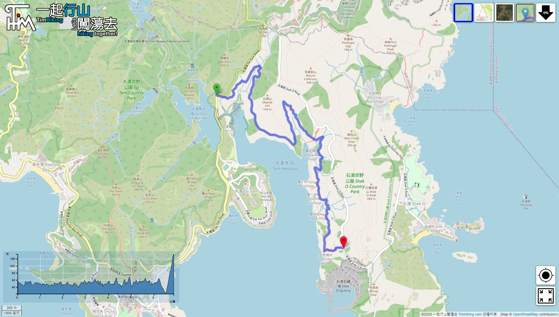
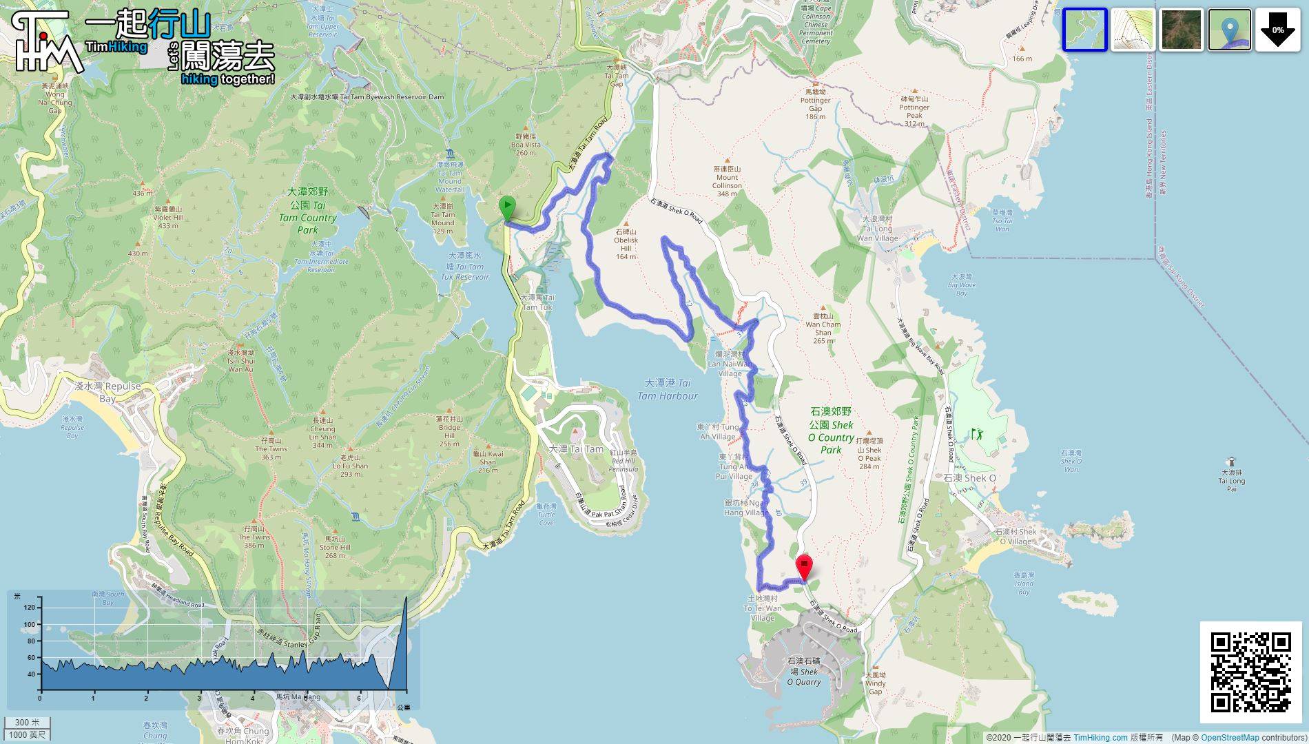
| Length : | 6.9km | ||
| Time : | 2hours | ||
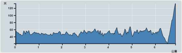 | |
| Ascent : 460m | Descent : 382m |
| Max : 133m | Min : 21m |
| (The accuracy of elevation is +/-30m) | |


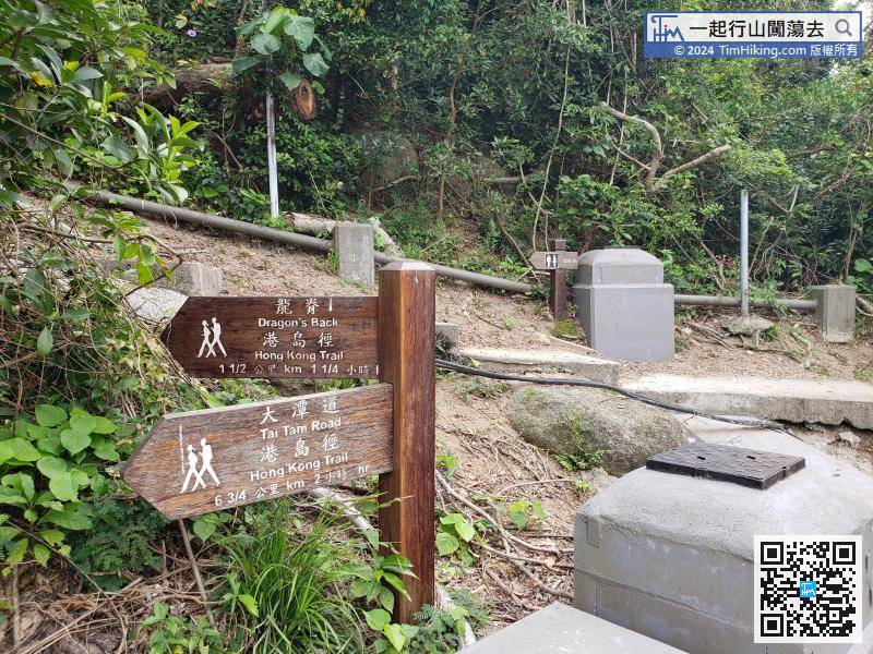
When going to the end, will see a sign to Dragon's Back pointing up the stairs,
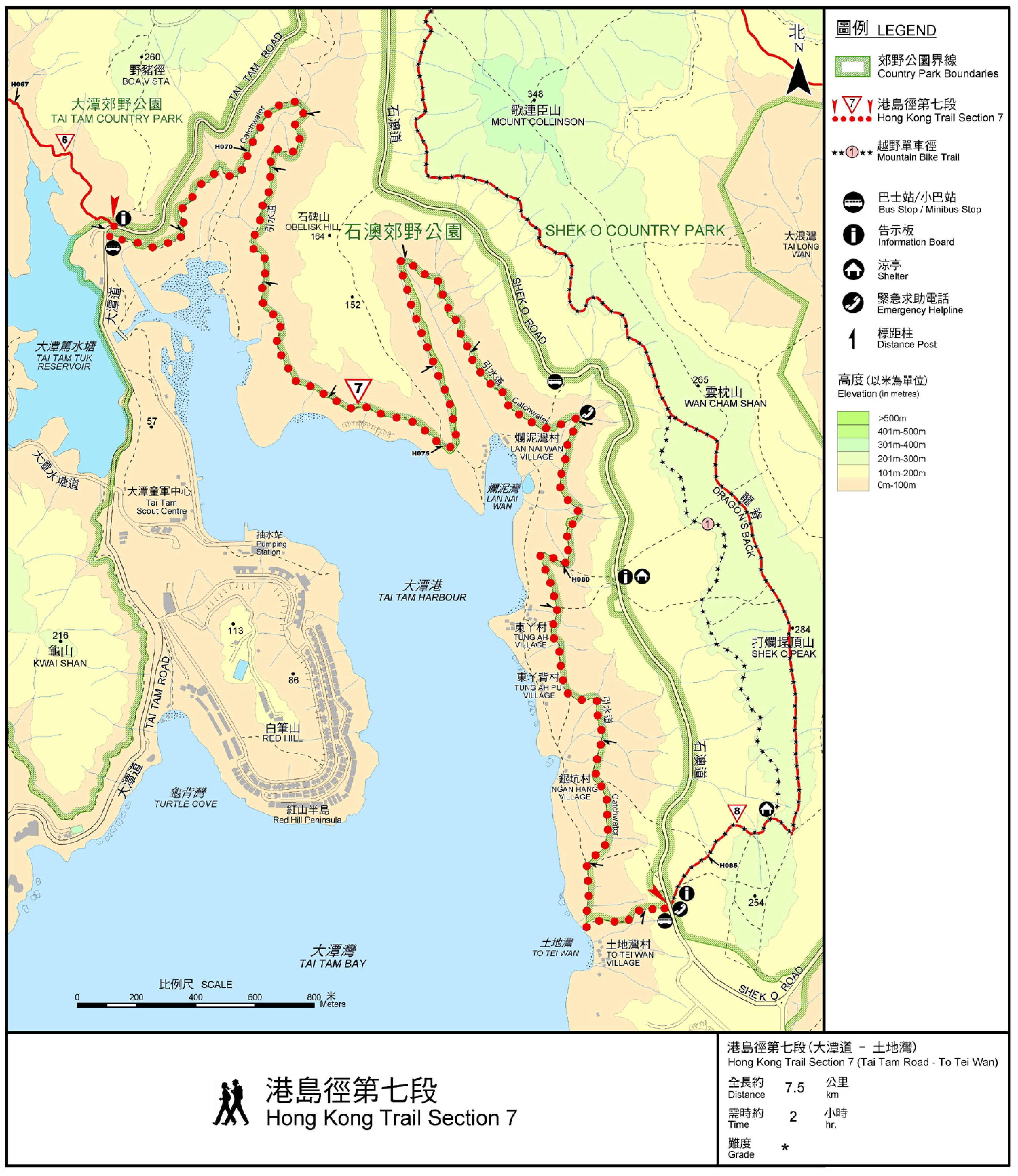
Official Map


| View : | | ||
| Difficulty : | | ||
| Path : | |||
| Length : | 6.9km | ||
| Time : | 2hours | ||
| |
| Ascent : 460m | Descent : 382m |
| Max : 133m | Min : 21m |
| (The accuracy of elevation is +/-30m) | |
Thanks a lot! Hope our hiking information is helpful to you. Everyone is happy to go hiking and safely!
Welcome to use Payme AlipayHK to sponsor Tim Sir's efforts! Continue to give selflessly for the mountain world.
The thief comes only to take the sheep and to put them to death: he comes for their destruction: I have come so that they may have life and have it in greater measure.
John 10:10 BBE
一起爬山闖蕩去 | timhiking | timhiking | timhiking | Message Board | Disclaimer


