


 Recommend YouTube


| View : |  | ||
| Difficulty : |  | ||
| Path : | |||
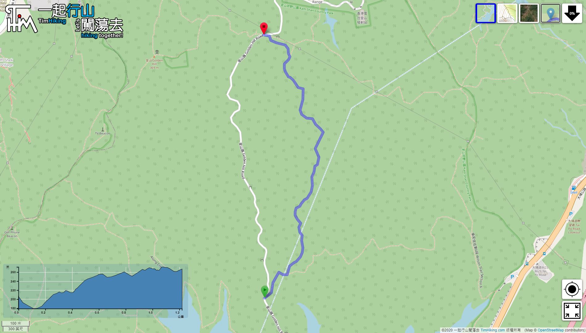
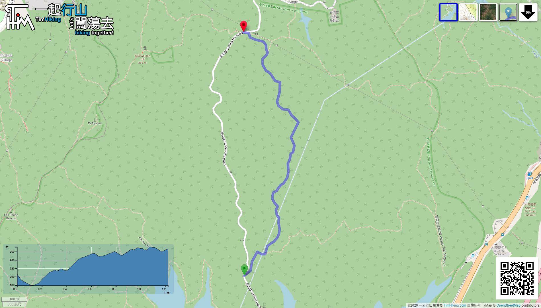
| Length : | 1.3km | ||
| Time : | ½hours | ||
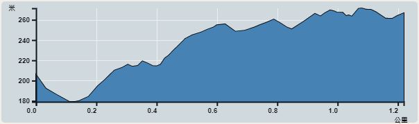 | |
| Ascent : 132m | Descent : 62m |
| Max : 271m | Min : 179m |
| (The accuracy of elevation is +/-30m) | |


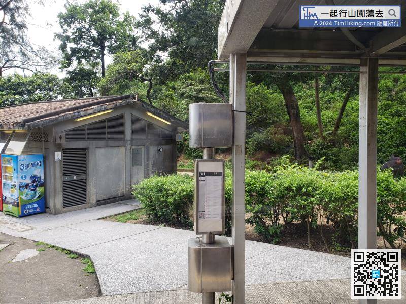
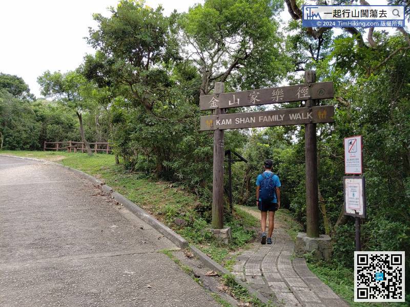
To get to the starting point, take bus 72/81 to Shek Lei Pui Reservoir and get off at Shek Lei Pui Reservoir,
Official Map


