


 Recommend YouTube

| View : |  | ||
| Difficulty : |  | ||
| Path : | |||
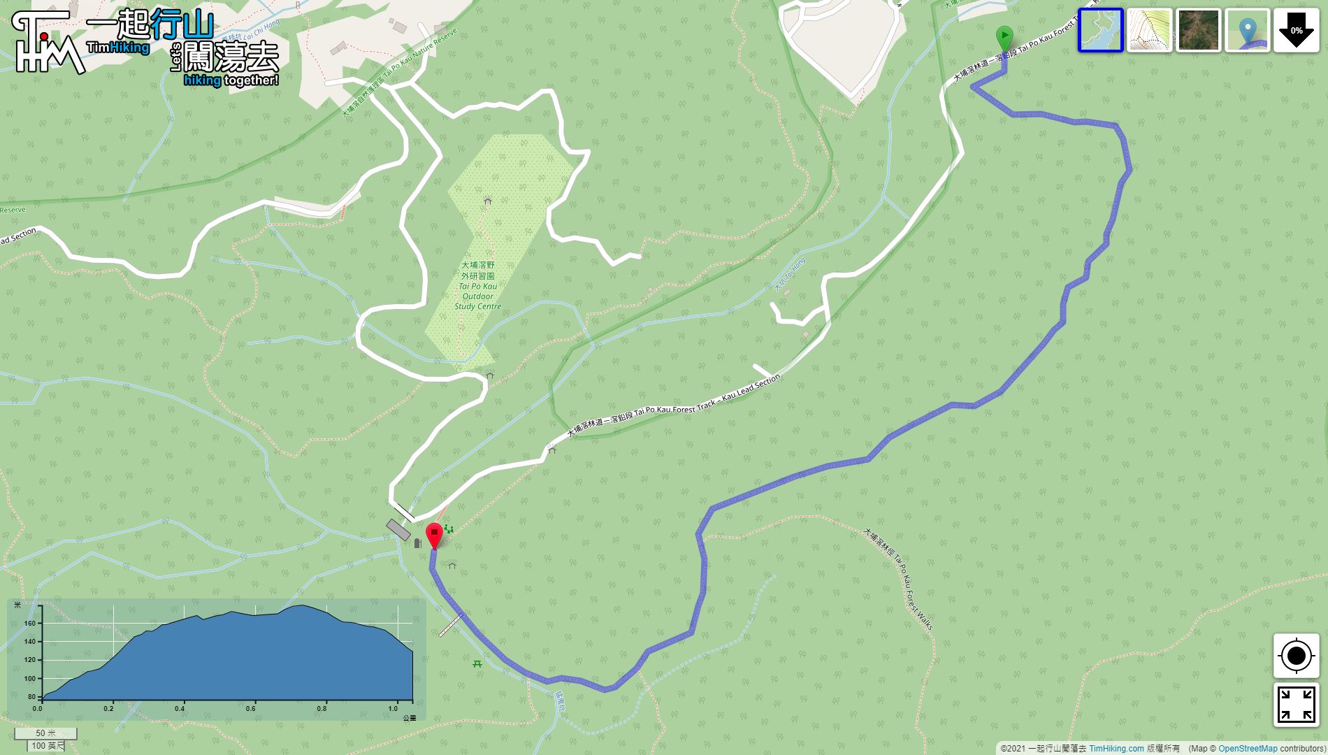
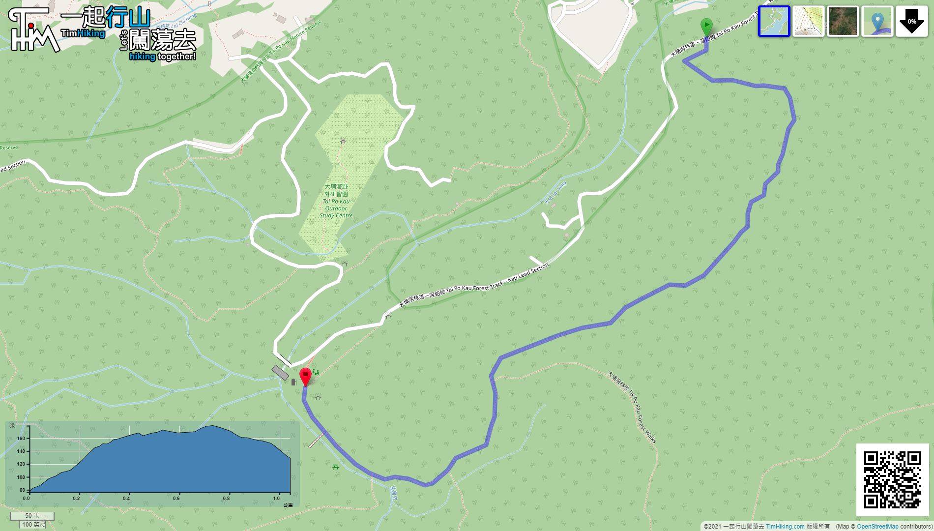
| Length : | 1.1km | ||
| Time : | ½hours | ||
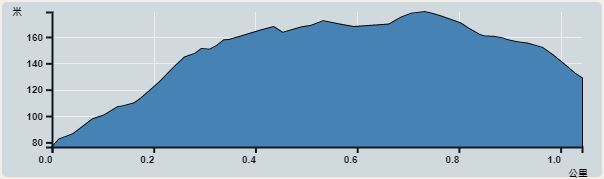 | |
| Ascent : 113m | Descent : 63m |
| Max : 179m | Min : 76m |
| (The accuracy of elevation is +/-30m) | |


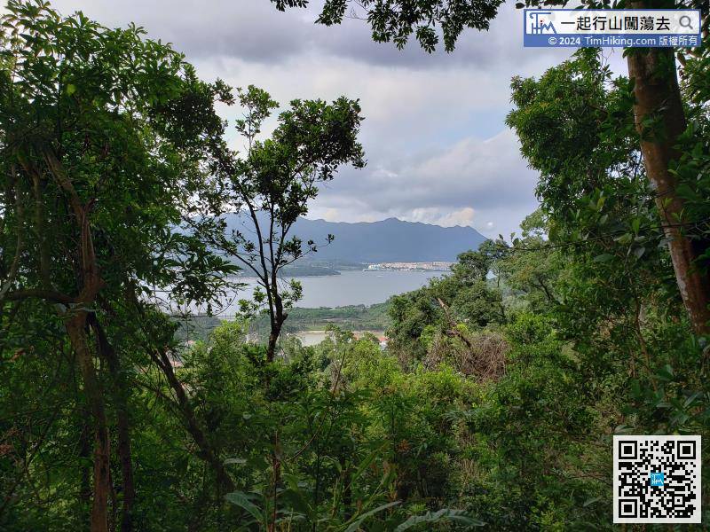
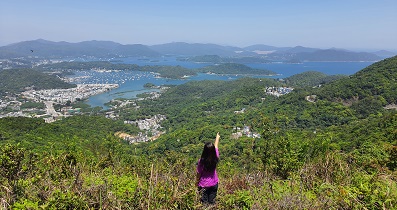
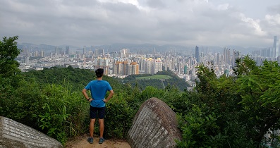
On the trail, can overlook Pat Sin Leng, which is the only distant view.
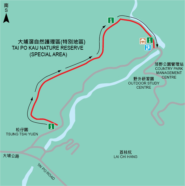
Official Map


| View : | | ||
| Difficulty : | | ||
| Path : | |||
| Length : | 1.1km | ||
| Time : | ½hours | ||
| |
| Ascent : 113m | Descent : 63m |
| Max : 179m | Min : 76m |
| (The accuracy of elevation is +/-30m) | |

一起爬山闖蕩去 | timhiking | timhiking | timhiking | Message Board | Disclaimer


