多謝支持!希望我們的行山資訊對你們有幫助。大家都開心上山,安全落山,一起行山闖蕩去! 歡迎以 Payme AlipayHK 贊助 Tim Sir 的努力!繼續為山界作出貢獻。
清心的人有福了!因為他們必得見神。馬太福音 5:8
清心的人有福了!因為他們必得見神。
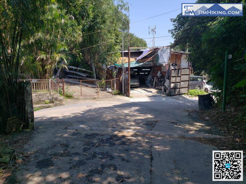
「魔鬼山」英文名「Devil's Peak」,官方名稱為「炮台山」,高海拔222米,位於鯉魚門與將軍澳之間的小山丘,將…
「小夏威夷」位於現時將軍澳與井欄樹之間的山徑,是將軍澳的後花園。不過,你有所不知!浪漫的背後卻有一段悲慘的故事。「小夏…
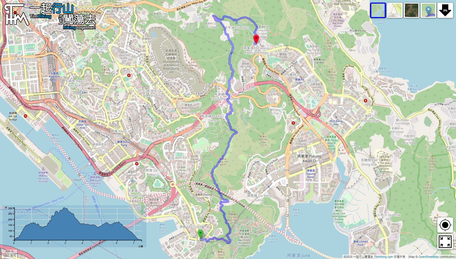
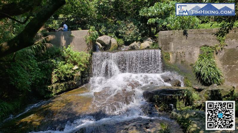
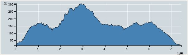
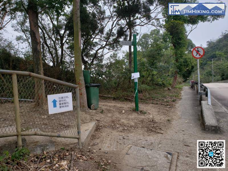
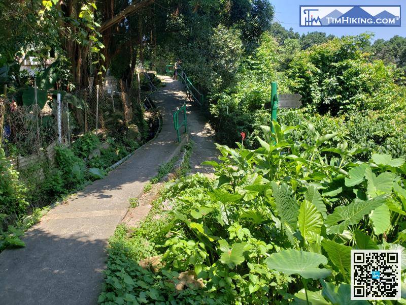
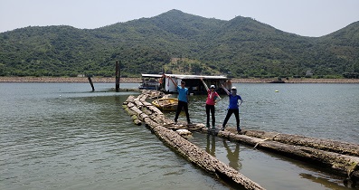
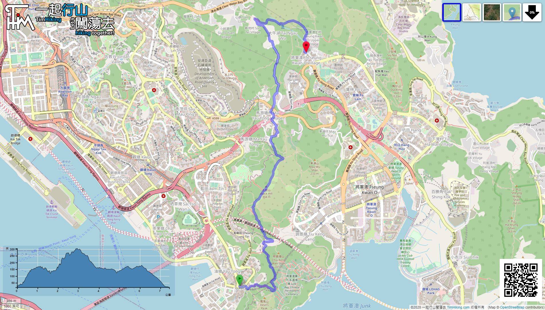
「衛奕信徑第三段」是十段之中第三長的一段,從第二段到第三段,是唯一一段需渡海才可連走。整條路線由藍田經炮台山、五桂山,…
「大上托」又名「過背山」、「蕉欄樹」,位於秀茂坪與井欄樹之間,是將軍澳附近第二高的山峰,現高度為海拔399米。「大上托…
「鴨仔山」舊名「魷魚灣山」,是位於將軍澳坑口至寶琳一帶的一座小山。很多年前將軍澳還未發展的時候,鴨仔山範圍覆蓋整個坑口…
「炮台山」原名「雞婆山」,又名「魔鬼山」,英文名「Devil's Peak」,高海拔222米。「炮台山」 — 油塘及將…
「曝罟灣」位於西貢北潭涌萬宜水庫、「擺頭墩」西面的一個海灣,其村落均已完全被荒廢,灣內最別具特色的是一條很長的半月形堤…
「曝罟灣」位於西貢北潭涌萬宜水庫的西北面,曾經有一條村落,但現今已完全被荒廢,人去流空。灣內留下了長長的半月形堤圍,是…
此路線是馬年行大運,將會在將軍澳行一個小馬圖案出來,路程大約是12公里,非常有趣的。全程近乎沒有山徑,走的都是行人路,…
「上洋山」、「下洋山」、「廟仔墩」、「釣魚翁」、「田下山」均位於西貢清水灣半島,分別高海拔260米、260米、335米…
「田下山」位於西貢清水灣半島,高海拔274米,屬於清水灣郊野公園,就近釣魚翁郊遊徑的盡頭,山友途經不妨上去看一看風景。…
「蓮花山」、「石龍拱」、「下花山」均位於「麥理浩第九段」以南及荃灣以西北的山峰,海拔高度分別為579米、474米、31…
「鯤鵬徑」的得名源於傳說中的神獸,「鯤」乃神獸大魚,身長幾千里;「鵬」則是鳳凰,又名火鳥、不死鳥。「鯤鵬徑」的起點及終…
「玉桂山」高海拔196米,是鴨脷洲最高的一座山峰,位於利東邨以南,山形尖而圓,山徑陡峭崎嶇,碎沙碎石猶如輕量版的蚺蛇尖…
「黃牛山」、「水牛山」位於沙田與西貢之間,與石芽山一脈相連,形成一個環形山脊。「黃牛山」、「水牛山」分別高海拔604米…
「鳳坑家樂徑」位於新界鹿頸,臨近沙頭角海,官方長度為2.25公里,需時約45分鐘完成。景點主要是兩個觀景台,一個面向紅…
「千島湖清景台」於2019年初落成,是欣賞大欖涌水塘千島湖的官方最佳地點。大欖涌水塘是屯門區大欖涌的一個大水塘,位於大…
「扶輪公園自然教育徑」的起點位於大帽山之下的扶輪公園燒烤場,終點在川龍之上的新開田,全程約為0.8公里,均往下走,非常…
「虎豹亭」,人稱為「大坑亭」,合共有三個,分別埋藏於港島大坑的密林中,實際位置是慧景園、龍華花園與大坑食水配水庫之間的…
「草山」高海拔647米,位於針山以北,大帽山以東的一座高峰,其北面是大埔,東南面是沙田,西南面是荃灣。「草山」的地貌特…
「港島徑第七段」全長7.5公里,是港島徑第二長的一段,全程九成是引水道,極之易行。引水道會先後繞過石碑山山腰、爛泥灣、…
「長索」是鄰近大嶼山陰澳的一個無人小島,跟橋咀洲、玉桂山一樣,擁有一條長沙洲,而沙洲就分隔開鹿頸灣及陰澳灣。陰澳以前有…
「港島徑第四段」由灣仔峽出發,經林蔭的金夫人馳馬徑,轉入中峽道上山,再沿金馬倫山山腰的布力徑行,最後去到黃泥涌峽完結。
「紅花山」位於深圳光明區,於1996年被闢地改建成「紅花山公園」,分多期不斷擴建改造,現佔地27.39萬平方米,是一個…
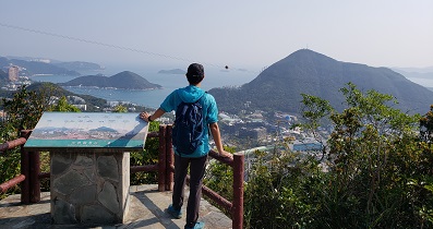
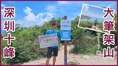
深圳「大筆架山」高海拔717米,位於深圳東部的壩光,深圳與惠州的交界,其山勢雄偉,近海而立,是畢業綫「三水綫」的必經之…
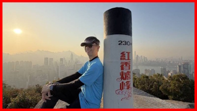
「紅香爐峰」高海拔230米,鄰近港島寶馬山,非常就近市區,路程極之短,上山少於1公里,來回快的半小時也能完成,影相時間…
一起爬山闖蕩去 | timhiking | timhiking | timhiking | 山友留言 | 免責聲明


 YouTube 隨 機 推 介


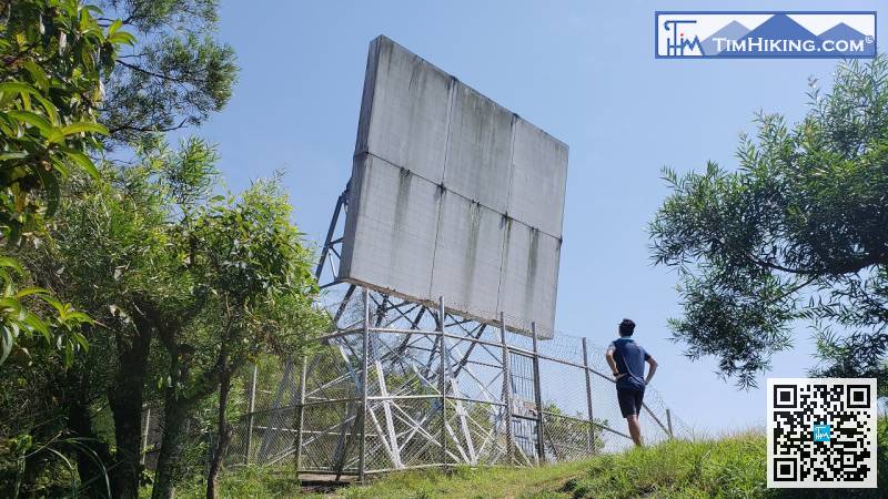


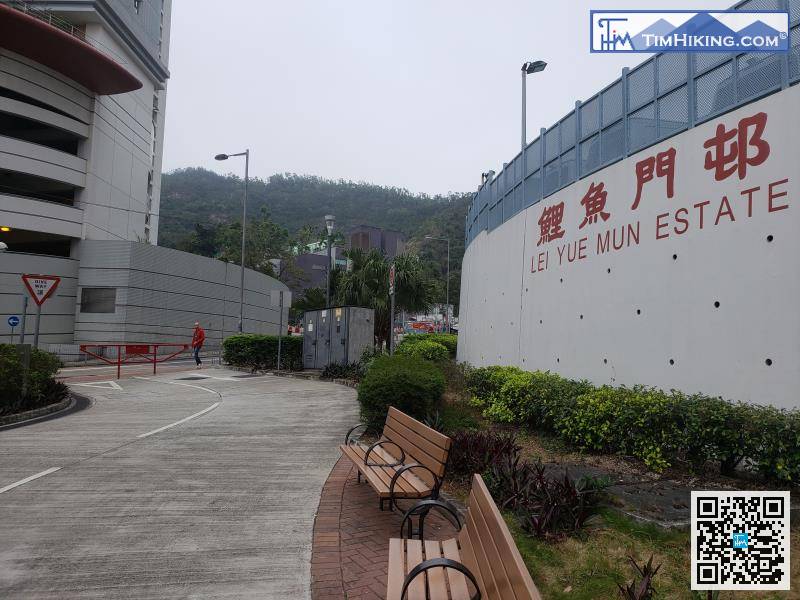
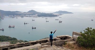
 37︰航空導航反射器一共有兩個,先是一個反向放的,也是五桂山的主峰。
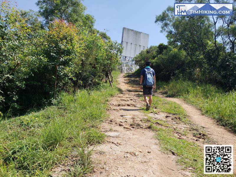

 37︰航空導航反射器一共有兩個,先是一個反向放的,也是五桂山的主峰。


