


 Recommend YouTube


| View : |  | ||
| Difficulty : |  | ||
| Path : | |||
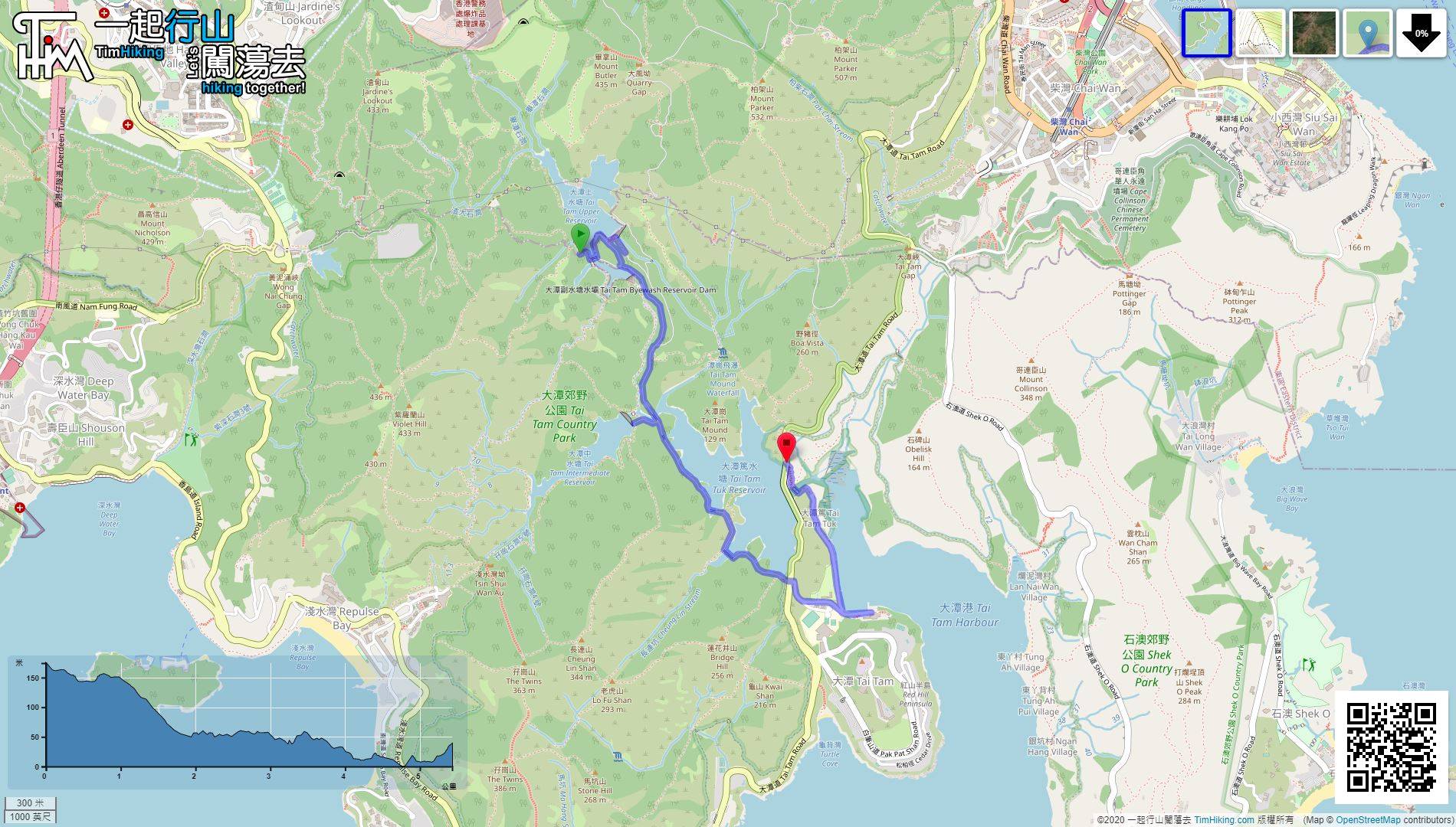
| Length : | 5.5km | ||
| Time : | 2hours | ||
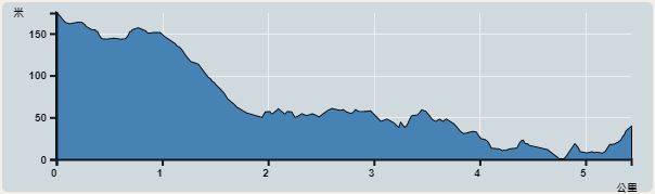 | |
| Ascent : 164m | Descent : 297m |
| Max : 174m | Min : 0m |
| (The accuracy of elevation is +/-30m) | |


 Drinks Machine
 14︰When coming to the Tai Tam Management Centre midway,
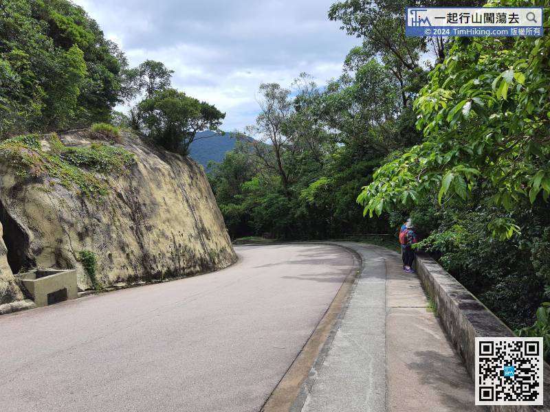
It still has one more kilometre to the starting point of Tai Tam Waterworks Heritage Trail.
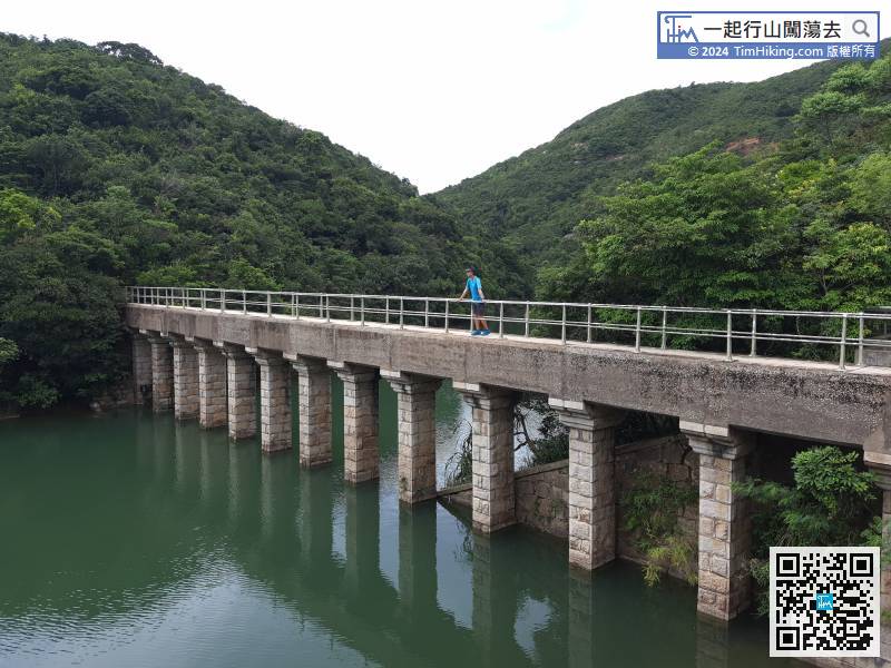
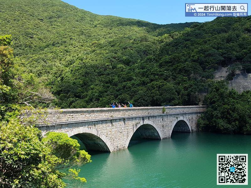
30︰On the left-hand side is (1) Tai Tam Upper Reservoir Masonry Bridge.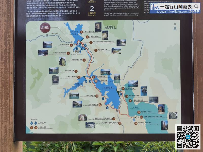
The bulletin board ahead shows the route map of the entire Tai Tam Waterworks Heritage Trail.
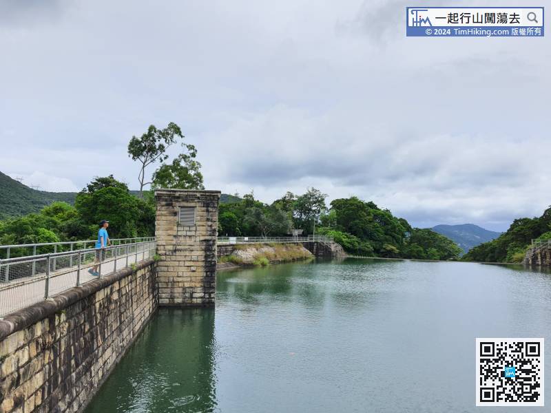
42︰(5) Tai Tam Upper Reservoir Recorder House and Tunnel Inlet is just behind.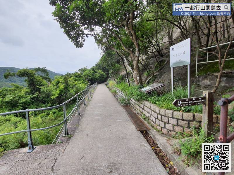
Return to the Waterworks Heritage Trail, do not cross over the dam.
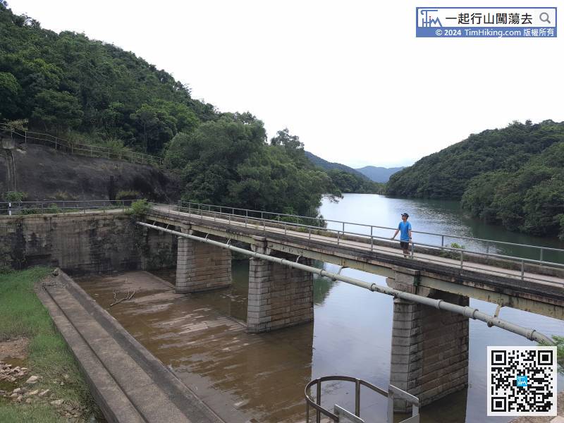
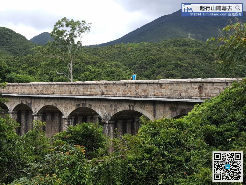
 68︰Looking back on the way, can see the elegant (8) Tai Tam Tuk Reservoir Masonry Bridge.
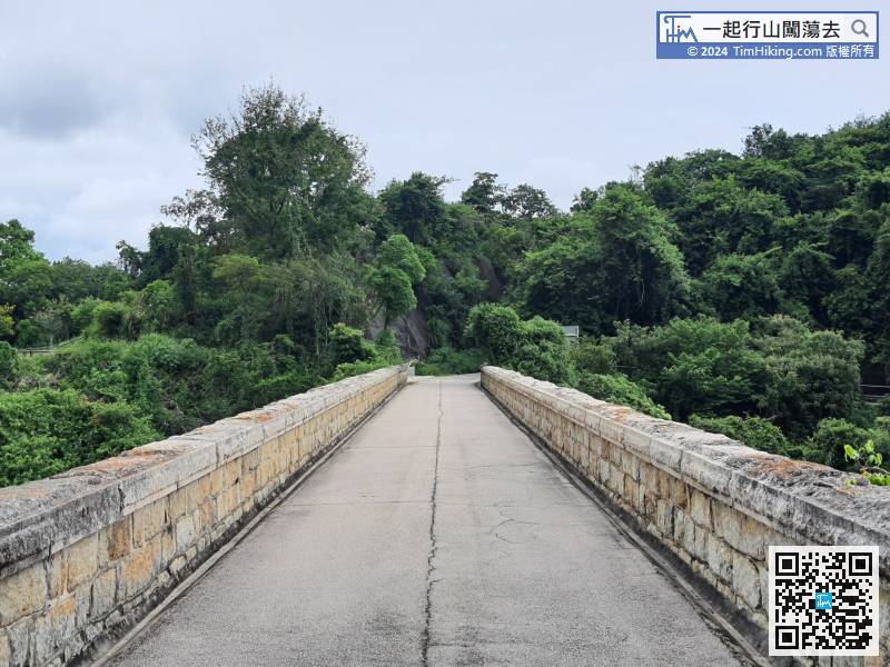
In an instance, come to a Masonry Bridge, which is (8) Tai Tam Tuk Intermediate Reservoir Masonry Bridge.
82︰Near the exit of Tai Tam Road, it is an ideal place to see Tai Tam Tuk Reservoir.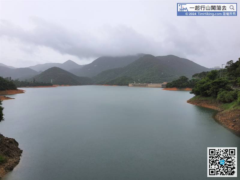
Near the exit of Tai Tam Road, it is an ideal place to see Tai Tam Tuk Reservoir.
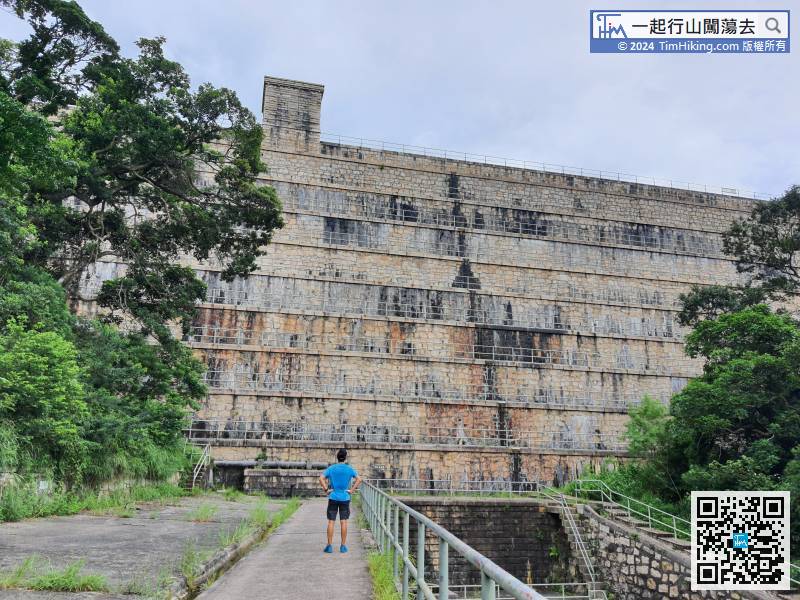
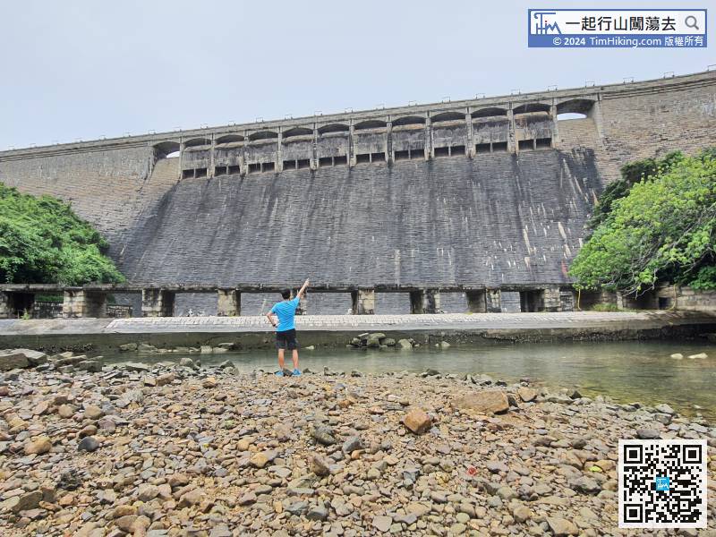
100︰which is (14) Tai Tam Tuk Reservoir Dam, that could be used for two-lane traffic, with 12 arch bridges and 10 spillways.
After visiting the quarters complex of Tai Tam Reservoir,


