


 Recommend YouTube


| View : |  | ||
| Difficulty : |  | ||
| Path : | |||
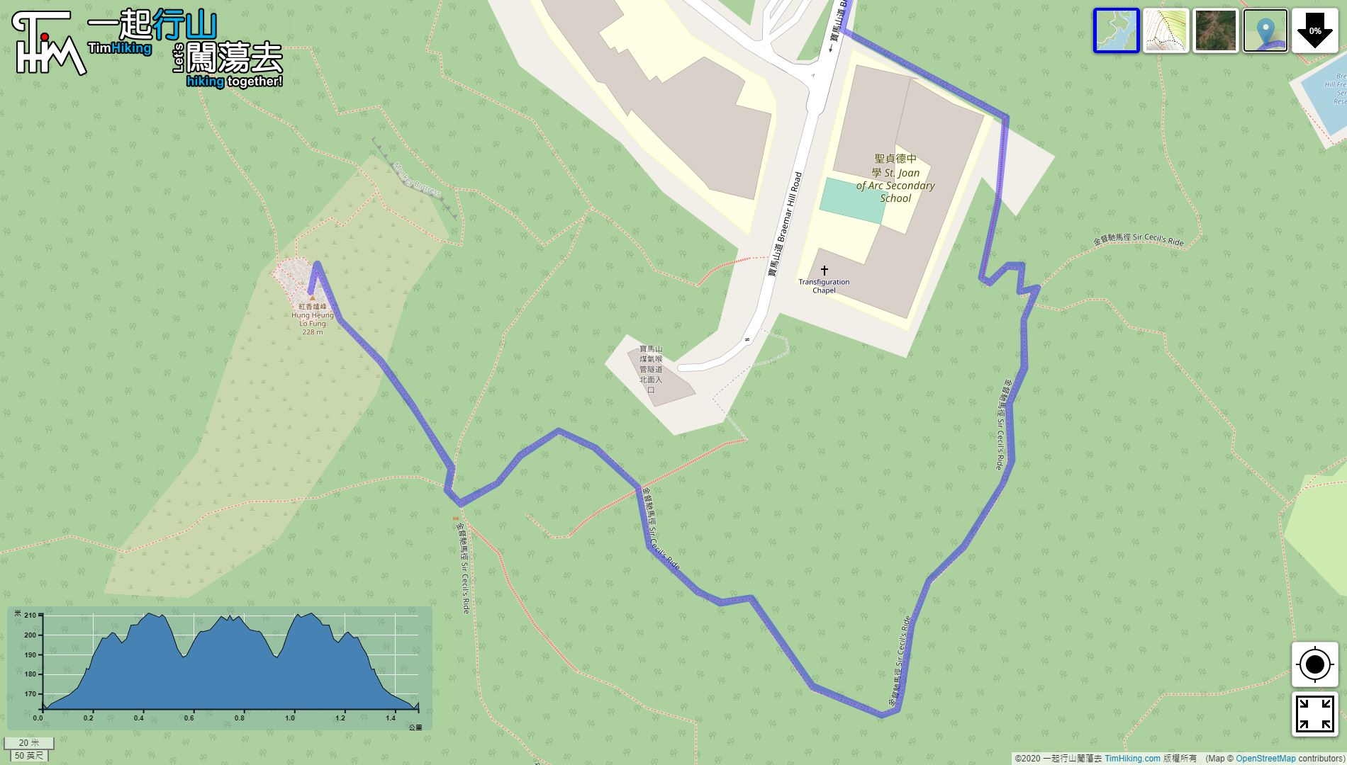
| Length : | 1.5km | ||
| Time : | ½hours | ||
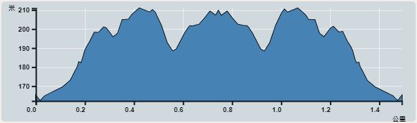 | |
| Ascent : 126m | Descent : 129m |
| Max : 211m | Min : 162m |
| (The accuracy of elevation is +/-30m) | |


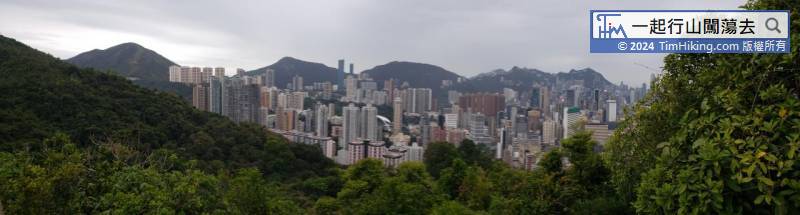
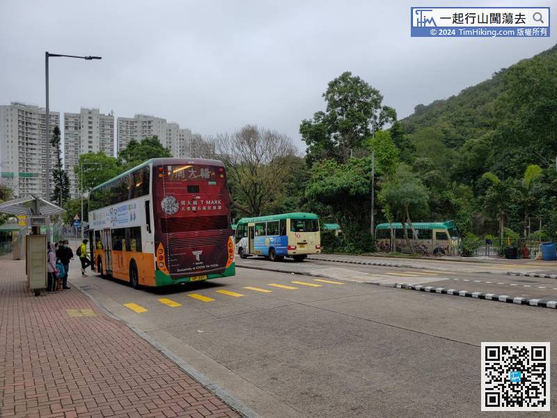
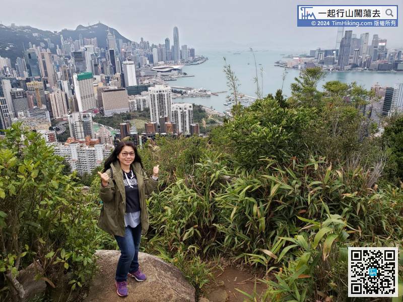
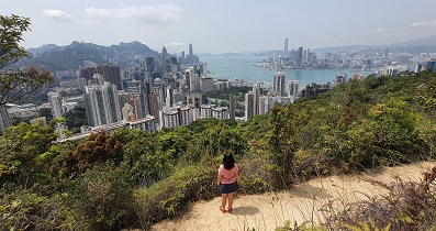
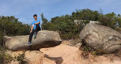
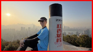
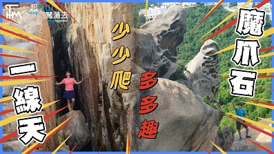
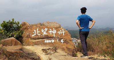
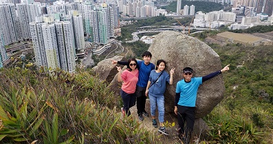
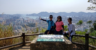
 14︰will reach the top of Hung Heung Lo Fung.
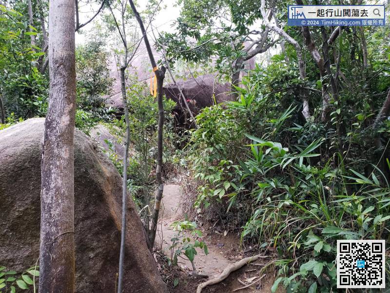


| View : | | ||
| Difficulty : | | ||
| Path : | |||
| Length : | 1.5km | ||
| Time : | ½hours | ||
| |
| Ascent : 126m | Descent : 129m |
| Max : 211m | Min : 162m |
| (The accuracy of elevation is +/-30m) | |
14︰will reach the top of Hung Heung Lo Fung.
| P.H.SO : |  Tim Sir 您好, 昨日我去到紅香爐峰標高柱, 發現標高柱的資料更新咗, 改為寶馬山. (2024-06-17) |
嚇... 那麼真正寶馬山呢?😨 (Tim Sir 2024-06-19) |
| Queennie : | 謝謝你仔細的分享,我終於第一次自己上到山啊! (2021-12-02) |
ENJOY 😍 (Tim Sir 2021-12-02) |
| Mark : | 非常多人嘅紅香爐峰! (2021-10-03) |
假日是非常多人的,因為真的很久市區,10-15分鐘就可由街邊行到上山頂。😉 (Tim Sir 2021-10-03) |
Thanks a lot! Hope our hiking information is helpful to you. Everyone is happy to go hiking and safely!
Welcome to use Payme AlipayHK to sponsor Tim Sir's efforts! Continue to give selflessly for the mountain world.
A man's good sense makes him slow to wrath, and the overlooking of wrongdoing is his glory.
Proverbs 19:11 BBE
一起爬山闖蕩去 | timhiking | timhiking | timhiking | Message Board | Disclaimer


