一起行山闖蕩去

Biu Tsim Kok
Po Pin Chau (2020 Outdated)

Biu Tsim Kok, Po Pin Chau (2020 Outdated)  Login can add to my Favorite

 2020-08-05
 Total Views: 37,781     (Last Updated︰2020-11-16)
 Map 「Biu Tsim Kok, Po Pin Chau (2020 Outdated)」路線Map
View :
Difficulty :

(Biu Tsim Kok only)
Path :
Length : 6.2km
Estimate : 3½hours
Ascent : 194m  Descent : 194m  Max : 155m  Min : 6m<br><p class='smallfont'>The accuracy of elevation is +/-30m

Ascent : 194mDescent : 194m
Max : 155mMin : 6m
(The accuracy of elevation is +/-30m)  
Section :
 
Trail 60%
Road 30%
Gravel 10%
Slope :
 
Ascent 194m (50%)
Descent 194m (50%)
Exposure :
 
100%
Climb :
 
 
Start Point :
Taxi 
Support :
 
 
End Point :
Minibus Taxi 
 ©2024 一起行山闖蕩去 TimHiking.com


17︰to enjoy the beautiful scenery.
Get off at the big pavilion at the end of the East Dam road,


 ©2024 一起行山闖蕩去 TimHiking.com
20︰Soon will come to Biu Tsim Kok Viewing Point. The Viewing Point is very wide
Soon will come to Biu Tsim Kok Viewing Point. The Viewing Point is very wide


 ©2024 一起行山闖蕩去 TimHiking.com
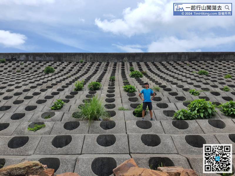
38︰or go to the breakwater to feel its magnificent aura.
Return to the other side,


 ©2024 一起行山闖蕩去 TimHiking.com
52︰Step forwards a little bit, can clearly see Kim Chu Wan below, and the Hong Kong Heart pattern on the mountain,
Look at the direction of Po Pin Chau,


 ©2024 一起行山闖蕩去 TimHiking.com
After a break,
After a break,


 ©2024 一起行山闖蕩去 TimHiking.com


 ©2024 一起行山闖蕩去 TimHiking.com


TimHiking【Biu Tsim Kok . Po Pin Chau (2020 Outdated)】Hong Kong Hiking Map

           
家政 :TIM SIR, 請問走落檢豬灣的70度斜坡的路段是否必須手腳並用才可? 沿途沒有任何扶繩可靠的? 回頭上回去是否會比下來更難? (2021-11-15)
 
是,未斷就有😂,上比落易。 (Tim Sir 2021-11-15)
Simon Suen :
去花⛰️破邊州途中,颱風吹咗大量垃圾在石灘上😩
木級好好行
執咗一大袋垃圾(膠樽、紙巾⋯⋯)
(2021-02-28)
 
感謝清徑,好在有你!😍 (Tim Sir 2021-02-28)
Ricky Pun :紀念碑前的樓梯已經修建好!非常易行! (2021-01-27)
 
GOOD! 不想攀爬的,可走回梯級。 (Tim Sir 2021-01-27)
mickey :圖44的鐵絲網下方有人放了大石上落 可以直接落到地行然後駁上荒徑了 不需靠鐵絲網沿走至荒徑 (2020-11-16)
 
謝謝,有沒有相片可提供給我們呢? (Tim Sir 2020-11-16)
Kelly :想要多少少由東霸鐵線網過破邊洲攀岩上的相片,想知道是否很險峻? (2020-10-21)
 
只要沒有落雨,岩石不濕滑就好安全,你可參考圖47的全景360相片。 (Tim Sir 2020-10-21)

Alias:      Email: 
   

😄
* Photos can only be personal or landscape photos, and group photos are authorized for portrait rights by default. In addition, headshots, dangerous shots, or photos containing promotional elements are not accepted.
* The shared content may be published after revision. The content must be absolutely positive. If it does not meet the standards, the content will be deleted.
* The message will be approved within one day, and the final decision-making authority will be reserved for TimHiking.

 Thanks a lot! Hope our hiking information is helpful to you. Everyone is happy to go hiking and safely!
 Welcome to use  Payme   AlipayHK  to sponsor Tim Sir's efforts! Continue to give selflessly for the mountain world.

他必救你脫離捕鳥者的羅網和毀滅人的瘟疫。他必用自己的翎毛遮蔽你;你要投靠在他翅膀底下。他的信實是大小的盾牌。

詩篇 91:3-4 和修版