


 YouTube 隨 機 推 介

| 景觀︰ |  | ||
| 難度︰ |  | ||
| 路線︰ | |||
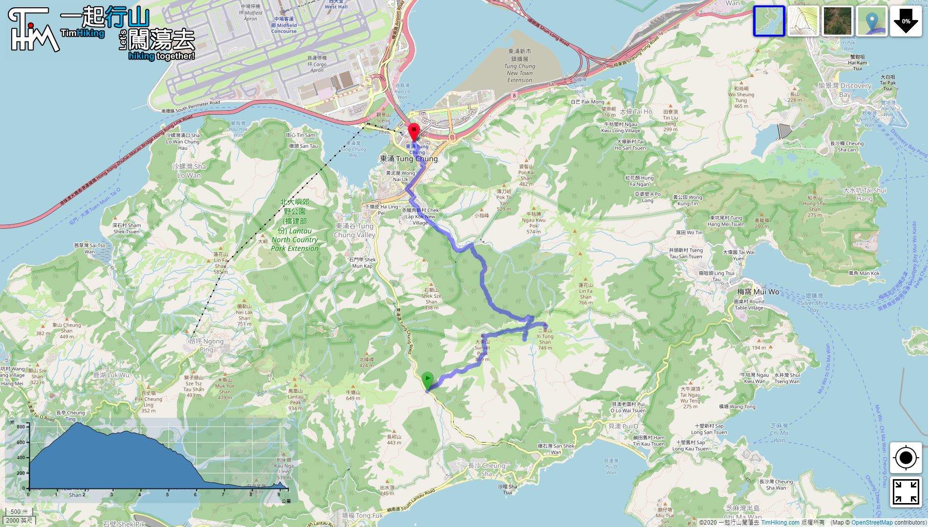
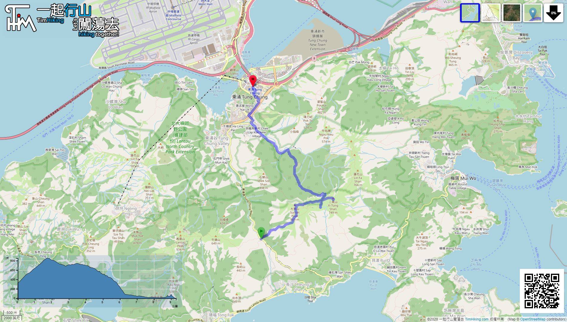
| 全長︰ | 9.4公里 | 需時︰ | 6小時 |
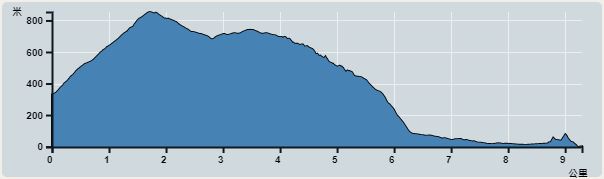 | |
| 攀升︰754米 | 下降︰1,158米 |
| 最高︰854米 | 最低︰0米 |
| (海拔高度值只供參考 誤差約是30米內) | |


| 景觀︰ | | ||
| 難度︰ | | ||
| 路線︰ | |||
| 全長︰ | 9.4公里 | 需時︰ | 6小時 |
| |
| 攀升︰754米 | 下降︰1,158米 |
| 最高︰854米 | 最低︰0米 |
| (海拔高度值只供參考 誤差約是30米內) | |
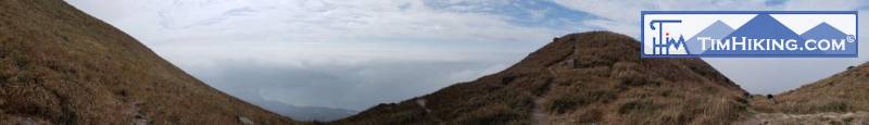
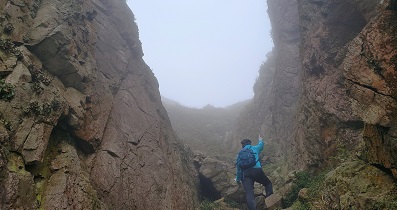
| Markk : |  Tim sir, 昨天試新路,從伯公坳經南大嶼郊遊徑轉行大東山南脊上一號觀景台上大東山。天氣非常大風亦大霧,如你所說,在大霧下穿越爛頭營要有啲方向感。到二東山仍然霧鎖山峯,放棄潮濕嘅黃龍坑郊遊徑落山,改由二東一號屋直落雙東坳接鳳凰徑落南山走人。 (2024-02-18) |
在大霧下行山,最好係曾經行過的路,就萬無一失。 (Tim Sir 2024-02-19) |
| seven : |  昨日(星期日)大東山又有山火。我從梅窩上,原本打算落伯公坳,但因山火,改落黃龍坑,梯級真是好多,但確實極速下山。非常多謝你詳細的路綫指引! (2021-12-13) |
 昨日經過,燒到山徑旁,好多地方都燻黑了。 (Tim Sir 2021-12-14) |
| fungfung178 : | 請問大東山燒了, 那麼這個星期六還可以行山嗎? (2021-12-07) |
可以,已經熄滅了。 (Tim Sir 2021-12-07) |
| CHEUK SHAN : | 我覺得係山徑上遇到小童時大讚對方好叻係行山的禮儀, 哈哈, 我女(5歲)都好受呢招. 正在打算帶女挑戰呢個路段 (2021-03-24) |
其實幾細都沒所謂的,小朋友隨時比大人更行得。😊 (Tim Sir 2021-03-24) |
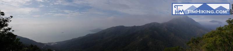
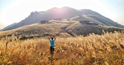
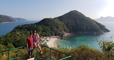
| 颱風 : | 大東山風景太美了, 謝謝你詳盡既行山路線及圖片! (2020-04-15) |
You're welcome! (Tim Sir 2020-04-16) |


