


 Recommend YouTube


| View : |  | ||
| Difficulty : |  | ||
| Path : | |||
| Length : | 3.8km | ||
| Time : | 2½hours | ||
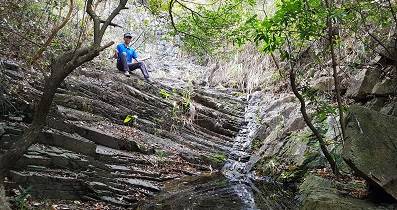
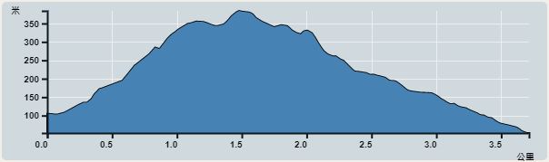 | |
| Ascent : 321m | Descent : 371m |
| Max : 384m | Min : 53m |
| (The accuracy of elevation is +/-30m) | |


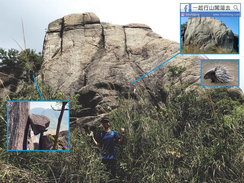
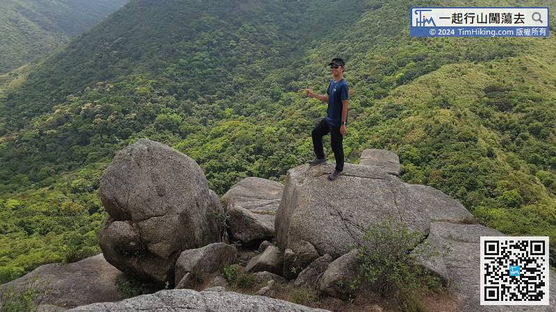
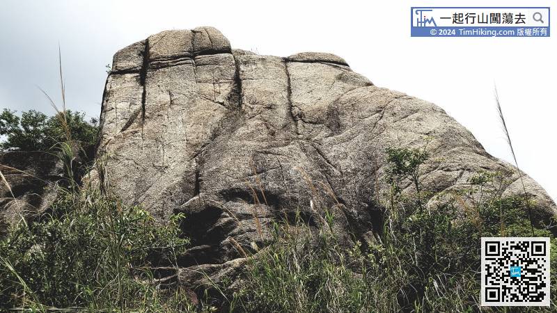
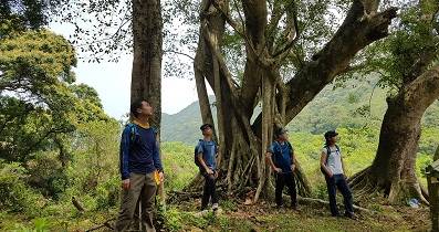
When coming to the bottom of Hedgehog Rock, the grass is denser, almost covering Hedgehog Rock.


| View : | | ||
| Difficulty : | | ||
| Path : | |||
| Length : | 3.8km | ||
| Time : | 2½hours | ||
| |
| Ascent : 321m | Descent : 371m |
| Max : 384m | Min : 53m |
| (The accuracy of elevation is +/-30m) | |
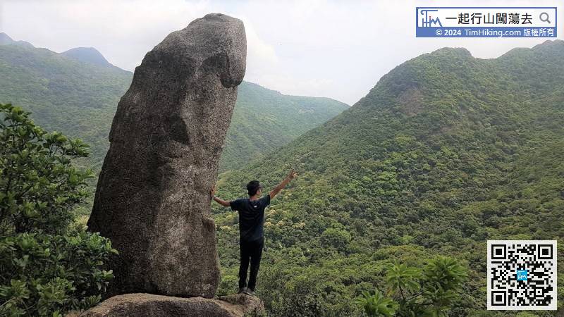
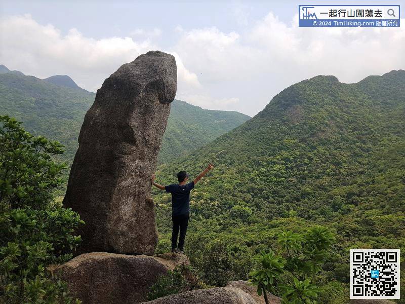
| 拉牛上山 : | 今早閒走梅花古道,記憶中在梅子林已經遠遠可見陽元石,但今天看不見。一直走,記憶中可見的角度都看不見陽元石。懷疑楊元石已倒下,可惜與行友同走,不便離隊上去證實。回家後比對從前照片,總覺得似乎倒下了。網頁也找不到有關資訊,Tim Sir知道陽元石還存在嗎? (2024-03-12) |
存在, 可見到的, 不過撞色, 難見. (Tim Sir 2024-03-12) |
| crystal126 : |  昨天由石門那邊的登山口開始上山,是為了尋找多一些奇石,如三兄弟石、心型石等等。不過由於前兩個月打風和黑雨的關係,上女婆山的路徑比之前多雜草和有輕微塌樹,有些草跟一個人一樣的高度,令到路徑稍為朦朧一點,但大致上不受影響。最終都順利到達陽元石😎,最後經花心坑走。 (2023-10-29) |
ENJOY! (Tim Sir 2023-10-30) |
| him : | 你好呀,想問下上女婆山邊一條路線會比較容易上山呢?多謝! (2021-11-02) |
上女婆山由山腳上的話,這條是最近易的,除非由梅子林由山上,打橫行返過去。 (Tim Sir 2021-11-02) |
| EnzoL : | 多謝TIm Sir介紹,大家都對佢愛不惜手,哈哈! (2020-12-21) |
哈哈…… (Tim Sir 2020-12-21) |
| Lingling wong : |  Tim Sir,多謝你提供的行山路線指示,今日終於搵到之前去唔到的打卡點,哈哈😄👍🙏 (2020-11-19) |
GOOD! 玩得開心D! (Tim Sir 2020-11-19) |
| Queenie Chan : | 今天跟着你的路綠上山,突破青年村的登山口俾好高的雜草蓋住,我們好不容易才找到上山的路。加上前日大雨,山路變泥路。雜草好高,基本上蓋過了鐵絲網,不過只要靠左沿着鐵絲網行就看到絲帶。一直上山,先難後易,大家要努力呀!多謝你的分享! (2020-10-02) |
是的,突破入口那個位置不多人行,草叢都會比一般茂密。但只要一找到路胚,之後就會越走越清晰。 (Tim Sir 2020-10-02) |
| Nerissa : |  今天跟你的資料與朋友去了女婆山,大家都盡興而返。多謝你! (2020-03-26) |
女婆山好多石玩,又近市區,非常正! (Tim Sir 2020-03-26) |
| 颱風 : |  謝謝你提供的行山路線圖 (2020-03-26) |
哈哈!Nice Shoot! (Tim Sir 2020-03-26) |
一起爬山闖蕩去 | timhiking | timhiking | timhiking | Message Board | Disclaimer


