多謝支持!希望我們的行山資訊對你們有幫助。大家都開心上山,安全落山,一起行山闖蕩去! 歡迎以 Payme AlipayHK 贊助 Tim Sir 的努力!繼續為山界作出貢獻。
智慧從何處來呢?聰明之處在哪裏呢?約伯記 28:20
智慧從何處來呢?聰明之處在哪裏呢?
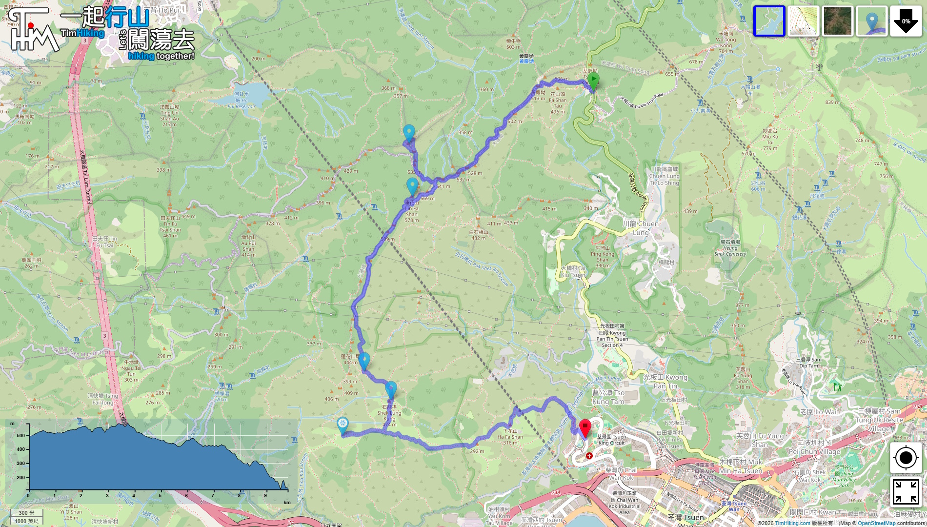
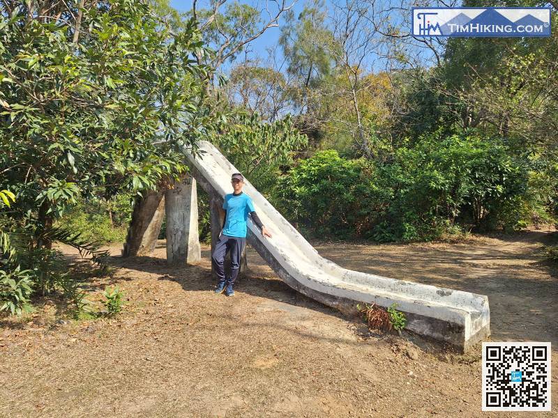
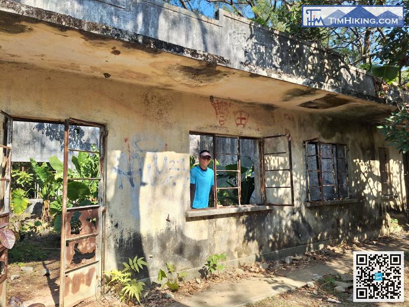
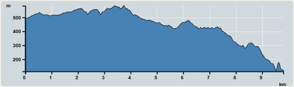
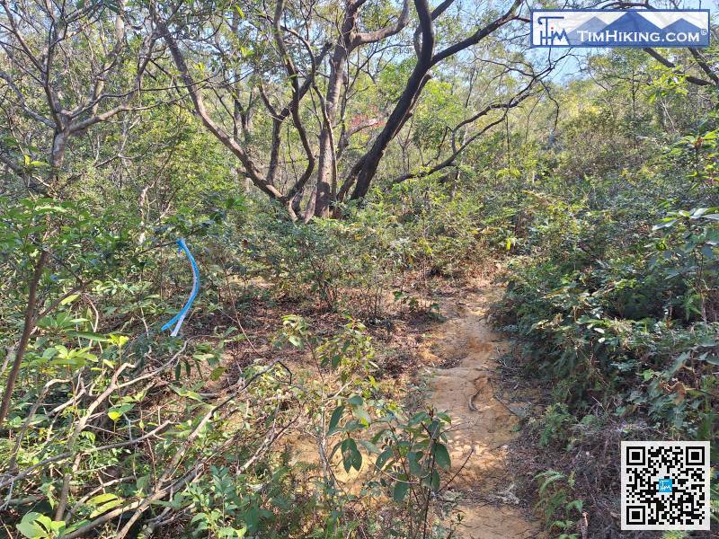
「元荃古道」位於元朗同荃灣之間的昔日古道,全程有點長,是次將行程減半,只由荃灣經元荃古道上石龍拱,順路尋訪蓮花山廢校,…
「大東山」高海拔869米,位於大嶼山,是全香港第三高峰,最大特色是爛頭營的石屋群,是由外籍傳教士所興建的。據說爛頭營原…
「元荃古道」是昔日連接元朗與荃灣的主要通道,約有三百至四百年歷史。當時,十八鄉一帶的農民就是利用這條古道運送農作物到荃…
「河背水塘」位於元朗八鄉,屬大欖郊野公園,其特色是它的「S」型水壩、水塘中央的綠洲小島,以及水壩下的大石板。「河背水塘…
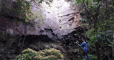
「天書壁」位於大嶼山,近東涌,在薄刀屻旁,也是北龍石澗的源頭。要一探天書壁,最直接是由東涌於【北龍石澗】直上到盡頭。不…
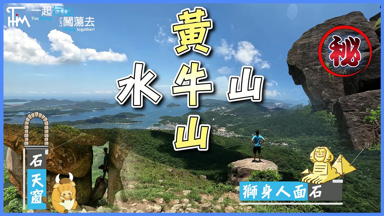
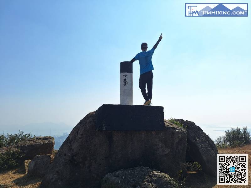
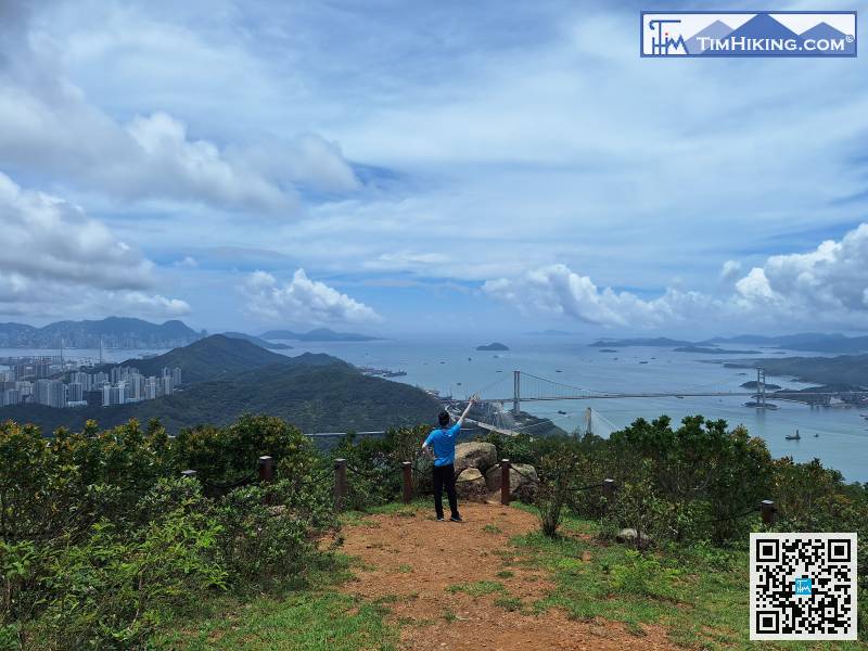
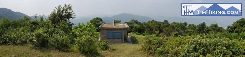
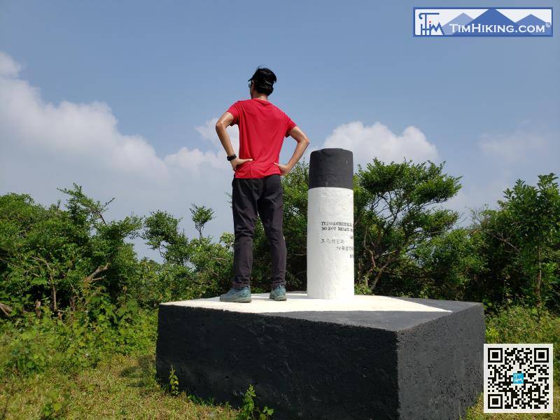
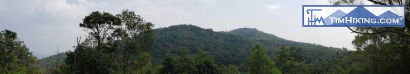
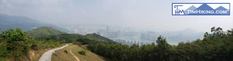
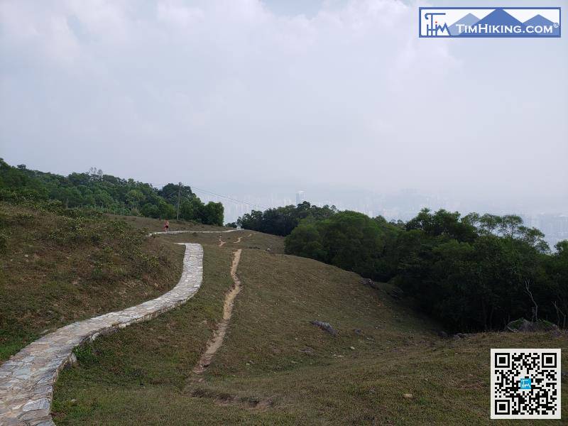
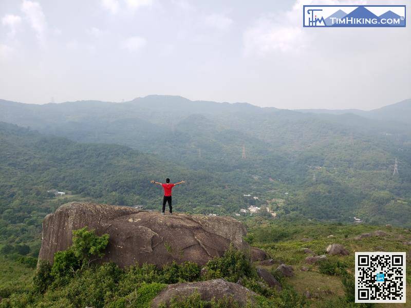
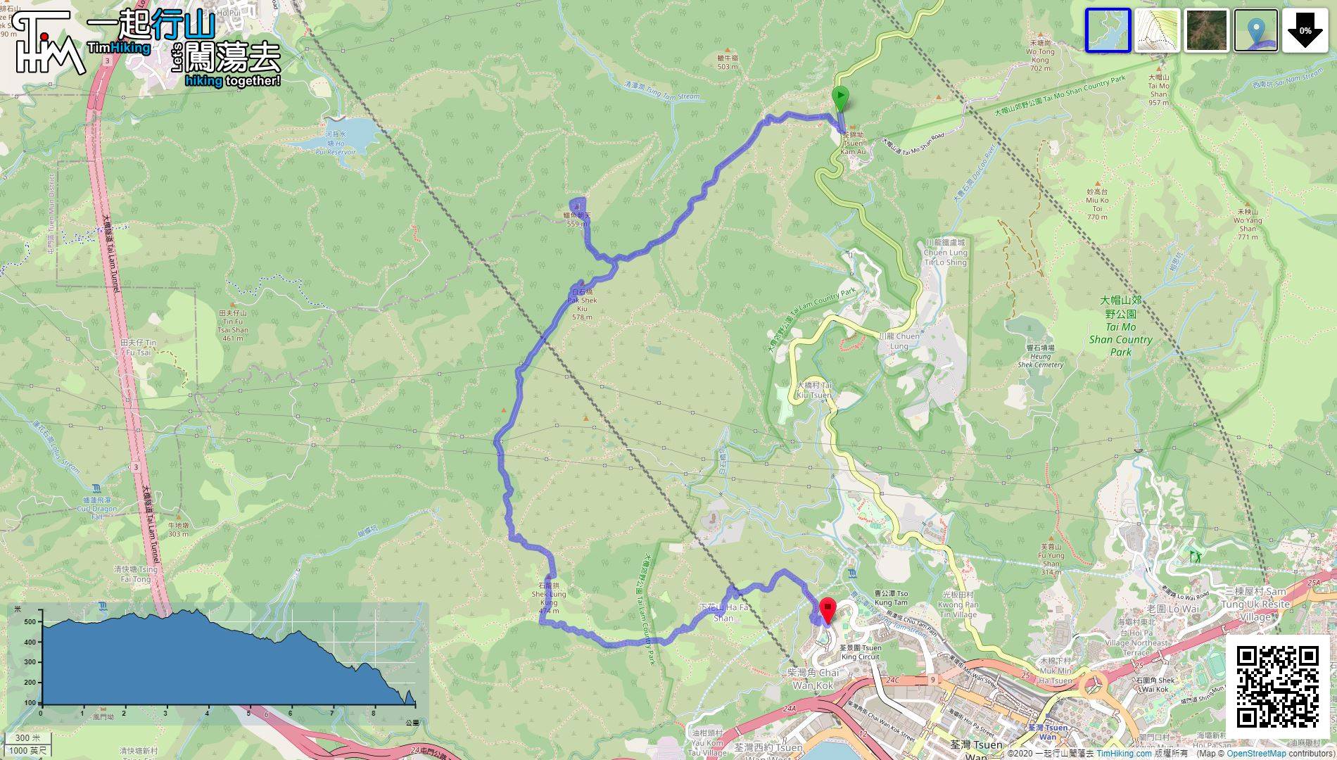
「石龍拱」高海拔474米,是位於汀九與荃灣之間的山峰。近山頂的位置有一個小平原,也有木涼亭,可飽覽荃灣、青衣一帶的市區…
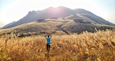
「鳳凰徑第二段」由南山起步,繞過二東山及大東山山腰,途經多個爛頭營,終點為伯公坳。每年秋季都一定會上來一趟欣賞芒草,雖…
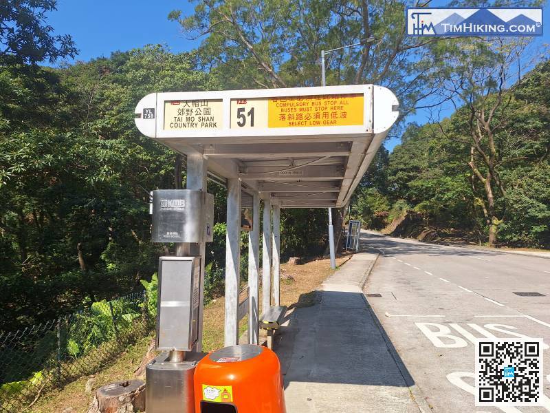
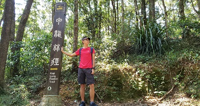
「甲龍林徑」是位於大帽山之西的一段山坡,可往來雷公田與荃錦公路近大帽山道之間。「甲龍林徑」全長約4公里,山徑大部份都是…
「老人山」高海拔303米,位於大嶼山芝麻灣半島的一座高山,山頂設有一座山火瞭望台,名為芝麻灣山火瞭望台,於1962年落…
「曝罟灣」位於西貢北潭涌萬宜水庫、「擺頭墩」西面的一個海灣,其村落均已完全被荒廢,灣內最別具特色的是一條很長的半月形堤…
「曝罟灣」位於西貢北潭涌萬宜水庫的西北面,曾經有一條村落,但現今已完全被荒廢,人去流空。灣內留下了長長的半月形堤圍,是…
此路線是馬年行大運,將會在將軍澳行一個小馬圖案出來,路程大約是12公里,非常有趣的。全程近乎沒有山徑,走的都是行人路,…
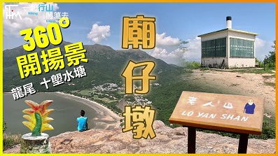
「上洋山」、「下洋山」、「廟仔墩」、「釣魚翁」、「田下山」均位於西貢清水灣半島,分別高海拔260米、260米、335米…
「田下山」位於西貢清水灣半島,高海拔274米,屬於清水灣郊野公園,就近釣魚翁郊遊徑的盡頭,山友途經不妨上去看一看風景。…
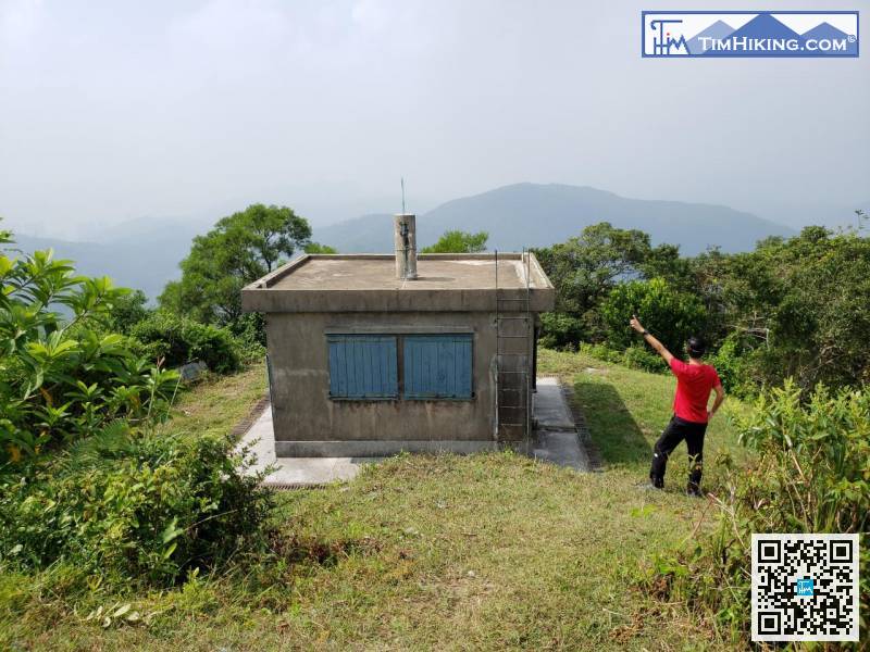
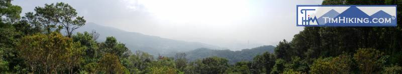
「蓮花山」、「石龍拱」、「下花山」均位於「麥理浩第九段」以南及荃灣以西北的山峰,海拔高度分別為579米、474米、31…
「筆架沖溝」是位於香港筆架山南面的一條天然沖溝。由於長期受雨水沖刷,山脊形成深切的溝壑,地貌陡峭崎嶇,仿如小型大峽谷。…
「鯤鵬徑」的得名源於傳說中的神獸,「鯤」乃神獸大魚,身長幾千里;「鵬」則是鳳凰,又名火鳥、不死鳥。「鯤鵬徑」的起點及終…
「釣魚翁郊遊徑」位於西貢清水灣半島,山徑由五塊田橫跨上洋山、下洋山、廟仔墩、釣魚翁、田下山的山腰,最後到達大廟。釣魚翁…
「十二號山」又稱「紅磡山」,高海拔84米,是位於何文田一個很矮的小山丘,即現時「京士柏食水配水庫」的位置。「十一號山」…
「小夏威夷」位於現時將軍澳與井欄樹之間的山徑,是將軍澳的後花園。不過,你有所不知!浪漫的背後卻有一段悲慘的故事。「小夏…
此路線將會在香港島的西面,行一隻小翼龍出來,就此命名為「闖蕩小翼龍」。小翼龍貌似暴龍多一隻小翼,路程大約是23.5公里…
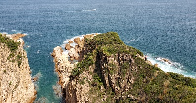
「火星洞」、「扭紋洞」位於清水灣半島以東蝦山篤的海岸邊,亦即西貢清水灣二灘以南。蝦山篤沿岸主要有四個出名的海蝕洞,都是…
「寶馬山」高海拔200米,位於紅香爐峰的東北面,小馬山的北面,非常近「賽西湖公園」,而「寶聯徑」就是上落「寶馬山」的環…
「壽臣山」高海拔148米,位於港島南部,黃竹坑與深水灣之間的一個小山丘,山上有標高柱,但並非山頂位置。「壽臣山」是昔日…
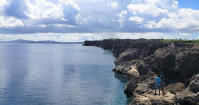
「沖繩」的山峰集中在北部名護市的東北面,普遍是二、三百米高,沖繩本島的最高峰是「與那覇岳」,高海拔503米,位於沖繩縣…
「日落脊」是飛鵝山正南面的山脊,旁邊是俗稱登上飛鵝山的【崎嶇路線】及【高危路線】。「日落脊」的難度比崎嶇路線再高一點,…
「大坳門」位於「清水灣半島」的東面,「釣魚翁」以東的一個小半島,是燒烤、郊遊、放風箏的勝地,相信好多人都熟悉。「大坳門…
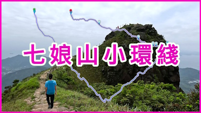
「七娘山小環綫」是專為上落七娘山、而不走回頭路的路線,完美融合野路與官方主徑於一身,既可觀山海,又可嘗一嘗走野路的樂趣…
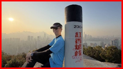
「紅香爐峰」高海拔230米,鄰近港島寶馬山,非常就近市區,路程極之短,上山少於1公里,來回快的半小時也能完成,影相時間…
一起爬山闖蕩去 | timhiking | timhiking | timhiking | 山友留言 | 免責聲明


 YouTube 隨 機 推 介


