


 Recommend YouTube


| View : |  | ||
| Difficulty : |  | ||
| Path : | |||
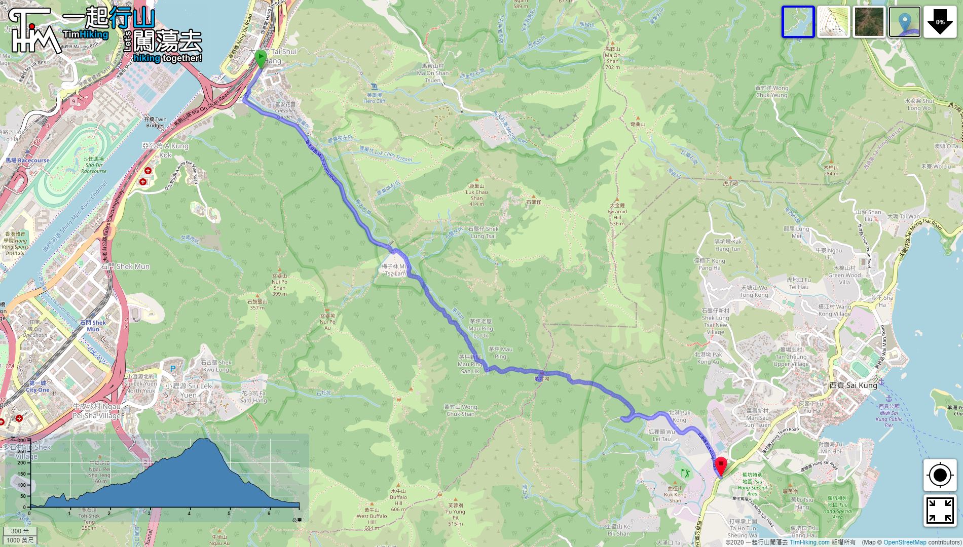
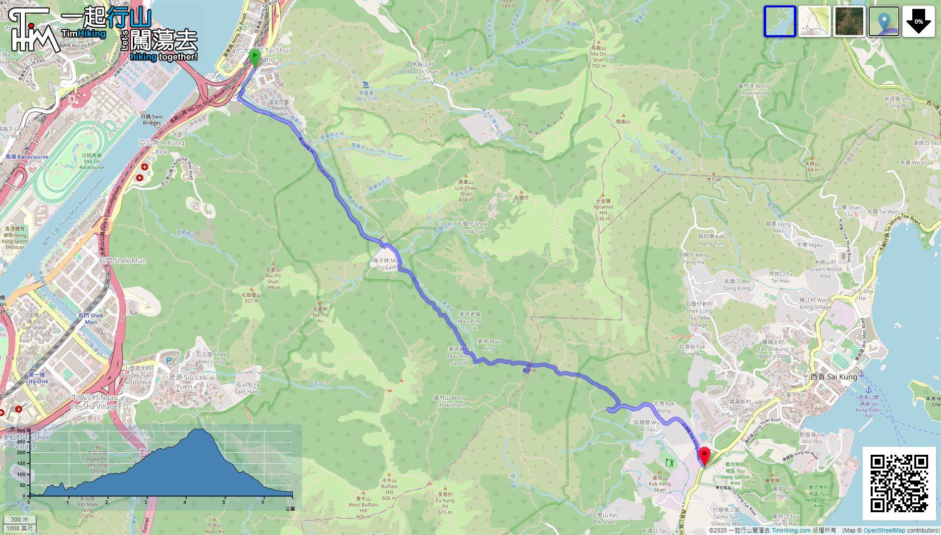
| Length : | 6.9km | ||
| Time : | 2½hours | ||
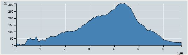 | |
| Ascent : 318m | Descent : 308m |
| Max : 308m | Min : 0m |
| (The accuracy of elevation is +/-30m) | |


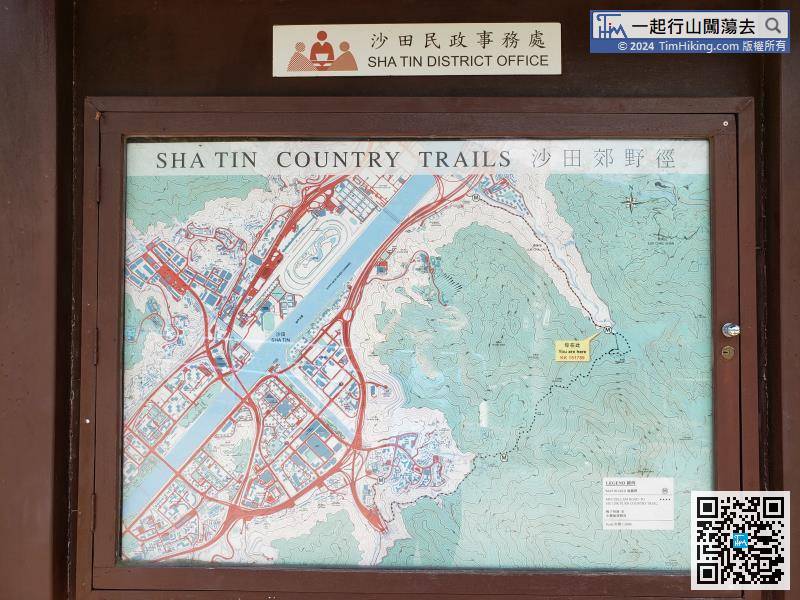
There is another map bulletin board at the entrance of the trail, showing your location.
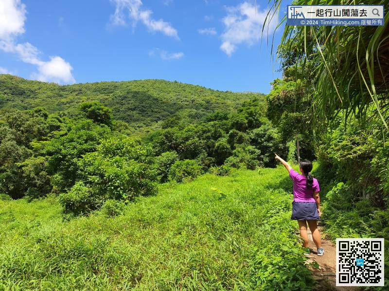
 34︰On the right is the small plain of Mau Ping Au.
 35︰Go on the path from the right side of the small pavilion, and will find the Giant Bean.
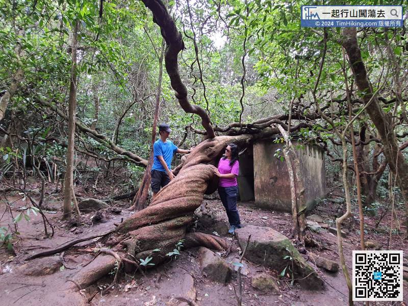
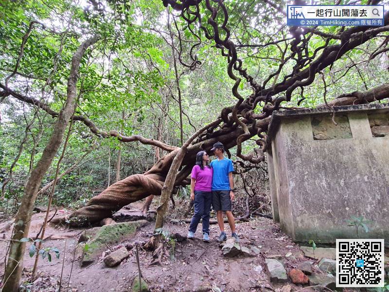
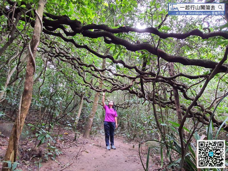
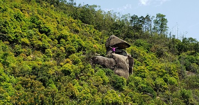
Go on the path from the right side of the small pavilion, and will find the Giant Bean.
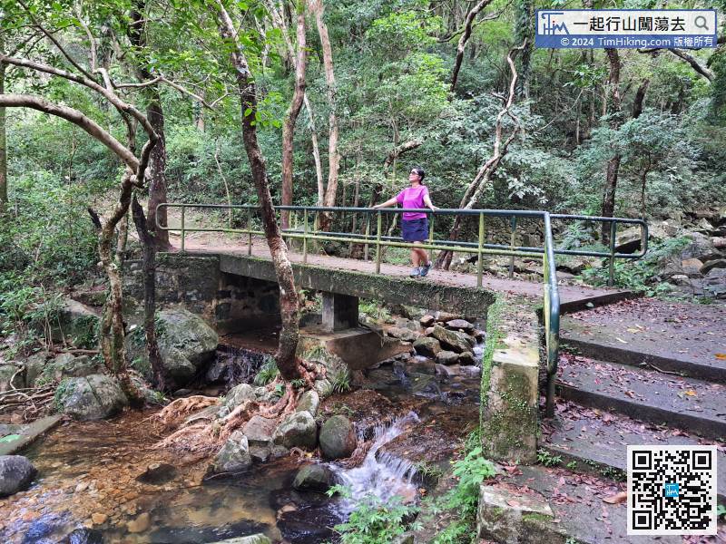
50︰No matter the viewing angle, it is also beautiful.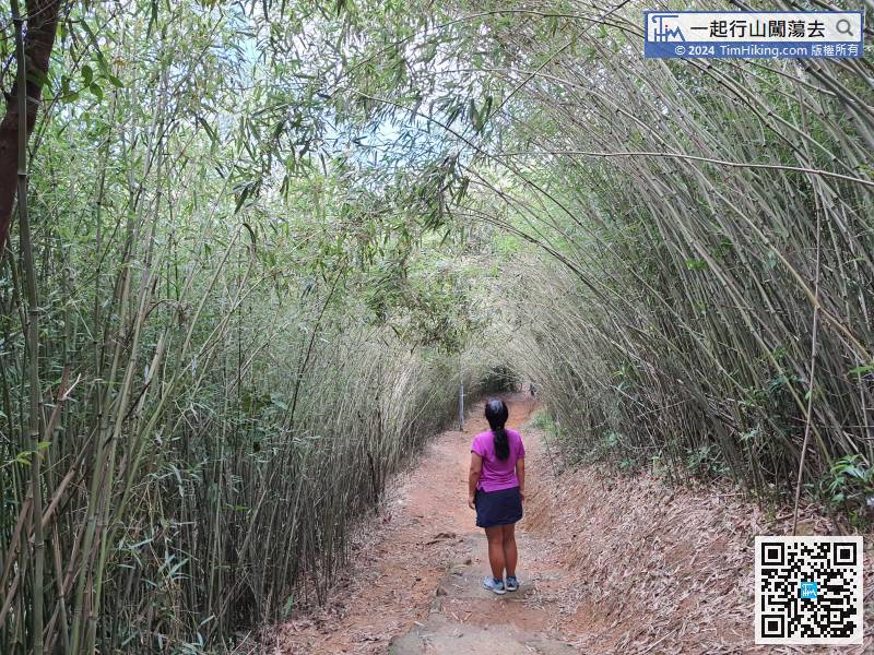
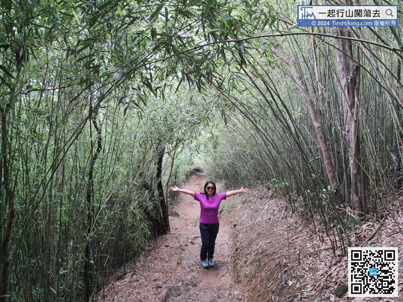
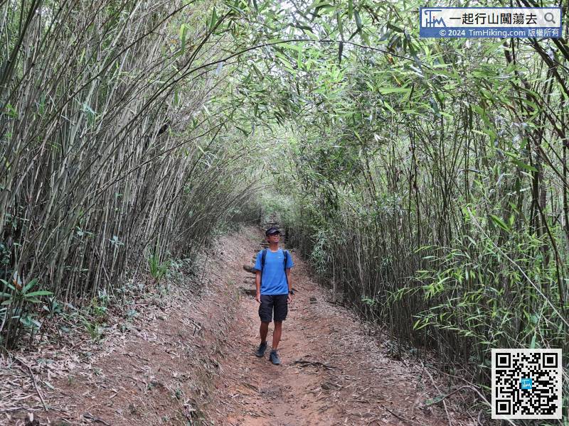
Step into the Pak Kong Ancient Trail for about 10 minutes, will then enter the Bamboo Tunnel of Pak Kong.


