


 YouTube 隨 機 推 介


| 景觀︰ |  | ||
| 難度︰ |  | ||
| 路線︰ | |||
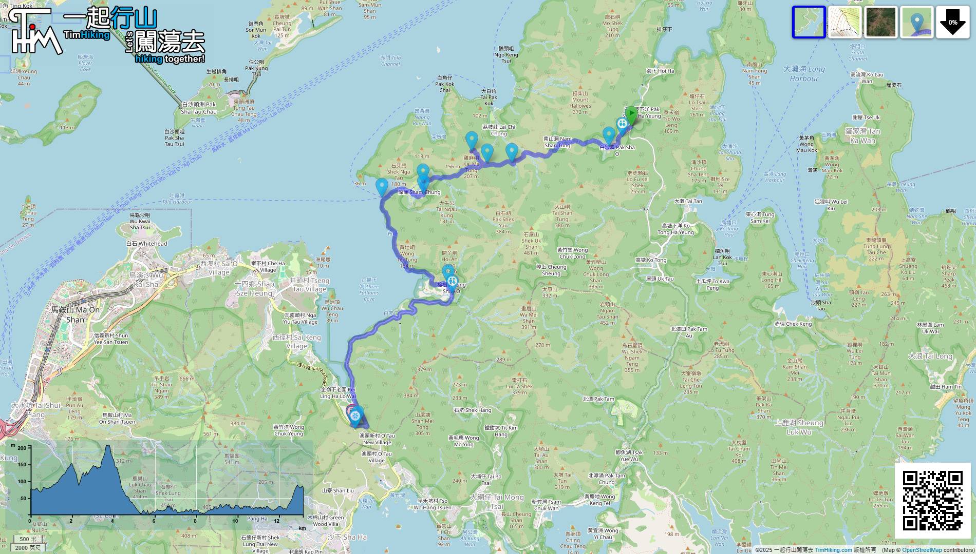
| 全長︰ | 13.2公里 | 需時︰ | 4½小時 |
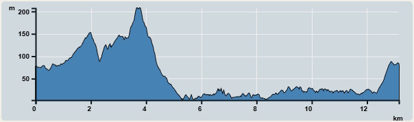 | |
| 攀升︰279米 | 下降︰277米 |
| 最高︰207米 | 最低︰2米 |
| (海拔高度值只供參考 誤差約是30米內) | |

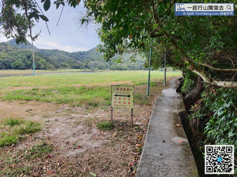
 深涌士多
深涌士多


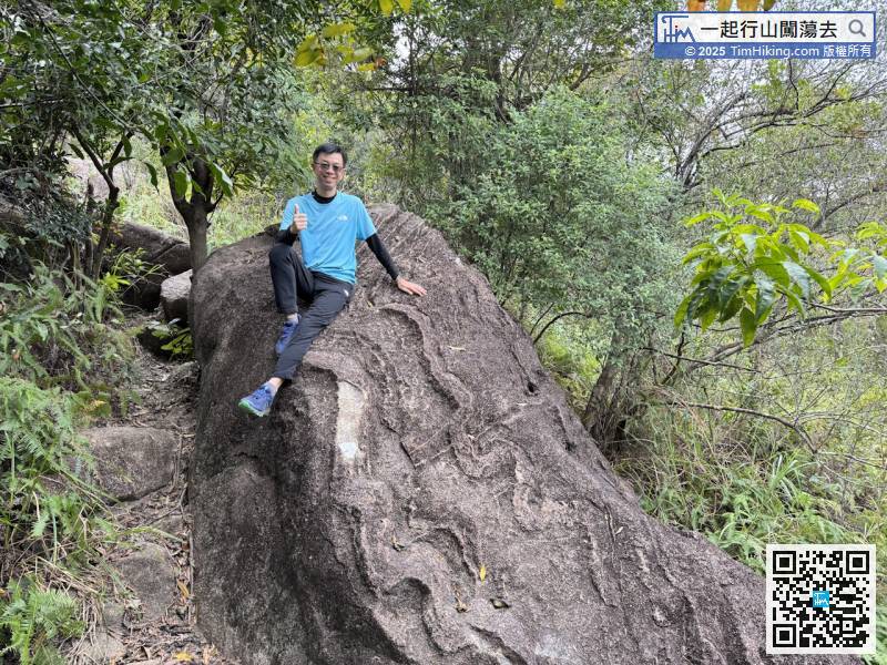
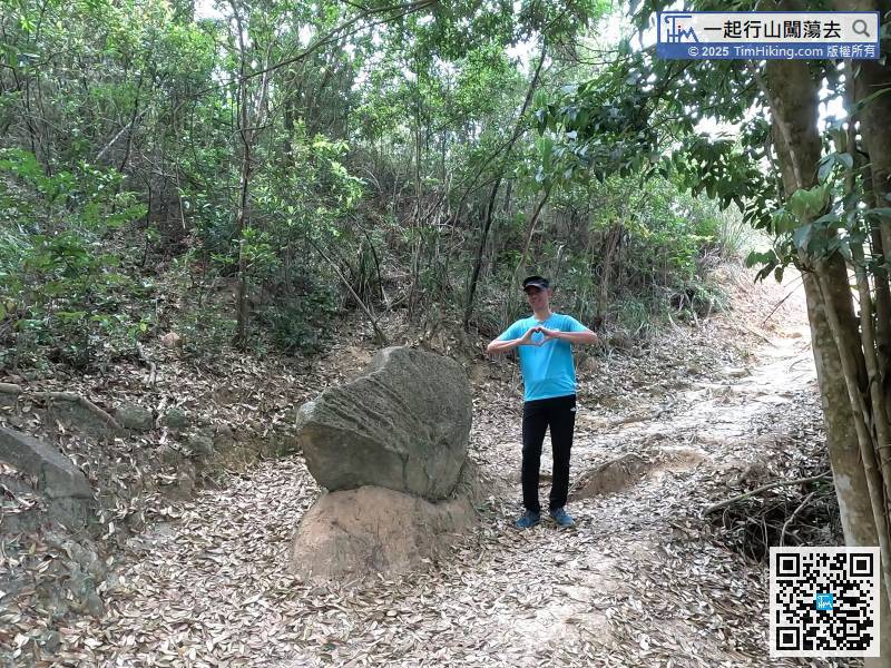
 深涌大草原 蛇石 雞麻峒
| 景觀︰ | | ||
| 難度︰ | | ||
| 路線︰ | |||
| 全長︰ | 13.2公里 | 需時︰ | 4½小時 |
| |
| 攀升︰279米 | 下降︰277米 |
| 最高︰207米 | 最低︰2米 |
| (海拔高度值只供參考 誤差約是30米內) | |
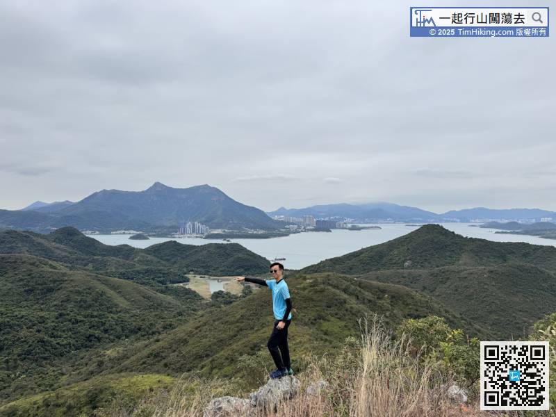
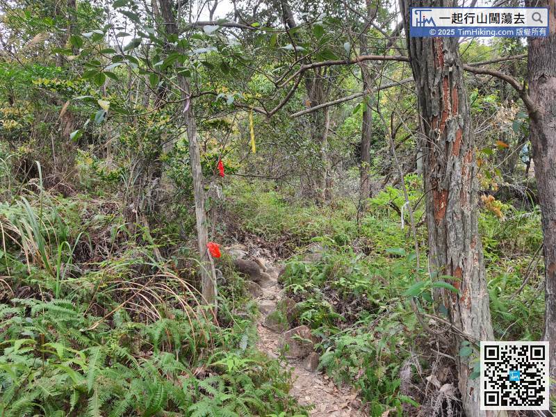
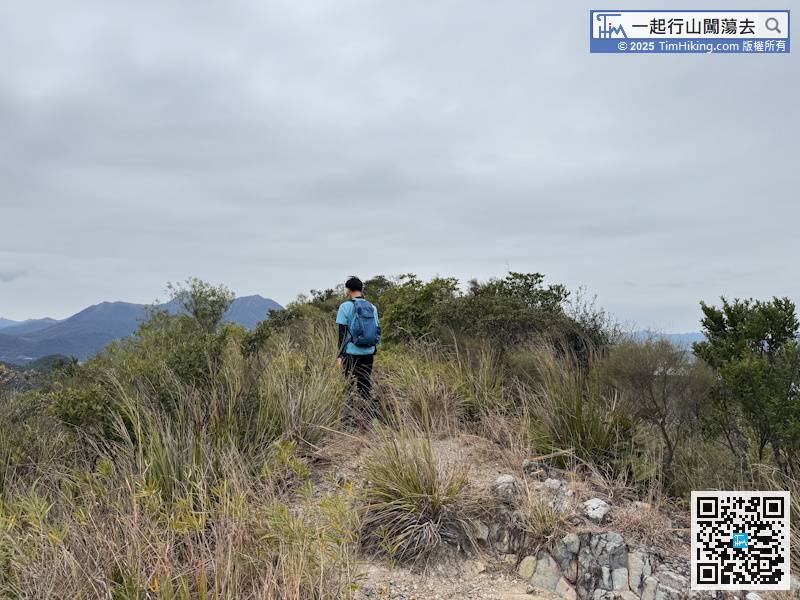
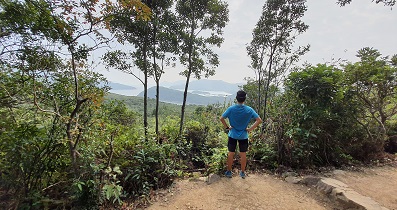
| Jackson : |  這條路線經過既幾個山峰景色唔錯,例如馬夾崙,上到去以為冇咩景睇,點知山後係企嶺下海大海景,幾有驚喜😚不過,馬夾崙難度真係唔講得笑,路胚雖然清晰,但全程都係急斜穿林泥徑,一半路段需要手腳並用,短短700米路程攀升300多米,相當費力。 以外觀及攀升幅度黎講,馬夾崙絕對有潛力成為西貢第四尖😁 (2026-02-15) |
以前馬夾崙可謂沒山徑可言,但樹較密,能扶手的位置較多,難度在於迷路;雖然現在已行了一條泥路出來,但樹木倒是少了,難度在於大斜危險。 (Tim Sir 2026-02-16) |
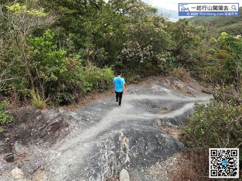
| Markk : |  Tim sir,蛇年大吉!昨天行去探訪蛇石應節,到深涌看看復修了的公民學校後見時間許可,上石芽頭看看。上山路口並不明顯,找了一回確認後便繼續,山頂風景一流,值得推薦。不過短短一段上山路,又斜又密,也有四星難度。落山後剛好趕上船期,回馬料水走人。祝Tim sir身體健康! (2025-02-03) |
蛇年快樂!身體健康!石芽頭俯瞰深涌又真係唔錯喎!😀 (Tim Sir 2025-02-05) |
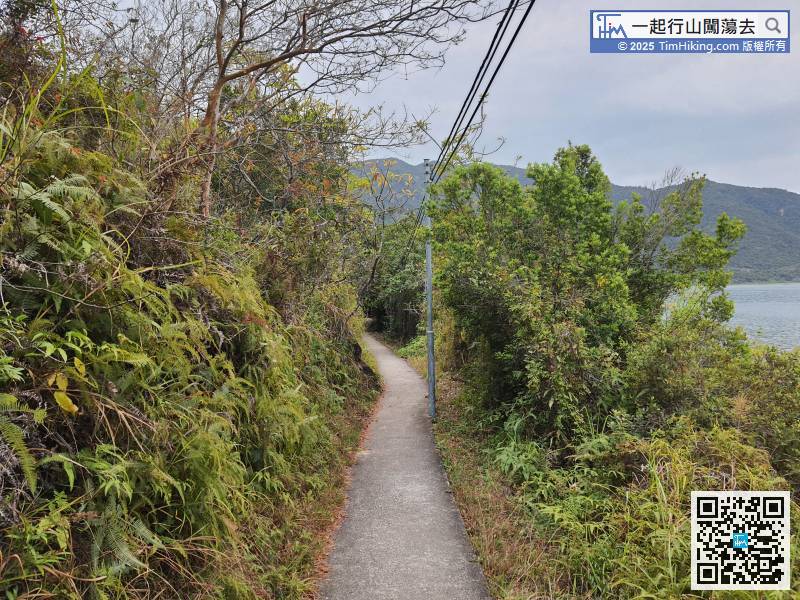
| Markk : |  Tim sir, 昨天試嚇新意思,中午西貢出發,從白沙澳落荔枝莊後沿荒徑上雞麻峒,路徑清𥇦,緩埗上斜,到頂後沿另一邊下山到蛇石坳去深涌。此路線值得推介,上山時可從高位回望荔枝莊。本來想上埋石芽頭不過唔夠時間,急步行出榕樹澳走人。 (2023-03-19) |
去石芽頭會遠了好多! (Tim Sir 2023-03-19) |
| ConnieT : | Tim Sir, 請問深涌草原有沒有厠所? (2022-10-27) |
附近都沒有 (Tim Sir 2022-10-27) |
| 華仔BB : | Tim sir, 請問從深涌往石屋山可以嗎?崎嶇嗎? Thank ! (2022-01-18) |
這條路近年都沒有行過,不過目測斜度是大的,因石屋山本身都好高481米。路胚是有的,由於少人行,草一定比另一邊密。 (Tim Sir 2022-01-19) |
| 8號 : | 你好!請問下小巴位置是否在白沙澳青年旅舍? 謝 (2021-03-12) |
是呀,只要放大地圖,就可顯示白沙澳青年旅舍了。 (Tim Sir 2021-03-12) |
| Chi Ming : |  今日天陰陰由黃石開始行,好正. (2020-11-21) |
風景本身好靚,沒有藍天一樣掂! (Tim Sir 2020-11-21) |
| 颱風 : |  謝謝你提供的行山路線圖 (2020-03-26) |
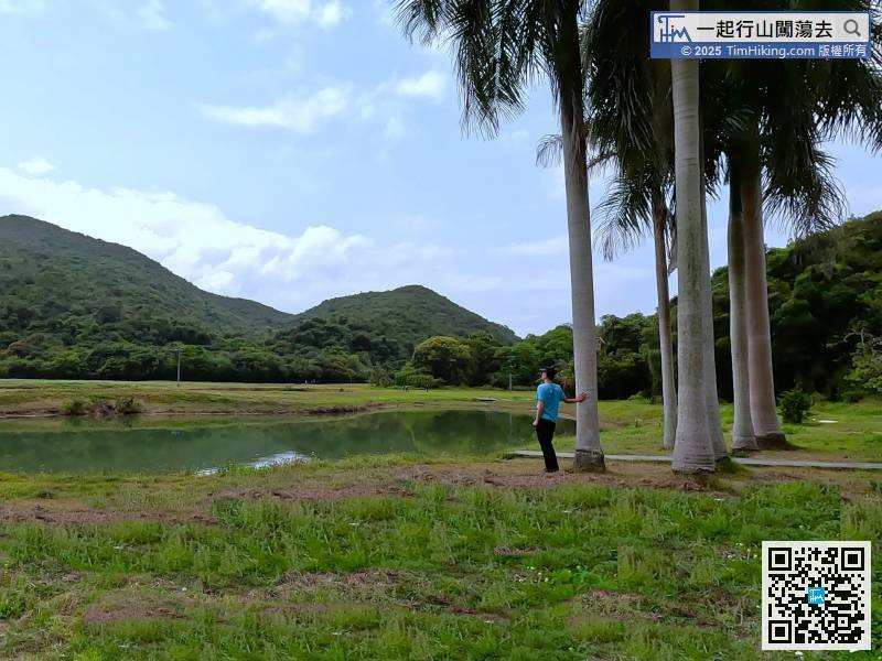
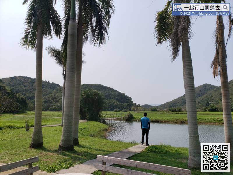
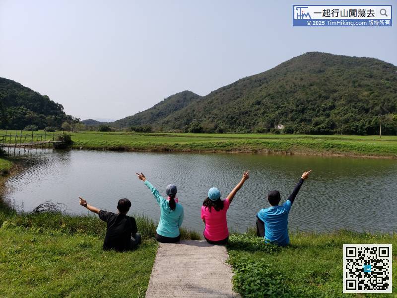
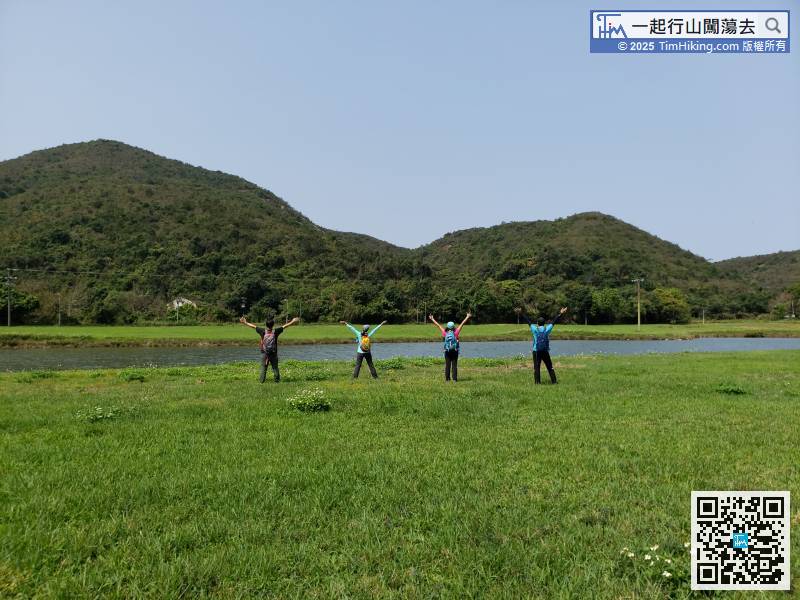
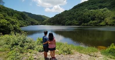
深涌大草原,好靚好平靜,的確是世外桃源。 (Tim Sir 2020-03-26) |


