


 Recommend YouTube


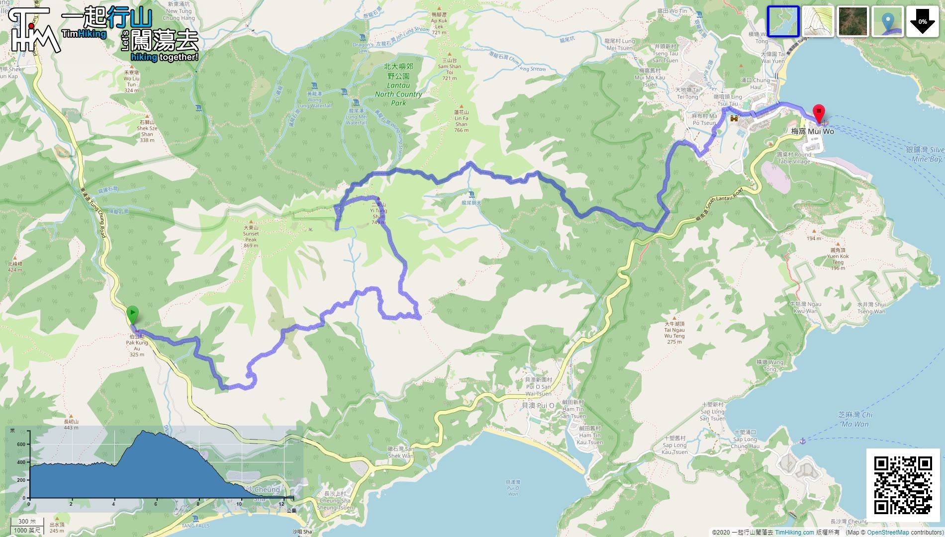
| View : |  | ||
| Difficulty : |  | ||
| Path : | |||
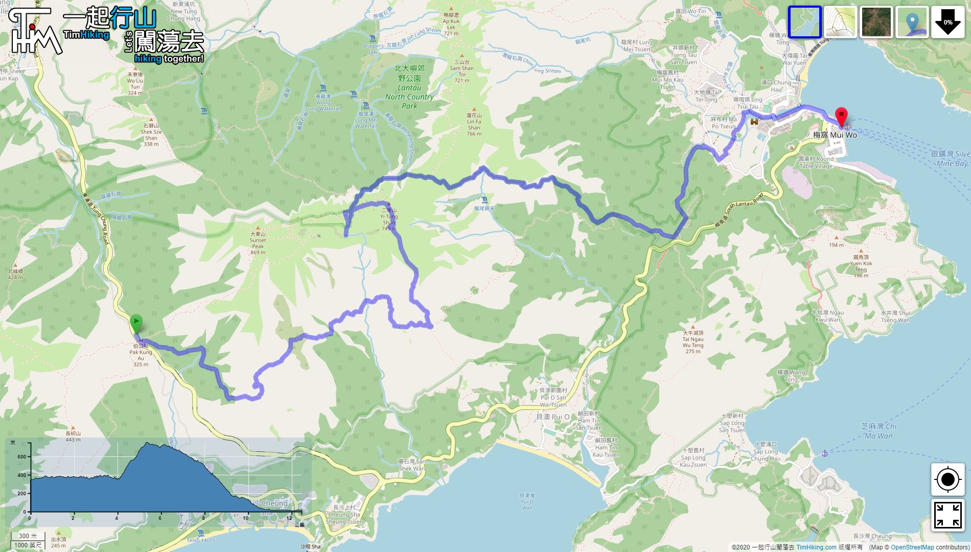
| Length : | 12.5km | ||
| Time : | 6½hours | ||
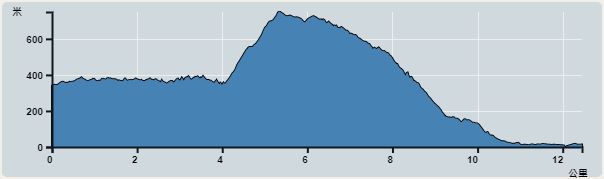 | |
| Ascent : 739m | Descent : 985m |
| Max : 739m | Min : 0m |
| (The accuracy of elevation is +/-30m) | |


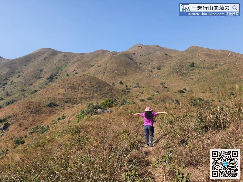
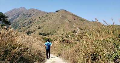
 6︰not the steps ahead on the Lantau Trail. South Lantau Country Trail is mainly a horizontal Country Trail,
 9︰The sceneries along the way are very good view,
 21︰The entrance of Ching Lung Ridge is at the corner.
 36︰just climb up.
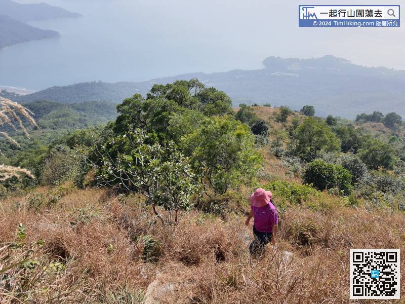 51︰will see the Sky Pool.
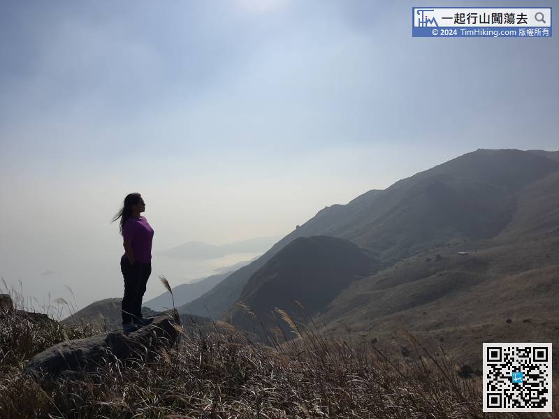
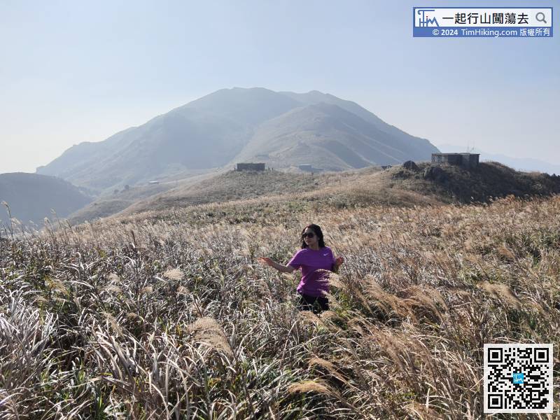
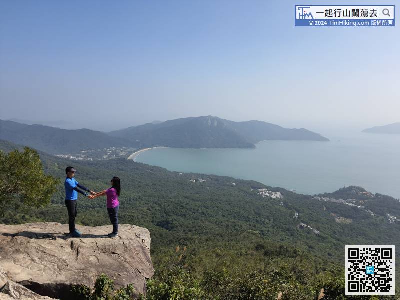
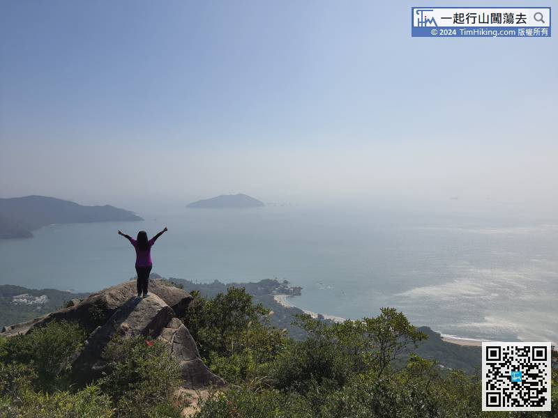
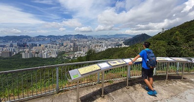
There is no trigonometrical station on the top of Yi Tung Shan, it has 360-degree views,
57︰and keep left at the bifurcation towards Nam Shan.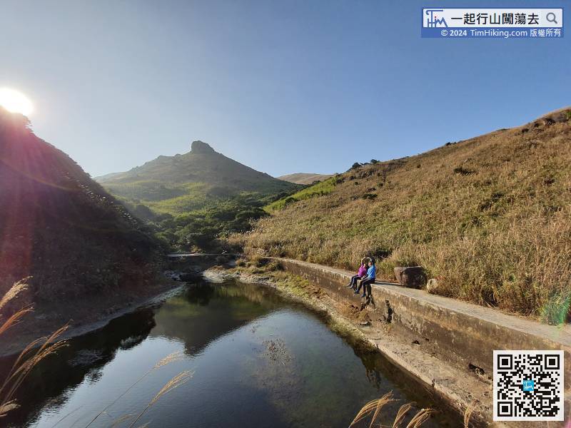
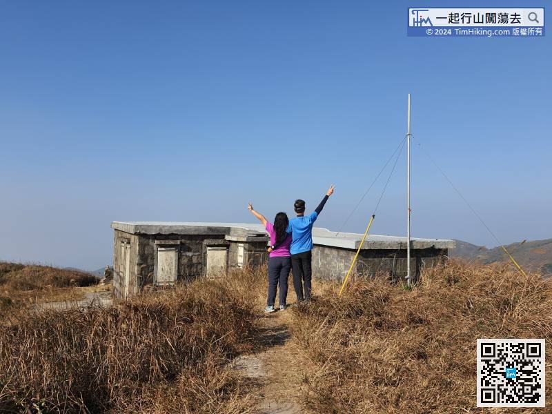
Yi Tung Shan Sky Pool is actually a storage pool built by the missionaries in the past, the size is as large as a standard swimming pool.
60︰In the distance post is L011, there is another big branch road on the left, can go to Lin Fa Shan, Heavenly Book Wall, Por Kai Shan, etc.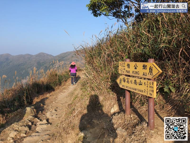 71︰can also go to South Lantau Road on the right.
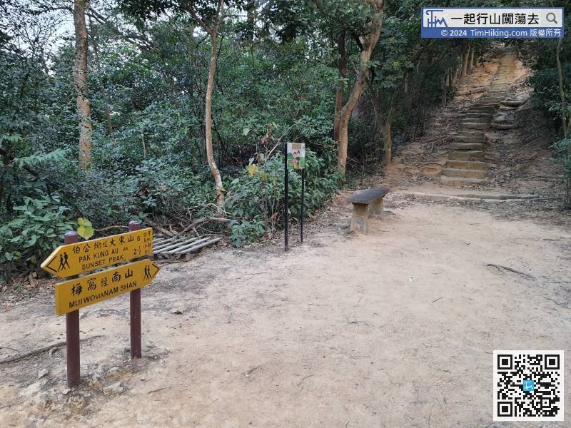 82︰The first half of the Nam Shan Ancient Trail is made of big rocks.
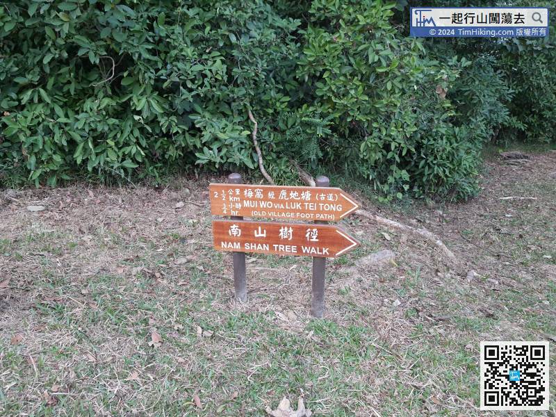
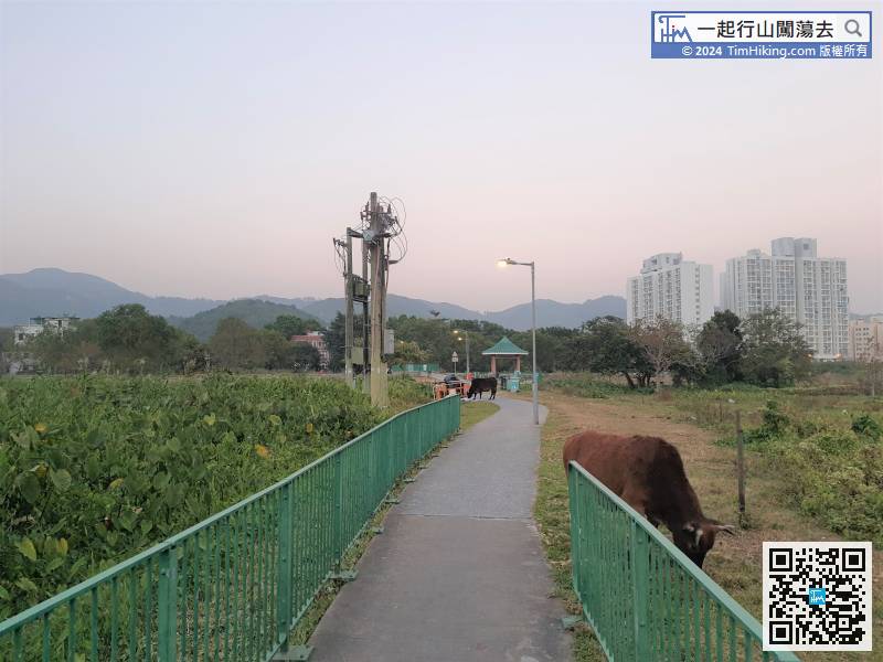
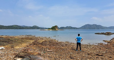
When coming to a field, the grassland is really big which is unexpected that Mui Wo have such grassland.


