


 Recommend YouTube


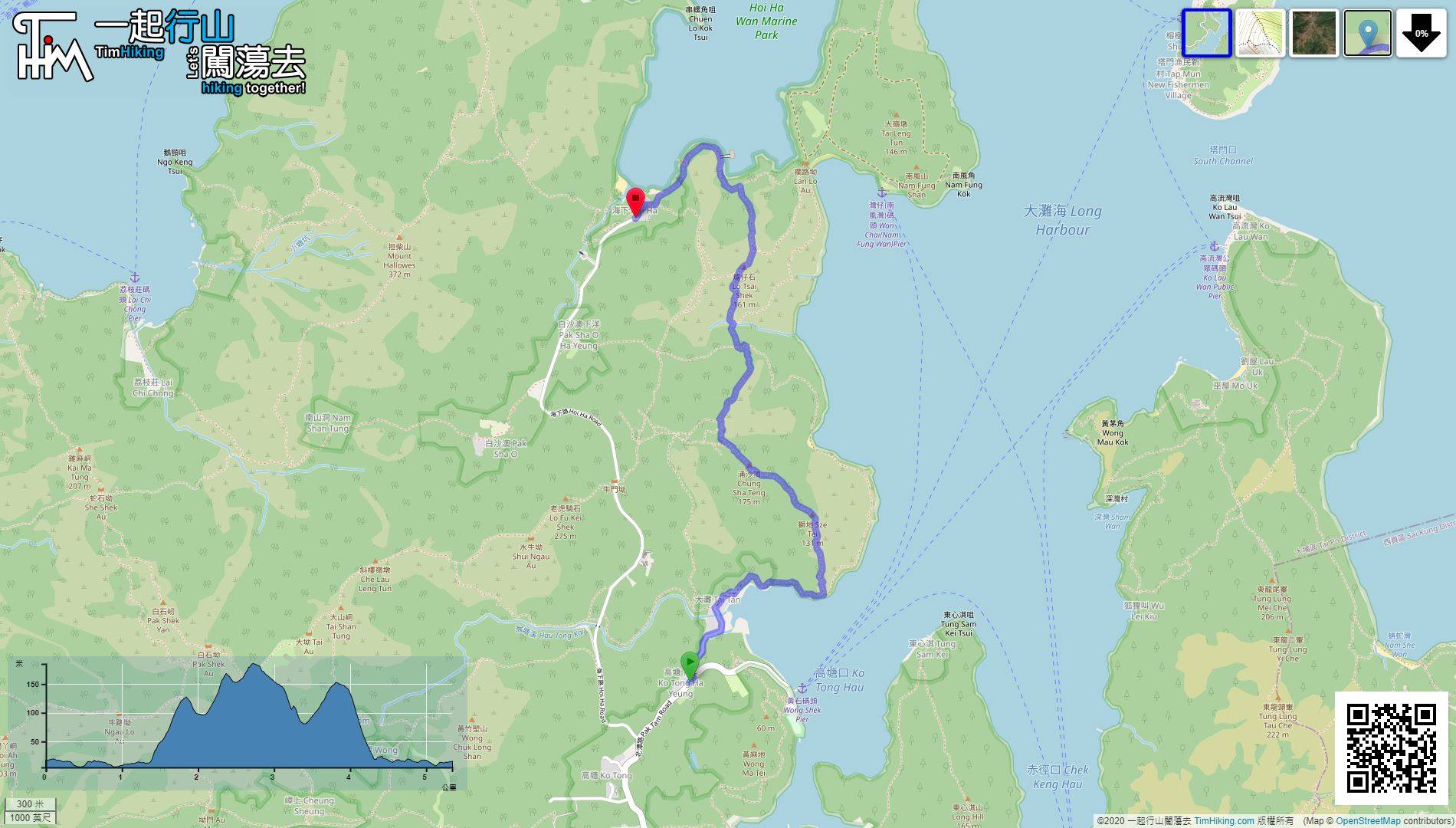
| View : |  | ||
| Difficulty : |  | ||
| Path : | |||
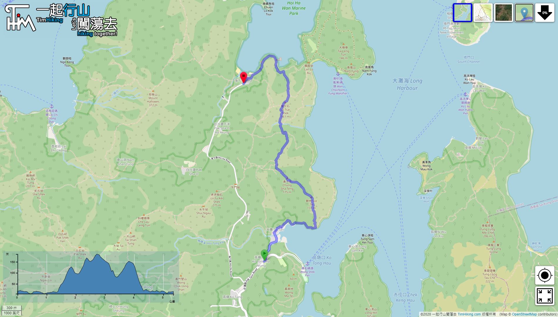
| Length : | 5.4km | ||
| Time : | 4hours | ||
| 【 Tai Tan Campsite 】 | |||
| Toilet : | Flushing Toilet | ||
| Water : | Tap | ||
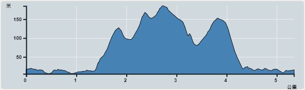 | |
| Ascent : 355m | Descent : 355m |
| Max : 185m | Min : 5m |
| (The accuracy of elevation is +/-30m) | |


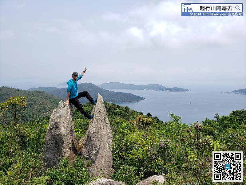
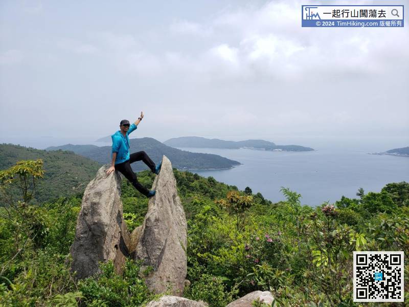
The shape of Yan Cup Rock is a pair of divination cups, which are also like an opened shell.


