


 YouTube 隨 機 推 介


| 景觀︰ |  | ||
| 難度︰ |  | ||
| 路線︰ | |||
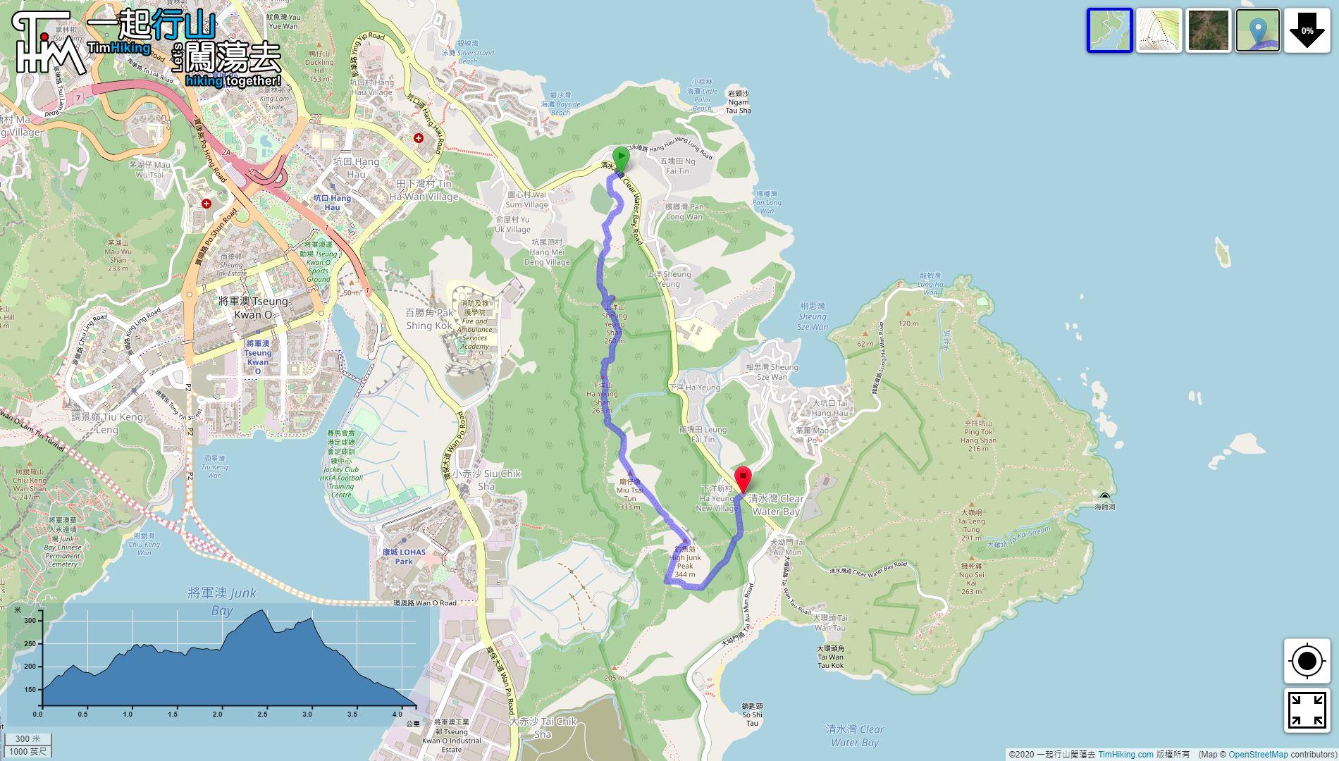
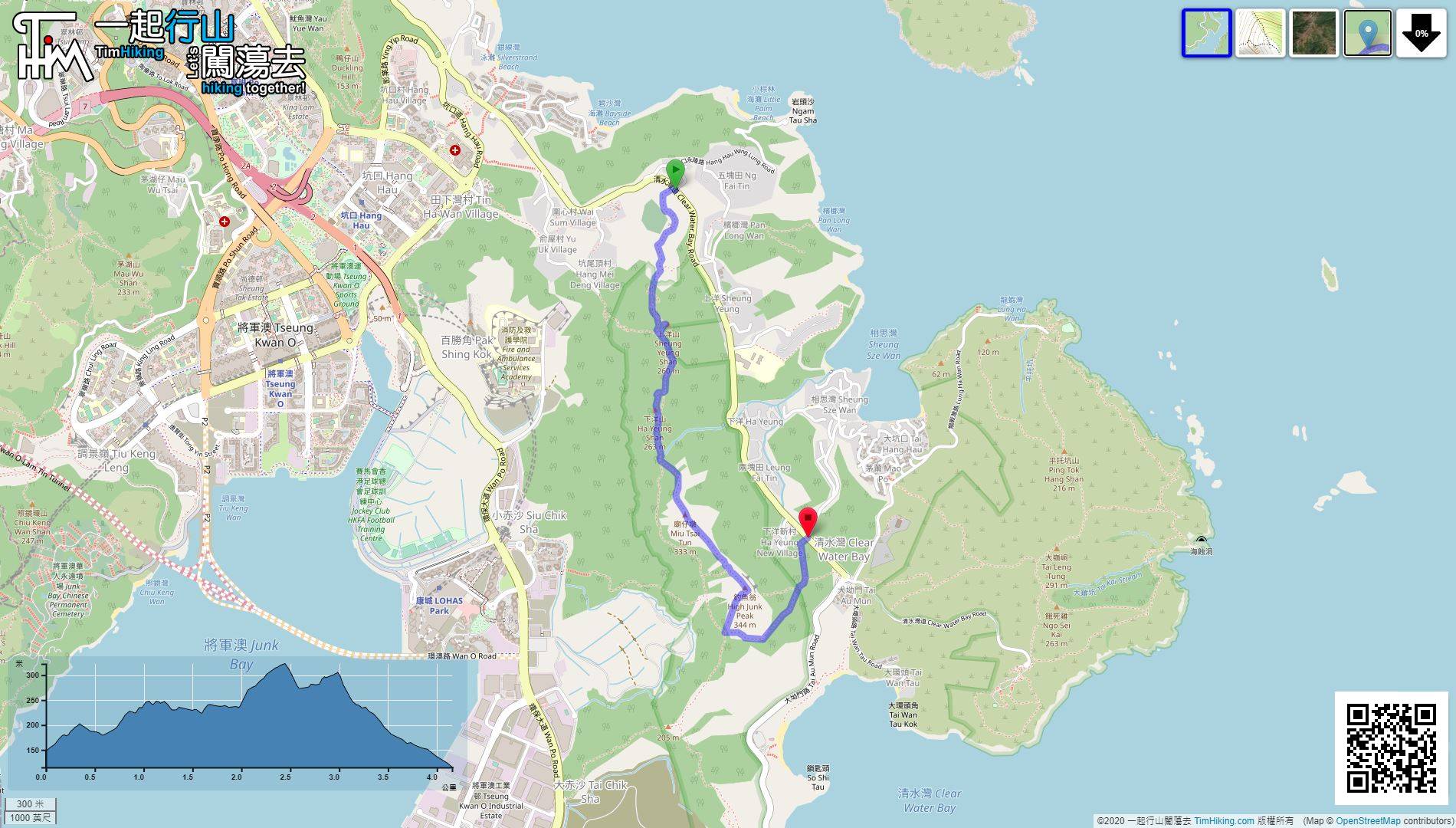
| 全長︰ | 4.2公里 | 需時︰ | 2小時 |
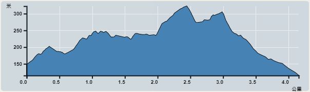 | |
| 攀升︰270米 | 下降︰310米 |
| 最高︰323米 | 最低︰115米 |
| (海拔高度值只供參考 誤差約是30米內) | |


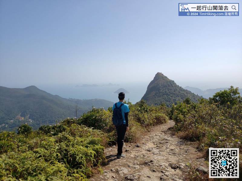
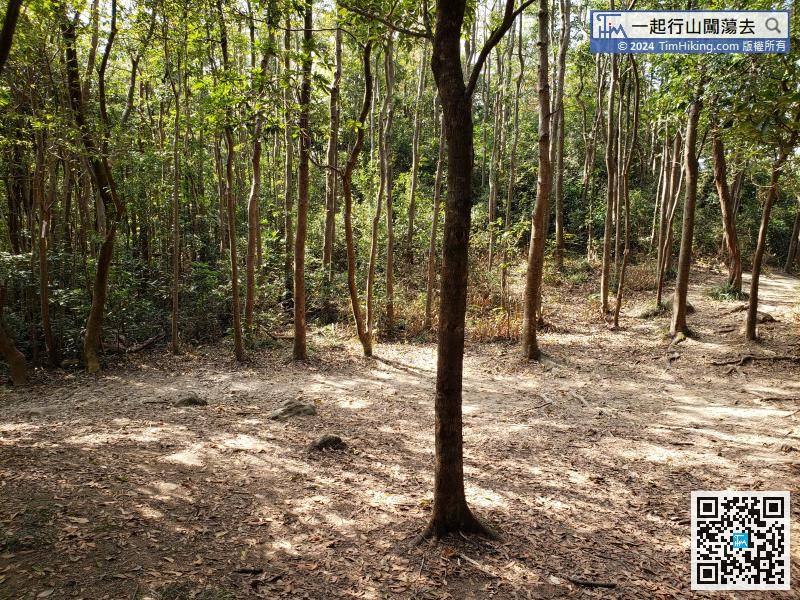
 9︰本來的林蔭路段,剎時間變成一條開揚寬闊小徑。
 13︰部份山徑與越野單車徑重疊,部份則分開。
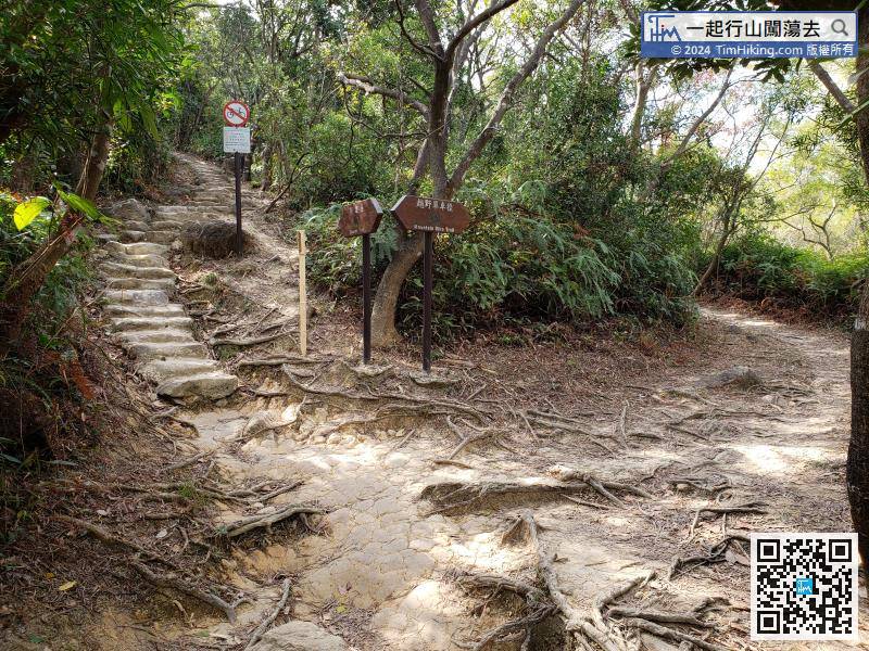
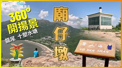
 37︰於200米後,左手邊有一條大木欄杆,那就是前往廟仔墩的山徑。
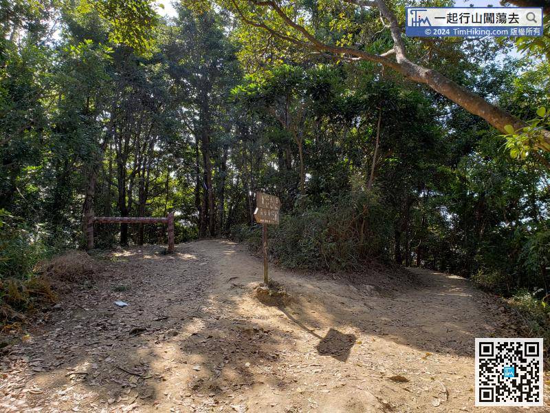
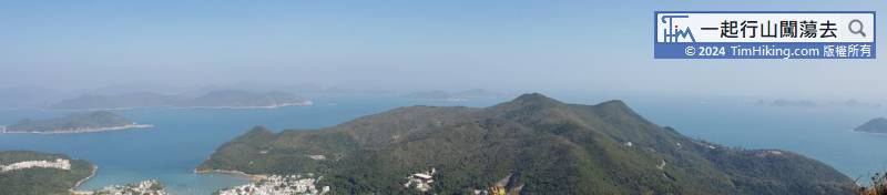
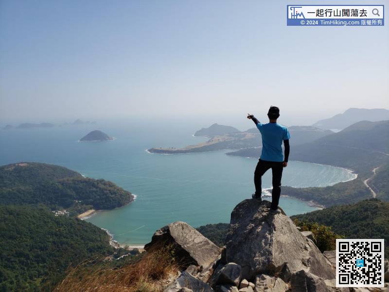
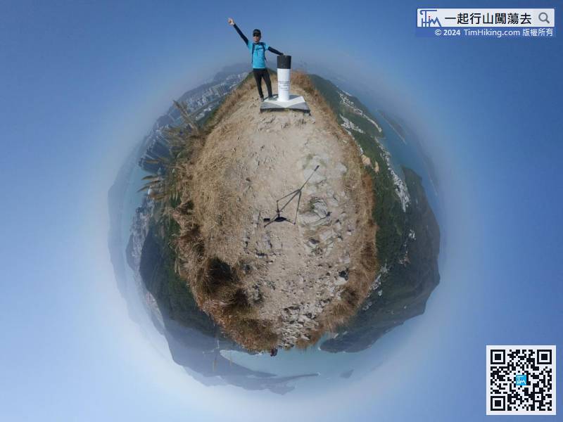
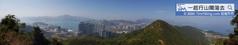
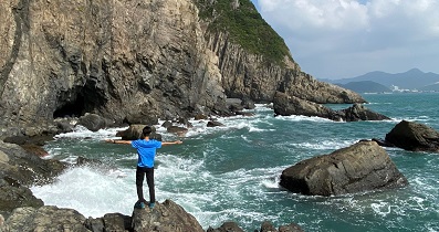
 54︰釣魚翁山頂有標高柱,更有360度靚景。
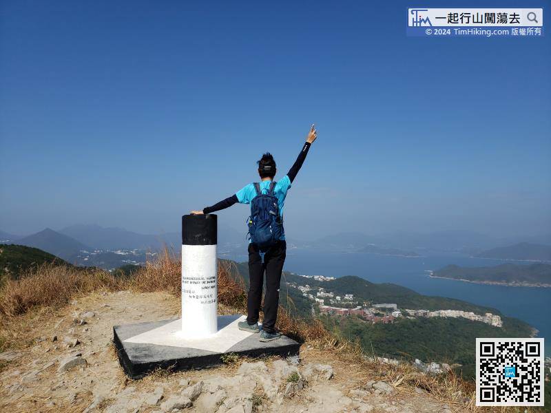


| 景觀︰ | | ||
| 難度︰ | | ||
| 路線︰ | |||
| 全長︰ | 4.2公里 | 需時︰ | 2小時 |
| |
| 攀升︰270米 | 下降︰310米 |
| 最高︰323米 | 最低︰115米 |
| (海拔高度值只供參考 誤差約是30米內) | |
9︰本來的林蔭路段,剎時間變成一條開揚寬闊小徑。 13︰部份山徑與越野單車徑重疊,部份則分開。
37︰於200米後,左手邊有一條大木欄杆,那就是前往廟仔墩的山徑。
54︰釣魚翁山頂有標高柱,更有360度靚景。
| Edward : | 師兄:請問沿着釣魚翁郊遊徑行到中間位,是否也可以登上釣魚翁?(不行廟仔墩) (2024-03-24) |
可以,有荒徑前往。 (Tim Sir 2024-03-25) |
| 極度驚慌 : | 師兄認為過去幾年香港山野蜘蛛網情況有冇受疫情影響? 而香港南部﹙如大嶼山 南丫島 港鳥﹚蜘蛛網情況係咪更嚴重? (2024-03-13) |
蜘蛛網冇人行未多D囉,有人行基本上都係冇嘅,越荒越多。 (Tim Sir 2024-03-15) |
| mavischick : | 想請問落釣魚翁條路,見左邊仲有條較短既路,係咪仲難落? (2020-12-17) |
行山選路其中一個重要守則︰所有崖邊的崎嶇險脊,在未上過之前都絕不應該用來落,自己上過一次,親身體會過,你自己自然有答案。 (Tim Sir 2020-12-18) |
| winfredchan : |  Tim哥您好😊 請問你這張相片用那部機拍攝🎬好美呀👍🏻👍🏻👍🏻 (2020-08-15) |
360相機 (Tim Sir 2020-08-15) |
| winfredchan : | 請問怎樣可避開上洋山和下洋山?謝謝指導😊🙏🏻🙏🏻 (2020-08-15) |
只要跟主徑直行就能避開上洋山及下洋山 (Tim Sir 2020-08-15) |
| Victor : | Tim Sir 你好, 小弟幾乎每週都行山, 很喜歡看你的網頁以安排郊遊行程。 上個月行了釣魚翁, 天氣正好, 碧海青山,風光迷人, 謝謝介紹。 (2020-07-10) |
非常感謝支持!大自然的確令人療癒。 (Tim Sir 2020-07-11) |


