


 Recommend YouTube


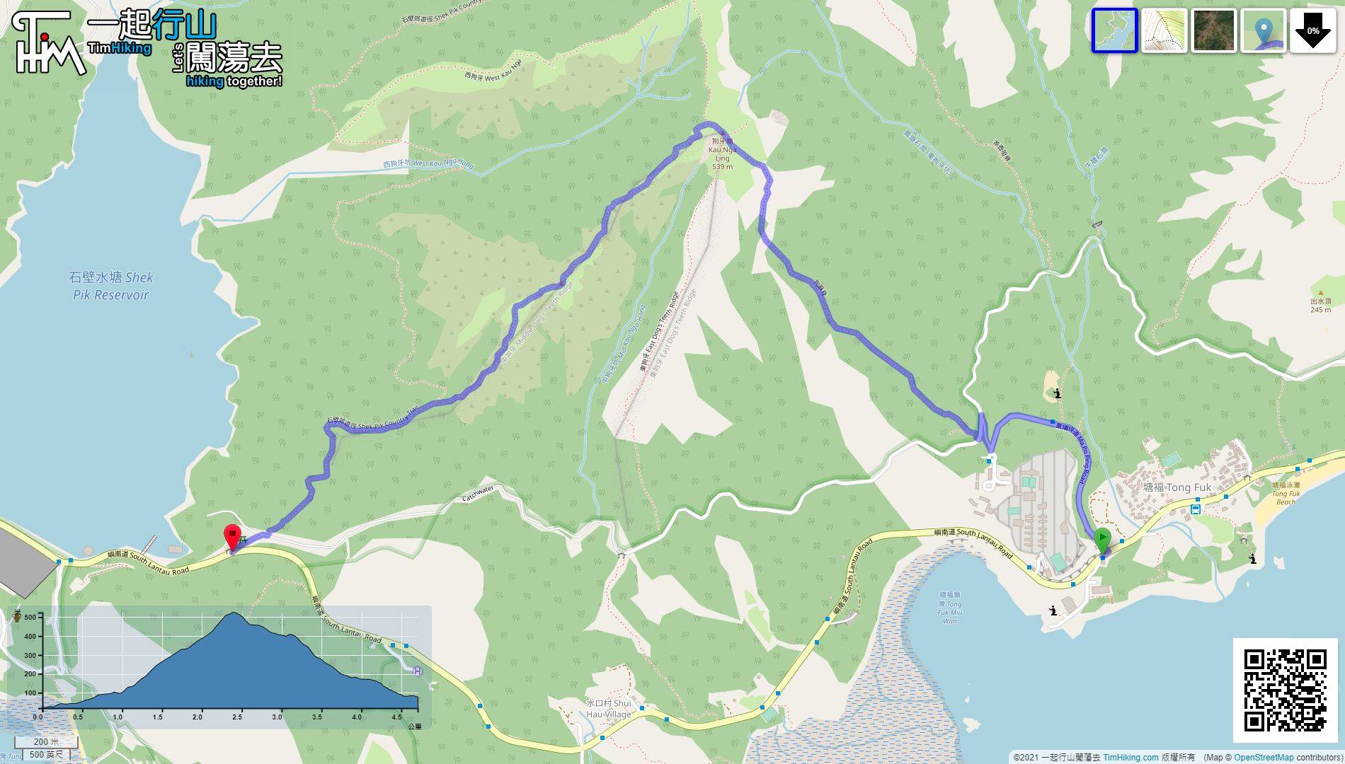
| View : |  | ||
| Difficulty : |  | ||
| Path : | |||
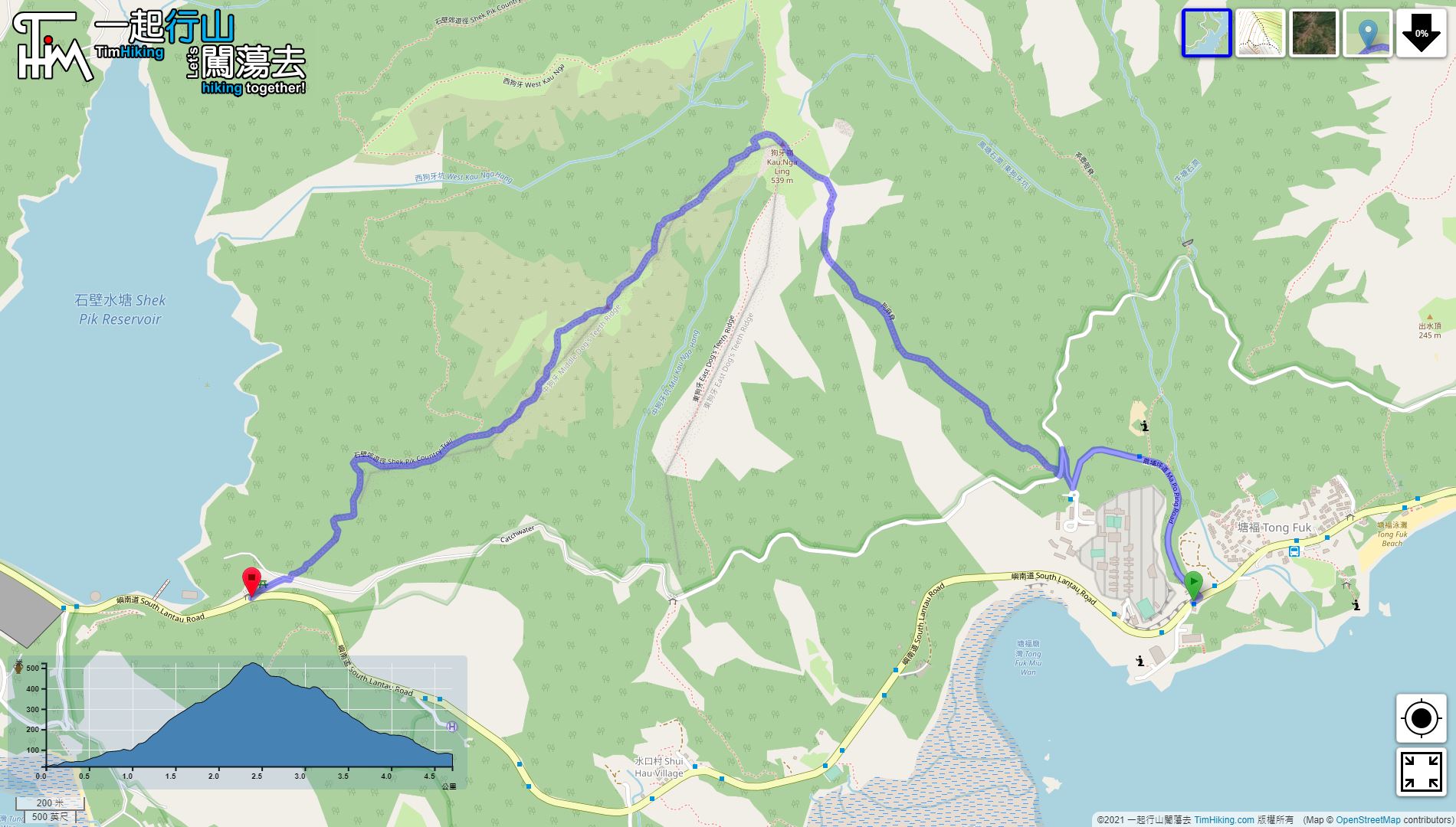
| Length : | 4.8km | ||
| Time : | 2½hours | ||
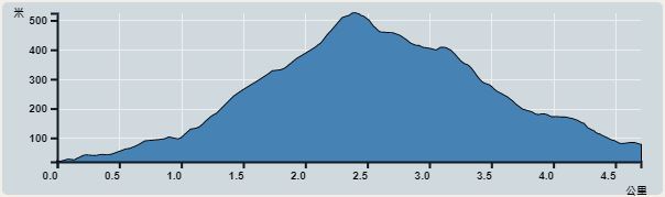 | |
| Ascent : 535m | Descent : 475m |
| Max : 524m | Min : 19m |
| (The accuracy of elevation is +/-30m) | |


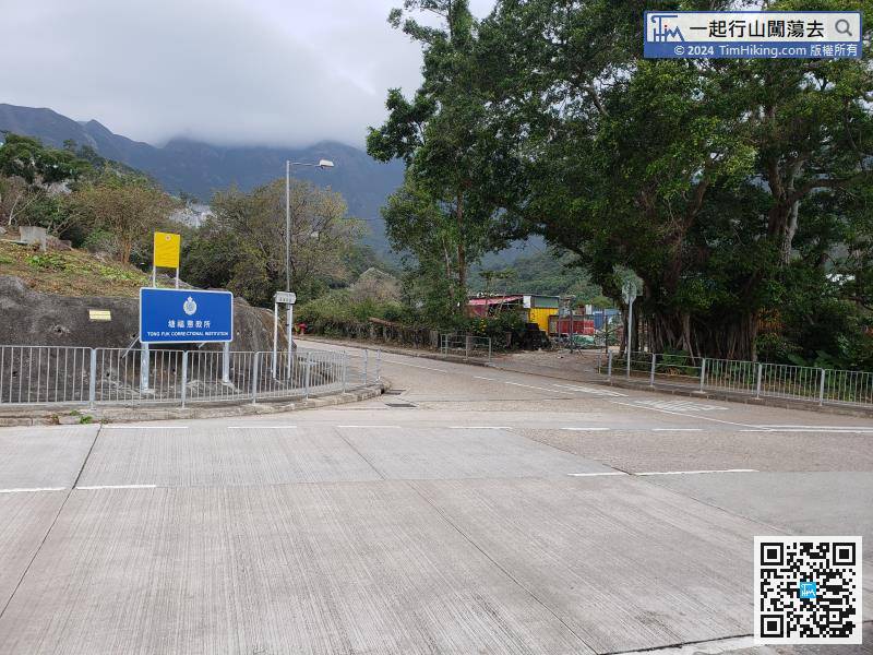
After getting off the bus, you will see the Tong Fuk Correctional Institution sign on the opposite side.
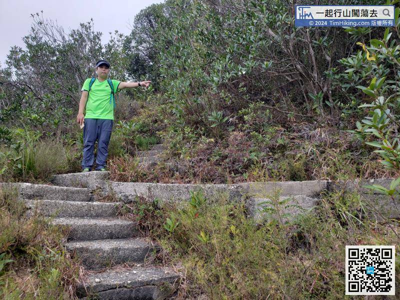
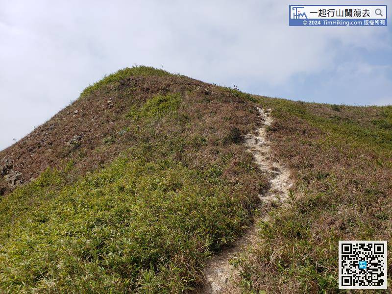
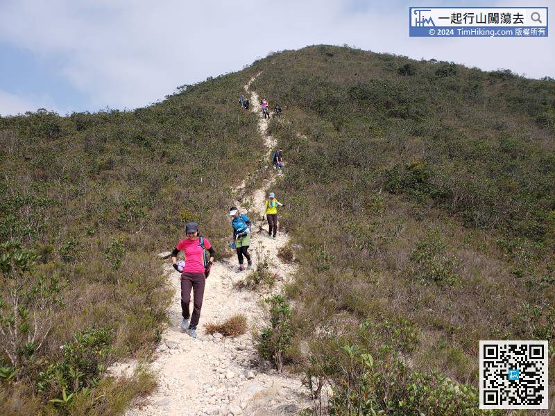
Continue to descent, although the trail is a lot of broken sand and gravel, so the road embryo is very clear.


